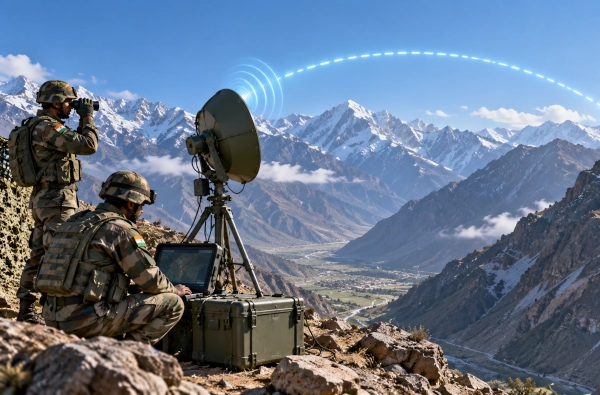
India’s Defence Research and Development Organisation has developed a compact communications system designed to address one of the most difficult problems faced by military formations operating in mountainous terrain: maintaining reliable high-speed communications when hills and ridgelines block the direct radio path between two locations.
Known as the Compact Trans-Horizon Communication System, or CTCS, the indigenous system has been developed by DRDO’s Defence Electronics Applications Laboratory in Dehradun. It is designed to provide beyond-line-of-sight digital connectivity between tactical locations, particularly in hilly and remote regions where conventional terrestrial communication links may be difficult to establish.
The system operates in the C-band and uses troposcatter and diffraction propagation to create communication links beyond the normal radio horizon. DRDO lists a maximum range of around 60 km in troposcatter or diffraction mode, while line-of-sight links can extend to approximately 100 km. The system can support data rates of up to 20 Mbps, allowing it to carry digital network traffic rather than functioning merely as a conventional voice communication link.
This capability is particularly valuable in mountainous areas because conventional microwave systems generally require a clear line of sight between transmitting and receiving stations. A mountain ridge, deep valley or steep terrain feature can interrupt such a connection completely. Troposcatter communication provides another option by using propagation through the lower atmosphere to establish links between locations that cannot directly see each other.
DRDO has developed CTCS specifically as a compact and deployable tactical system rather than as a large fixed communications installation. The organisation describes it as a man- or mule-portable system, making it suitable for movement into high-altitude and difficult terrain where heavy communication vehicles may not be able to operate.
The principal equipment weighs less than 35 kg, excluding accessories, and can be packed into two lightweight enclosures. This gives troops the ability to transport the system by personnel or pack animals and establish communication nodes at forward locations that may be accessible only by narrow roads, tracks or mountain trails.
The system consists primarily of a radio unit, antenna assembly and an alignment and pointing mechanism mounted on a lightweight tripod. Correct antenna alignment is important because long-range point-to-point communication depends on accurately establishing the intended propagation path. DRDO has therefore incorporated sensor-assisted alignment features to simplify deployment in the field.
CTCS also uses specialised link-prediction software to help operators determine whether a proposed communication route is feasible before setting up the system. DRDO documentation describes this software as using geographical information system data for offline link planning, helping communication teams assess terrain conditions and identify suitable terminal locations.
More recent DRDO material also describes the link-prediction software as AI-enabled. This is intended to speed up the process of calculating and establishing communication links, which can be particularly useful in mountainous terrain where small changes in location can significantly affect radio propagation.
The importance of CTCS lies in the fact that it functions as a portable tactical backhaul system. A handheld military radio may connect soldiers or units over relatively short distances, but a backhaul system connects those local networks to command posts, larger communication nodes and wider military networks.
In the Himalayan environment, establishing such backhaul connections can be difficult because valleys and ridgelines can isolate formations from one another. CTCS provides a means of linking command and tactical-level networks across those geographical barriers without requiring a chain of fixed relay stations at every intermediate location.
DRDO states that the system can provide reliable IP network connectivity between command and tactical levels, particularly in hilly terrain. This could allow forward surveillance posts, logistics bases, command centres and dispersed military units to remain part of a larger digital network even when conventional line-of-sight radio links are unavailable.
The technology could be particularly useful along India’s northern borders, where military formations often operate across widely separated valleys and high-altitude regions. In such environments, installing permanent communication towers or fibre-optic infrastructure everywhere may be impractical, while satellite links may not always be the preferred or only solution.
CTCS therefore adds another layer to the military communications architecture. Rather than replacing satellite communications, fibre networks or conventional radios, it can complement them by providing an independent terrestrial beyond-line-of-sight link.
The system is also relevant in locations where civilian communication infrastructure does not exist. DRDO specifically identifies remote regions without access to conventional communication grids as one of the intended operating environments for CTCS.
That also gives the technology potential applications beyond routine military operations. Natural disasters such as earthquakes, landslides and floods can destroy or isolate conventional telecommunications networks, particularly in mountainous regions. A portable trans-horizon system could help establish temporary high-capacity communication links between rescue teams, command centres and isolated locations until normal infrastructure is restored.
CTCS has progressed beyond the laboratory stage. DRDO reported field evaluation of the system during 2026 as part of broader technology assessments involving security agencies. This indicates that the system has already been exposed to operational conditions rather than remaining limited to controlled laboratory trials.
More importantly, DRDO states that the Indian Army has formulated Qualitative Requirements for induction of the system. This is an important step because it indicates that the technology has moved closer to possible operational acquisition.
Indian industry is also being brought into the programme through the Transfer of Technology route. DRDO has issued technology-transfer documentation for CTCS and has indicated that Indian companies are in the process of taking up the technology for production.
This industrial transition is significant because a battlefield communication system requires far more than a successful prototype. Operational deployment demands serial production, spares, maintenance support, training and long-term lifecycle support. Transfer of Technology allows domestic companies to build that manufacturing and support ecosystem within India.
The development of CTCS also reflects the wider importance of indigenous communications technology in modern warfare. Contemporary military operations depend heavily on the rapid movement of data between sensors, commanders and combat units. Surveillance feeds, maps, targeting information, logistics data and operational orders must all move securely and reliably between widely separated locations.
In mountainous terrain, geography itself becomes an obstacle to that network. A ridge that blocks a vehicle can also block a radio signal. A valley that isolates a patrol physically can also isolate it digitally if the communication system depends entirely on direct line-of-sight links.
CTCS has been designed specifically to overcome that problem. Its combination of C-band operation, up to 60 km of beyond-line-of-sight range, data rates of up to 20 Mbps, compact packaging and portable deployment makes it particularly suited for military operations in difficult terrain.
Its strategic value therefore does not lie in being a large or visually impressive defence platform. It lies in solving a basic operational requirement that can determine whether dispersed forces remain connected during combat.
For Indian troops deployed across the Himalayas and other difficult regions, reliable communications can be as critical as mobility, surveillance or firepower. By allowing tactical units and command posts to establish digital links even when mountains stand between them, DRDO’s Compact Trans-Horizon Communication System could become an important part of India’s future battlefield communications network.
You may also like
-
ICAR Scientists Develop Indigenous Protective Gloves for Cotton Farmers, Sign Commercial Manufacturing Agreement
-
India Moves Towards Five-Year Assured Orders for Defence Startups Under New Procurement Reforms
-
BHEL–Coal India Joint Venture Begins Construction of ₹25,016 Crore Indigenous Coal Gasification Project in Odisha
-
Zen Technologies Introduces Indigenous Hyper-Strike Falcon AI-Guided Counter-Drone Interceptor
-
L&T and Germany’s SCHOTTEL Expand Partnership for Controllable Pitch Propeller Systems in Indian Shipbuilding
