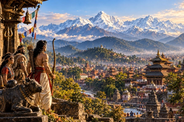
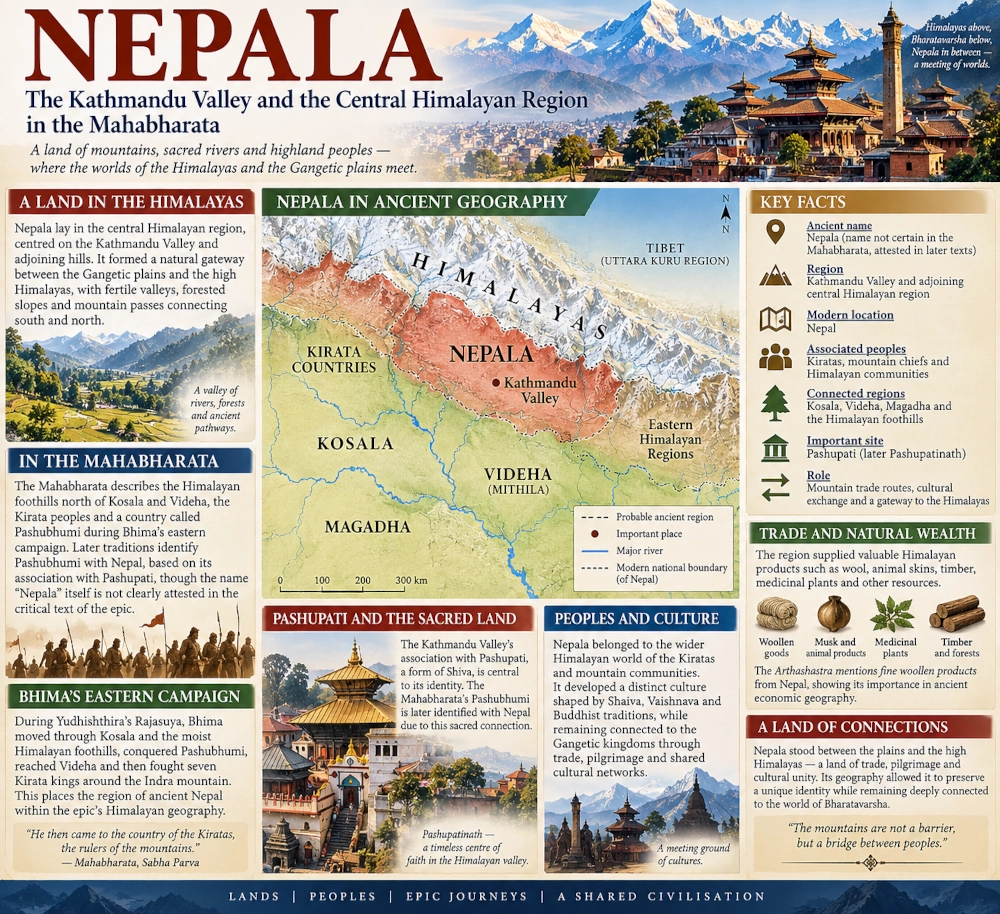
The ancient land of Nepala, centred on the Kathmandu Valley and the adjoining hills of the central Himalayas, occupied one of the most distinctive geographical positions in the northern world of the Indian subcontinent. Sheltered by mountain ranges yet connected to the Gangetic plains through river valleys and passes, the region developed at the meeting point of the Himalayan highlands and the great civilisations to its south. In the geographical world reflected by the Mahabharata, this central Himalayan zone belonged to a wider landscape inhabited by Kiratas, mountain chiefs, forest communities and peoples controlling the approaches to the higher Himalayas.
The identification requires some care. Unlike kingdoms such as Kuru, Panchala, Magadha or Videha, Nepala is not securely attested as a named political kingdom in the critically established text of the Mahabharata. Older manuscript traditions and later geographical interpretations have occasionally connected passages in the epic with Nepal, but scholars have long differed over whether the name itself occurs in an original layer of the text. The geographical region, however, is unmistakably part of the epic’s Himalayan world. The Mahabharata repeatedly describes territories along the Himalayan foothills and mountain valleys immediately north of Videha and Kosala, precisely the wider zone within which ancient Nepal developed.
Between the Gangetic Plain and the High Himalayas
Nepala’s geography gave it an unusual character. The Kathmandu Valley lies within the central Himalayan hill country, separated from the Gangetic plain by successive ranges but connected to it by routes descending towards the Terai and the river systems of northern Bihar. To the north rise still higher ranges leading towards the Tibetan plateau.
This placed the region between two very different worlds. The plains to the south supported large agricultural kingdoms such as Kosala, Videha and Magadha. The mountains to the north contained forest communities, pastoral societies and trade routes carrying wool, salt, animals, metals and other highland products. Ancient Nepal stood between them, functioning both as a protected mountain region and as a corridor through which goods and people could move between the plains and the Himalayas.
The Mahabharata’s descriptions of the northern and northeastern frontier repeatedly evoke this type of landscape. Its armies leave the established kingdoms of the plains and move into wetter foothills, forested mountain country and territories ruled by numerous local chiefs. These passages provide the geographical setting within which the region later known clearly as Nepala can be understood.
Bhima’s Campaign Towards the Himalayan Foothills
One of the most useful descriptions appears in the Sabha Parva during Bhima’s eastern digvijaya, undertaken before Yudhishthira’s Rajasuya sacrifice.
After moving through Kosala and neighbouring kingdoms, Bhima reaches what the text describes as the moist country at the foot of the Himalayas. From there his expedition passes through a succession of smaller territories before reaching Videha and the lands of the Kiratas.
Among the places conquered on this route is a country called Pashubhumi. Some later Indian geographical traditions identified Pashubhumi with Nepal, partly through its association with Pashupati, the form of Shiva whose great sacred centre lies in the Kathmandu Valley. That identification has become influential, although the Mahabharata itself does not explicitly say that Pashubhumi and Nepala were the same country.
What is more secure is the geographical sequence. Bhima is travelling through the Himalayan borderlands north of the Gangetic kingdoms. The episode places a collection of mountain territories between the plains and the deeper Himalayan world, showing that the epic’s political geography extended well into the region adjoining present-day Nepal.
From Videha, Bhima also sends expeditions against seven Kirata kings living around the Indra mountain. This brings the central and eastern Himalayan hill peoples directly into Yudhishthira’s expanding sphere of influence.
Nepala and the Kirata World
The relationship between ancient Nepal and the Kiratas is particularly strong in later historical tradition.
The Mahabharata knows the Kiratas as mountain-dwelling peoples distributed across the Himalayan and northeastern hills. They appear as hunters, archers, warriors and subjects of numerous chiefs rather than as inhabitants of one centralised kingdom. Some lived around the eastern Himalayas and the Lohitya or Brahmaputra region, while other references place Kirata communities farther west along the Himalayan slopes.
Central Nepal lay within this broader cultural zone.
Nepalese historical traditions later remembered a Kirata period preceding the Licchavi age, and the eastern hills of modern Nepal continue to preserve Kirati cultural and linguistic traditions. These later traditions cannot simply be projected backwards to identify every Kirata in the Mahabharata with Nepal, but they demonstrate the remarkable persistence of the name within the Himalayan region.
The central Himalayan country represented by ancient Nepal therefore fits naturally into the wider Kirata geography of the epic, although the Kirata world itself extended considerably beyond the Kathmandu Valley.
The Kathmandu Valley at the Centre of Nepala
In later historical usage, Nepala referred especially to the Kathmandu Valley and its surrounding hill country. The name eventually expanded far beyond the valley as successive kingdoms and, much later, the unified Nepalese state incorporated a much larger stretch of the Himalayas.
The valley’s physical character explains why it became such an important centre. Surrounded by hills, it forms a broad and comparatively fertile basin in an otherwise rugged mountain landscape. Rivers and streams descend through the valley, with the Bagmati becoming the most culturally important waterway.
The enclosed terrain offered both protection and agricultural potential. Settlements could flourish within the valley while passes through the surrounding hills maintained contact with regions to the south and north.
This combination of isolation and accessibility shaped Nepal throughout its history. It was sufficiently protected to develop a distinctive culture, yet never so isolated that it became detached from the larger religious, commercial and political networks of the subcontinent.
Pashupati and the Sacred Landscape
The Kathmandu Valley’s association with Pashupati, Lord of Beings, became one of the defining features of its sacred geography.
The great sanctuary of Pashupatinath stands on the Bagmati and is dedicated to Shiva in his form as Pashupati. The temple complex visible today belongs to much later historical periods, but the religious importance of the site is deeply rooted in Nepalese tradition.
This connection has encouraged the identification of the Mahabharata’s Pashubhumi with Nepal. The resemblance is attractive because Bhima encounters Pashubhumi in a sequence involving territories near the Himalayan foothills. Later encyclopaedic traditions explicitly described Pashubhumi as the country of Nepal because of its association with Pashupati.
The identification nevertheless remains an interpretation rather than an explicit statement of the epic. It is more useful as evidence of how later Indian geographical tradition understood the passage than as proof that the author of the Sabha Parva was naming the Kathmandu Valley.
Shiva’s presence throughout the Himalayan world of the Mahabharata nevertheless gives this region a natural place within the epic’s sacred geography. The mountains are repeatedly portrayed as landscapes of austerity, pilgrimage and divine encounter. Arjuna’s famous meeting with Shiva disguised as a Kirata likewise takes place in the Himalayan wilderness, binding Shiva, Kirata culture and the mountains together within the narrative.
A Land Connected to Videha
Ancient Nepala’s southern approaches were closely connected geographically with Videha, the powerful kingdom centred in the Mithila region of present-day northern Bihar and adjoining Nepalese plains.
The relationship was dictated by geography. The plains of Mithila run northwards towards the Himalayan foothills, and routes through this region provided some of the most natural approaches into central and eastern Nepal.
This helps explain the sequence in Bhima’s eastern campaign. After operating in the Himalayan foothill region, his forces eventually confront Janaka’s Videha and then move against Kirata rulers farther into the mountain zone.
Ancient political frontiers would have shifted repeatedly, but the plains and hills belonged to an interconnected geographical system. Agricultural produce travelled northwards, while timber, medicinal plants, animal products and other Himalayan commodities moved towards the markets of the Gangetic region.
Nepala therefore cannot be understood in isolation from Videha. The two occupied adjoining ecological worlds on opposite sides of the Himalayan foothills.
Mountain Wealth and the Trade Routes of Nepala
The economic importance of the Himalayan regions appears repeatedly in ancient Indian literature. Mountain communities supplied products that were difficult or impossible to obtain in the plains: wool, animal skins, musk, timber, aromatic substances, medicinal plants, minerals and precious materials.
The Mahabharata describes Kirata chiefs arriving at Yudhishthira’s court with valuable products of the mountains and forests. Such descriptions fit the trading environment that later sources explicitly associate with Nepal.
One of the clearest early literary references to the name Nepala occurs in the Arthashastra. Its discussion of valuable goods entering the royal treasury mentions rain-resistant woollen products called Bhingisi and Apasaraka as coming from Nepal. Whatever date is assigned to the various layers of the Arthashastra, the passage demonstrates that Nepala had already become known in Sanskrit economic geography for specialised Himalayan woollen goods.
This commercial reputation makes geographical sense. Nepal occupied routes linking the warmer plains with regions where sheep, goats and other high-altitude animals supplied wool and hides. Traders moving between the Gangetic basin and the Himalayas would naturally pass through these intermediate valleys.
The mountain gifts described in the Mahabharata and the Nepalese woollens recorded in the Arthashastra belong to the same larger economic world.
From Epic Geography to Historical Nepala
The uncertainty surrounding the name in the Mahabharata disappears in later historical evidence.
By the Gupta period, Nepala was unquestionably recognised as a distinct political territory. The famous Allahabad Pillar inscription of Samudragupta, dating to the fourth century CE, lists Nepala among the frontier kingdoms associated with the Gupta emperor’s sphere of power. This is one of the earliest securely dated epigraphic appearances of the country’s name.
Its inclusion alongside other frontier states is revealing. Nepala was neither portrayed as an ordinary district of the Gangetic heartland nor as a completely remote land beyond the known political world. It was a recognised Himalayan kingdom maintaining relations with the great power of northern India.
That position closely resembles the geographical relationship already visible in earlier literary traditions: a mountain country linked to the plains yet retaining its own political identity.
The Himalayan Routes to the North
Nepala’s position also opened routes towards the trans-Himalayan world.
From the Kathmandu Valley and adjoining regions, trails crossed increasingly high terrain towards Tibet. These routes later became important channels for the movement of salt, wool, metals, religious ideas and luxury commodities.
The Mahabharata frequently presents the Himalayas not as the absolute edge of the inhabited world but as a landscape that can be crossed. Its heroes encounter mountain peoples and move through regions associated with Kiratas, Kulindas, Daradas and other northern communities. Beyond them lie still more distant lands.
Nepala belongs naturally within this layered geography. It stood not at the end of the road, but at one stage of a network stretching from the Gangetic plain through the middle hills and towards the high Himalayas.
The Valley of Many Traditions
The cultural history that later emerged in the Kathmandu Valley reflects this geographical position.
Shaiva, Vaishnava and Buddhist traditions developed side by side, while the valley became renowned for temples, sacred sites, monasteries, sculpture and ritual culture. Indian religious traditions arriving from the plains encountered older Himalayan practices and interacted with traditions moving southwards through the mountains.
The result was never a simple extension of the Gangetic cultural world. Nepal developed its own distinctive civilisation while remaining deeply connected with Sanskritic India.
This pattern has roots in the geography itself. The valley was protected enough to preserve local traditions, but accessible enough to participate continuously in the cultural networks of South Asia.
Nepala in Mahabharata Geography
Within the geographical framework of the Mahabharata, Nepala can be placed broadly in the Kathmandu Valley and the surrounding central Himalayan hill region of present-day Nepal. Its southern approaches connected with Videha and the Gangetic plains, while its northern routes climbed towards the higher Himalayas and the Tibetan world. The surrounding mountains were inhabited by peoples whom the epic commonly groups within its broader Kirata and Himalayan geography.
The name Nepala itself is textually less certain in the Mahabharata than many later retellings suggest. The epic instead preserves the landscape through descriptions of Himalayan foothill territories, Kirata kingdoms and places such as Pashubhumi. Later Sanskrit literature and historical inscriptions make the identification of Nepal as a distinct Himalayan country much clearer.
This distinction does not diminish Nepala’s place in the geography of the epic. It reveals how ancient regional identities developed. A landscape could be well known long before one political name became dominant.
The Kathmandu Valley and its neighbouring hills formed part of the northern mountain world through which the Mahabharata imagined Bharatavarsha extending towards the Himalayas.
Nepala eventually emerged from that Himalayan mosaic as one of its most enduring geographical names. Protected among the mountains but linked to Videha, Magadha and the wider Gangetic world, it became a meeting ground between plains and highlands, between trade routes and sacred routes, and between the cultures of the Indian subcontinent and the peoples of the great Himalayan ranges.
You may also like
-
Kirata: The Himalayan and Eastern Hill Peoples of the Mahabharata
-
Kamarupa — The Historic Kingdom of the Brahmaputra Valley and the Eastern Himalayas
-
Bharat Vandana Park: Delhi’s ‘Mini India’ Brings the Nation’s Heritage Together in One Landscape
-
Pragjyotisha — Bhagadatta’s Kingdom of the Brahmaputra Valley
-
Samatata — The Low-Lying Deltaic Realm of Southeastern Bengal
