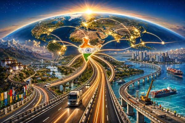
India’s infrastructure footprint increasingly extends far beyond its national boundaries. From mountain roads constructed by the Border Roads Organisation in Bhutan to highways across Myanmar, transport corridors in Bangladesh and Nepal, bridge-and-road networks in the Maldives and India-financed highways in Africa, New Delhi has gradually developed an overseas connectivity programme that combines engineering, development finance and foreign policy.
These projects are not all of the same kind. Some directly connect Indian territory with neighbouring countries. Others form parts of larger multimodal corridors linking India with ports and markets. Still others are roads built or financed by India entirely within partner countries. Together, however, they illustrate the emergence of infrastructure development as an important component of India’s engagement with the Global South.
India’s Ministry of External Affairs says more than 300 concessional Lines of Credit worth about $32 billion have been extended to 68 countries, supporting roughly 600 projects covering roads, railways, ports, airports, power, agriculture and other sectors. Africa alone has received 196 Indian Lines of Credit worth approximately $12 billion, while India’s immediate neighbourhood remains the largest concentration of major connectivity projects.
Roads as an Instrument of Indian Development Partnership
India’s overseas infrastructure model differs significantly from simply awarding contracts to Indian construction companies. Projects can be financed through grants, concessional Lines of Credit administered through the Export-Import Bank of India, Buyers’ Credit arrangements or combinations of grants and loans. Host governments normally identify infrastructure priorities, while Indian agencies, public-sector organisations and private construction companies may provide financing, project management, engineering or execution.
The approach is particularly visible in India’s neighbourhood. Bangladesh has received Indian Lines of Credit worth about $7.86 billion, Nepal $1.65 billion, Myanmar around $745 million and the Maldives approximately $1.43 billion. Connectivity has been specifically identified as a priority because roads, ports and railways can stimulate trade while improving movement between communities separated by international borders.
India’s road diplomacy consequently operates at several levels. Bhutan and Nepal illustrate long-term neighbourhood development cooperation. Bangladesh provides transit routes capable of transforming access to India’s Northeast. Myanmar is the gateway through which India hopes to establish continuous land connectivity with Southeast Asia. The Maldives demonstrates India’s growing ability to undertake large marine bridge and urban-road projects, while projects in Africa extend Indian infrastructure expertise into countries with no physical connection to the subcontinent.
Project DANTAK: India’s Six-Decade Road-Building Mission in Bhutan
Few international infrastructure programmes demonstrate the longevity of India’s involvement better than Project DANTAK in Bhutan. The Border Roads Organisation established DANTAK in April 1961, initially to assist Bhutan in building the transport infrastructure required for its economic and administrative development.
Over more than six decades, DANTAK has constructed approximately 1,650 kilometres of black-topped roads, 115 kilometres of tracks and 5,150 metres of bridges in Bhutan. The organisation has also contributed to airports, telecommunications infrastructure, buildings and other strategic facilities. More than 1,200 personnel have lost their lives during DANTAK’s construction activities, reflecting the difficult Himalayan terrain in which much of the work was undertaken.
The importance of DANTAK extends well beyond kilometres of asphalt. Bhutan’s mountainous geography means that roads determine whether settlements can reach markets, hospitals, schools and administrative centres. Roads constructed with Indian assistance have therefore become embedded in Bhutan’s national transport system rather than remaining isolated foreign-aid projects.
DANTAK also established a model that India would later apply elsewhere: using engineering capability to create physical connectivity while simultaneously building political and economic relationships. More than sixty years after its establishment, the project remains operational, making it one of India’s longest-running development missions anywhere abroad.
Nepal’s Terai Roads: Connecting the Borderlands
In Nepal, India has concentrated heavily on roads that strengthen connections between communities along the open India-Nepal frontier. One of the largest programmes is the Hulaki or Terai Roads Project, under which India committed ₹500 crore for ten priority roads totalling about 306 kilometres.
The roads connect towns along Nepal’s East-West Highway with areas near the Indian border. The programme was divided into 14 construction packages and included seven-metre carriageways, shoulders, drainage systems, footpaths, road furniture and hundreds of culverts. Thirteen of the fourteen packages had been completed and dedicated by March 2021, while India’s current diplomatic overview lists the Terai Roads among the major physical-connectivity projects delivered with Indian assistance.
The strategic value of these roads is inseparable from everyday economic geography. India and Nepal have an open border, with enormous volumes of local movement for employment, trade, family connections, pilgrimage and commerce. Better feeder roads on the Nepalese side therefore increase the utility of border check posts, railway links and commercial crossings already being developed between the two countries.
India’s Nepal connectivity strategy consequently operates as a network rather than through roads alone. Terai highways are being complemented by Integrated Check Posts, cross-border railway links, petroleum pipelines and other infrastructure. The objective is to make the border less of a transport barrier even while modernising customs and logistics facilities.
Bangladesh: The Missing Geography Between India and Its Northeast
Bangladesh occupies perhaps the most consequential position in India’s eastern connectivity strategy. Before the Partition of the subcontinent, transport routes naturally connected Bengal with Assam, Tripura and other northeastern regions. Modern international borders disrupted many of these routes, forcing goods travelling between mainland India and the Northeast to make a long detour through the narrow Siliguri Corridor.
Improved connectivity through Bangladesh can dramatically alter that geography. India has therefore financed road, railway, inland-waterway and port infrastructure designed both to support Bangladesh’s development and to improve regional movement.
One of the most important road projects is the Ashuganj River Port–Sarail–Dharkhar–Akhaura Land Port highway, which is being upgraded to a multi-lane national highway. The corridor runs for roughly 50 kilometres towards Akhaura, directly across the border from Agartala in Tripura. Bangladesh government records continue to classify the project as ongoing in 2026, while an Indian parliamentary assessment valued the Indian-assisted component at about $354.73 million.
Its significance becomes clearer when considered together with Ashuganj’s inland-waterway position. Cargo can move by water from ports and river systems in Bangladesh to Ashuganj and then travel by road towards Tripura. What appears to be a conventional highway is therefore actually one segment of a wider multimodal logistics chain.
A second major India-supported project is the approximately 38-kilometre widening of the Baraiyarhat–Heako–Ramgarh road, valued at about $80.06 million under Indian assistance. The route connects Ramgarh near the Tripura frontier with the wider Chattogram transport network and remains listed as an ongoing Indian Line of Credit project.
The corridor is particularly important because the Maitri Setu across the Feni River links Ramgarh in Bangladesh with Sabroom in southern Tripura. Combined with roads towards Chattogram, the crossing could eventually give parts of India’s Northeast far shorter access to maritime gateways than routes passing through the rest of India.
Bangladesh therefore demonstrates the central principle behind India’s modern connectivity policy: the value of a road is determined not simply by where it ends, but by the ports, bridges, railways, waterways and border facilities to which it connects.
The India-Myanmar-Thailand Highway: India’s Road to Southeast Asia
The most ambitious expression of India’s eastward road strategy is the India-Myanmar-Thailand Trilateral Highway. The approximately 1,360-kilometre corridor is intended to connect Moreh in Manipur with Mae Sot in Thailand through Myanmar, creating an overland transport axis between India’s Northeast and mainland Southeast Asia.
India had already constructed the Tamu-Kalewa portion of the route in Myanmar, with the original Friendship Road becoming one of the earliest major Indian road-building projects in Southeast Asia. Current Indian government information states that the Tamu-Kalewa highway was completed and handed over to Myanmar in 2009.
India subsequently took responsibility for upgrading the challenging Kalewa-Yagyi section and for replacing 69 bridges with approach roads along the Tamu-Kyigone-Kalewa section. The Kalewa-Yagyi road project covers approximately 120.74 kilometres, while the bridge programme extends across a 149.7-kilometre corridor.
The programme has progressed, although far more slowly than originally envisaged. A particularly important update came in August 2026, when the Ministry of Development of North Eastern Region reported that the section of the Kalewa-Yagyi highway between kilometre 112 and kilometre 60 had been completed and handed over to Myanmar in October 2025. The wider corridor, however, is not yet functioning as the seamless India-to-Thailand road link originally envisioned.
Myanmar’s internal conflict has compounded engineering and contractual delays. Transport corridors in affected regions have repeatedly faced security disruptions, making construction, maintenance and commercial movement considerably more difficult. Myanmar authorities themselves renewed attention to both the Trilateral Highway and Kaladan projects in July 2026, while roads associated with the corridor around Kalay, Tamu, Kalewa, Yagyi and Monywa were reported reopened in August following earlier disruptions.
The highway also requires more than physical completion. Truly seamless international trucking will depend upon compatible customs procedures, border infrastructure, vehicle permits and a functioning trilateral motor-vehicle arrangement. A paved road without agreed cross-border operating rules cannot by itself create an international economic corridor.
If those obstacles can eventually be resolved, the implications would be considerable. Manipur could become a gateway rather than an endpoint, while Indian goods could travel overland through Myanmar into Thailand and potentially onwards through the wider ASEAN road network.
Kaladan: Giving Mizoram an Alternative Route to the Sea
Running parallel to the Trilateral Highway is another major Indian connectivity initiative: the Kaladan Multi-Modal Transit Transport Project.
Kaladan was conceived not as a single road but as an integrated sea-river-road corridor. Cargo can travel from India’s eastern coast to Sittwe Port in Myanmar, continue inland through the Kaladan River system towards Paletwa and then move by road towards Zorinpui on the Mizoram border.
The waterway component has been completed and was inaugurated in May 2023. The remaining road component comprises a 109-kilometre two-lane highway from Paletwa to Zorinpui, according to an August 2026 government update.
The project’s strategic rationale is straightforward. Mizoram and other parts of the Northeast currently depend heavily on land connections through the Siliguri Corridor and Assam. Kaladan would create another logistics pathway, connecting the region with the Bay of Bengal through Myanmar.
Like the Trilateral Highway, however, the project has been affected by Myanmar’s prolonged instability. The road remains unfinished despite completion of the maritime and waterway infrastructure. This gap demonstrates one of the fundamental realities of cross-border infrastructure: engineering can create roads, but political stability ultimately determines whether they function as dependable trade corridors.
The Maldives: Building Roads Across the Sea
The Maldives presents a very different engineering challenge. Its scattered island geography means that road connectivity frequently requires bridges, viaducts and causeways rather than conventional highways.
India’s flagship project there is the Greater Malé Connectivity Project, also known as the Thilamalé Bridge project. The approximately 6.74-kilometre network will connect Malé with Villingili, Gulhifalhu and Thilafushi using bridges, marine viaducts, causeways and at-grade roads.
India is financing the approximately $500-million project through a $400-million Line of Credit and a $100-million grant, while Indian infrastructure company Afcons is executing the works. India’s High Commission in Malé reported in August 2026 that overall construction had reached around 75% completion.
A major milestone was reached in August 2026 when the structural link between Malé and Villingili was completed. On 30 August, Maldives President Mohamed Muizzu walked across the newly connected section and described the project as an important symbol of India-Maldives cooperation.
The scale of the engineering is considerable. Afcons says the project incorporates deep- and shallow-water marine viaducts and three navigation bridges, while some foundations extend extraordinarily deep into the seabed. Once completed, the network will connect the Maldivian capital with areas intended for industrial, port and urban development.
India has also supported the Addu City road and drainage programme, where Afcons completed approximately 111 kilometres of roads, extensive drainage infrastructure, street lighting and a 1.4-kilometre detour link incorporating two ocean bridges. In an island nation, these projects show how Indian road-building expertise is expanding into complex coastal and marine environments.
Zaranj-Delaram: India’s Highway Across Afghanistan
One of India’s most demanding completed overseas highways lies in Afghanistan. The Border Roads Organisation constructed the 218-kilometre Zaranj-Delaram Highway, also known as Route 606, connecting Zaranj near the Iranian border with Delaram on Afghanistan’s main highway network.
Completed and inaugurated in January 2009 at a cost of roughly $150 million, the project also included dozens of kilometres of urban and connecting roads. Hundreds of Indian and Afghan personnel worked on the highway under severe security conditions. Eleven Indians and 129 Afghans lost their lives during its construction, including personnel killed in terrorist attacks.
The road was strategically designed to provide western Afghanistan with an additional route towards Iran and ultimately Chabahar Port. This offered Afghanistan an alternative maritime outlet while also fitting India’s longer-term interest in creating transport links with Afghanistan and Central Asia that did not depend upon transit through Pakistan.
Although subsequent political changes in Afghanistan have altered the strategic environment in which the road operates, Zaranj-Delaram remains one of the clearest examples of India’s willingness to undertake difficult infrastructure projects in challenging overseas conditions.
Africa: India as a Builder and Financier Rather Than a Neighbour
India’s road projects in Africa serve a different purpose. They do not physically connect African countries with India. Instead, they form part of India’s broader development partnership, using concessional finance and Indian engineering capabilities to strengthen transport infrastructure requested by partner governments.
The scale of India’s African development financing is substantial. The Government of India says it has extended 196 Lines of Credit worth approximately $12 billion to 42 African countries, covering infrastructure, energy, agriculture, manufacturing and other sectors.
Mozambique’s Tica-Buzi-Nova Sofala Corridor
One of the clearest road examples is in Mozambique, where India extended a $149.72-million Line of Credit for the rehabilitation and construction of the Tica-Buzi-Nova Sofala road network in Sofala province. Indian infrastructure company Afcons is involved in executing the project.
The corridor consists of about 117 kilometres between Tica and Nova Sofala together with a roughly 17-kilometre spur towards Buzi, creating a total road length of approximately 134 kilometres. It is designed to improve connectivity across a region repeatedly affected by difficult weather and cyclones.
The project has also illustrated the difficulties that can affect overseas infrastructure. EXIM Bank documents published in 2025 acknowledged significant delays and indicated that a revival plan was being prepared to facilitate completion. India’s African road story therefore includes not only successful construction but also the practical challenges of contract management, extreme weather, financing and long implementation periods.
Rwanda’s Base-Butaro-Kideho Road
India has also extended a $66.6-million Line of Credit to Rwanda for upgrading the Base-Butaro-Kideho road corridor. The financing agreement was signed between EXIM Bank of India and the Government of Rwanda in May 2018 as part of a much larger Indian development partnership covering power, agriculture, skills and infrastructure.
Unlike DANTAK or Zaranj-Delaram, such projects demonstrate India’s role primarily as a development financier rather than a direct government road-building agency. Indian concessional credit can support a partner country’s transport priorities while generating opportunities for Indian engineering, equipment and consultancy firms.
Overseas Roads Are Also Export Platforms for Indian Engineering
India’s international road programme has increasingly involved private-sector companies alongside traditional state institutions such as the BRO.
Afcons Infrastructure, for example, has become an important Indian overseas contractor, executing major work in the Maldives and Mozambique. Other Indian engineering companies participate in projects financed through EXIM Bank Lines of Credit, while organisations such as NHIDCL and Indian consultancy firms provide project-management and technical expertise.
This creates an industrial dimension to development partnership. Overseas projects give Indian companies experience in marine construction, tropical roads, mountainous terrain, bridges, ports, drainage, logistics and complex project management. That expertise can subsequently support bids for commercially financed infrastructure projects elsewhere.
India’s development-finance system therefore does two things simultaneously: it provides partner countries with infrastructure while helping Indian engineering companies expand internationally.
Why the Northeast Is at the Centre of India’s Road Strategy
The most strategically significant roads beyond India’s borders are concentrated east of the country because the geography of the Northeast creates unusual connectivity challenges.
The eight northeastern states are connected to the rest of India through the narrow Siliguri Corridor. Yet the region shares international frontiers with Bangladesh, Bhutan, China and Myanmar and lies geographically close to the markets of Southeast Asia.
India’s Act East Policy increasingly treats this geography as an opportunity rather than simply a constraint. The Ministry of Development of North Eastern Region explicitly describes the Trilateral Highway and Kaladan project as flagship cross-border initiatives intended to place the Northeast at the centre of India’s engagement with Southeast Asia.
If the Bangladesh transit corridors, Kaladan route and India-Myanmar-Thailand highway mature simultaneously, the transport geography of the Northeast could change substantially. Tripura could gain shorter approaches to Bangladeshi ports, Mizoram could gain access towards Sittwe, and Manipur could become India’s principal land gateway towards Myanmar and Thailand.
For businesses, this could shorten logistics chains. For border communities, it could expand markets. For Indian foreign policy, it would physically link the Act East strategy to roads rather than leaving it primarily dependent on maritime and air connections.
A Road Is Only One Part of a Corridor
Perhaps the greatest lesson from India’s international road projects is that roads alone cannot create connectivity.
A truck travelling from India to Thailand requires usable pavement, bridges, customs facilities, immigration procedures, insurance recognition, vehicle permits, security arrangements and compatible regulations in three different countries. A road from Tripura through Bangladesh becomes significantly more useful when connected with ports, railways and inland waterways. Kaladan cannot reach its full potential until both the maritime and road components operate reliably.
Successful international connectivity therefore depends on multimodal integration. India’s most advanced projects increasingly combine roads with ports, inland waterways, border posts, bridges, railways and logistics infrastructure.
This is why projects such as Kaladan, the Bangladesh corridors and Greater Malé Connectivity Project are better understood as transport systems rather than individual construction works.
The Difficult Reality of Building Across Borders
Overseas road construction also carries risks that domestic projects do not face to the same degree.
Political instability has repeatedly affected projects in Myanmar. Security threats shaped construction of the Zaranj-Delaram road in Afghanistan. Cyclones and difficult ground conditions have complicated work in Mozambique. Bangladesh road projects have encountered redesigns, cost revisions and implementation delays, while some African projects financed through Indian credit have faced contractor or sovereign-financing difficulties.
Changes of government can also alter priorities. International projects frequently outlast the administrations that originally negotiated them, making institutional continuity essential.
Maintenance is another challenge. Building a highway creates an asset; maintaining pavement, drainage, bridges and safety systems over decades determines whether that asset continues delivering economic value. Sustainable development partnerships therefore require host-country institutions capable of operating infrastructure long after Indian contractors have departed.
From Border Roads to Connectivity Diplomacy
India’s overseas road-building history began largely with neighbouring countries and strategic necessity. Project DANTAK helped Bhutan establish basic national connectivity. The Friendship Road opened routes through Myanmar. Zaranj-Delaram created an alternative corridor across Afghanistan.
The newer generation of projects is more ambitious. Highways are increasingly integrated with ports, economic corridors, industrial zones, urban development and international supply chains.
The Greater Malé Connectivity Project connects an urban capital with future port and industrial areas. Roads in Bangladesh form part of a network linking India’s Northeast to river ports and seaports. The Trilateral Highway is intended eventually to place India’s road network within the transport geography of ASEAN. African projects demonstrate that Indian engineering and development finance can operate thousands of kilometres away from the country’s immediate strategic periphery.
India is therefore moving from building roads abroad to building connectivity systems abroad.
India’s Emerging Infrastructure Footprint
The full significance of these projects is visible only when they are considered together. In Bhutan, Indian engineers have spent more than sixty years constructing mountain roads. In Nepal, India has helped improve hundreds of kilometres of border-region highways. In Bangladesh, Indian finance is supporting road corridors that could reshape access to the Northeast. In Myanmar, two major projects seek to connect India with both the Bay of Bengal and Thailand. In the Maldives, Indian engineers are creating roads where the sea itself separates communities. In Afghanistan, the BRO built a highway towards Iran under exceptionally difficult conditions. Across Africa, Indian credit and construction companies are supporting partner-country road networks.
Not every project has progressed according to schedule, and several remain unfinished. Myanmar demonstrates how conflict can overwhelm engineering timelines, while projects in Africa and Bangladesh show that financing, contractors, regulations and political changes can be just as decisive as construction itself.
Yet the broader direction is unmistakable. Roads have become an increasingly important component of India’s external engagement, combining Neighbourhood First, Act East and Global South development cooperation with the growing international capabilities of Indian engineering firms.
For India, the ultimate objective is not simply to lay asphalt outside its borders. It is to shorten economic distances: between Manipur and Southeast Asia, Tripura and the Bay of Bengal, Mizoram and Sittwe, Maldivian islands separated by the sea, African communities and their domestic markets, and landlocked regions with ports.
India’s roads beyond its borders are therefore becoming physical expressions of a larger idea — that connectivity can turn geography from a barrier into an economic bridge.
You may also like
-
India’s Economic Warfare Challenge: Strategic Autonomy, Energy Security and the Rise of a Global Power
-
India-US Trade Deal Stalemate: Why Washington’s Tariff Pressure Has Failed to Secure an Agreement
-
US Double Standards in Foreign Policy: 16 Recent Cases Involving India, Russia, China and Global Trade
-
India’s Arctic Energy Ambitions: Russian Oil, LNG and a New Sea Route to Indian Ports
-
Indian Navy Vice Chief Inspects Japan’s Mogami-Class Stealth Frigate as India-Japan Shipbuilding Cooperation Expands
