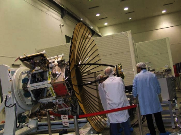
The Synthetic Aperture Radar (NISAR) satellite being developed by the US Space Agency NASA and the Indian Space Agency ISRO is expected to be launched in the year 2022. This will be the first such radar imaging satellite in the world to use two frequencies simultaneously. Not only this, it will also be the world’s most expensive Earth Imaging Satellite. In this sense, it will also be special in many ways. The countries had reached an agreement in 2014 for this joint mission.
This satellite will also be a remote sensing satellite, which will be helpful in understanding the natural structures of the earth and their nature. This satellite, costing one and a half billion dollars, will obviously get more high-resolution photos than before, which will provide proper information about the ratio of ice present above the earth.
The special aspect of this satellite is that it is designed to measure the natural hazards of Earth’s ecosystem disturbances, snowflake collapses, earthquakes, tsunamis, volcanoes and landslides. Also designed to see some of the most difficult natural processes of this planet. In any type of emergency, such as tsunami or earthquake or landslide, fresh photos can be easily taken from this satellite in a short time. The photos obtained from this will also give scientists an opportunity to understand the difficulty of the Earth and they will be able to work on it easily.
Source:NewsTrackLive
You may also like
-
India Leads BIMSTEC Security Cooperation as Seven Nations Adopt Delhi Declaration
-
India and Cyprus Strengthen Naval Cooperation with Focus on Maritime Security and Joint Training
-
India’s NSA Ajit Doval Holds High-Level Security Talks with Iran Amid Rising Tensions in West Asia
-
India Expands Diplomatic Presence in Central America with New Embassy in Costa Rica
-
New Technology Provides Environment Friendly Route for Treating Dye-Contaminated Wastewater
