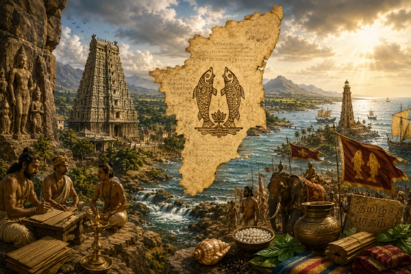
Mahabharata Geography — Dravida
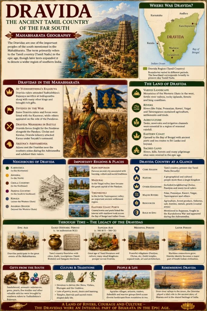
Modern geographical correspondence: Tamil country, especially present-day Tamil Nadu; the term was also used more broadly for southern India in later traditions
At the southern end of Bharata lay a vast country where ancient river valleys descended from the peninsula towards the eastern sea, rocky hills rose abruptly above fertile plains, tropical forests covered the mountain slopes and long coastlines opened towards the Indian Ocean. Within the geographical vocabulary of the Mahabharata, one of the peoples inhabiting this southern world was known as the Dravidas. The name is historically important because it would eventually acquire meanings far broader than any single kingdom, yet within the epic it could still designate a recognisable southern people distinct from neighbouring Cholas, Pandyas, Keralas and Andhras.
For the purposes of Mahabharata geography, Dravida is best associated primarily with the Tamil country, broadly corresponding to present-day Tamil Nadu and adjoining areas whose political and cultural orientation belonged to ancient Tamilakam. Its exact boundaries cannot be reconstructed with confidence, and the epic itself sometimes uses regional names in ways that overlap. Later Sanskrit geographical traditions could use Dravida much more broadly for southern India, while still other texts employed it more specifically for Tamil-speaking country. The safest approach is therefore to understand epic Dravida as a major southern ethnogeographical identity whose heartland lay in the Tamil country without treating it as identical to the boundaries of modern Tamil Nadu.
This distinction becomes especially important because the Mahabharata names Dravidas, Cholas, Pandyas, Keralas, Andhras and other southern peoples separately. Dravida therefore cannot simply mean “all of South India” every time the epic uses the word. At the same time, later geographical usage widened the term considerably, eventually producing expressions in which Dravida represented much of peninsular southern India. The history of the word is therefore one of expansion: an ancient regional or ethnic designation gradually became one of the most enduring collective names for the south.
Dravida in the Geography of the Mahabharata
One of the clearest references appears in the Bhishma Parva during the epic’s famous description of Bharatavarsha. When the southern regions are enumerated, the text names the Dravidas, Keralas, Mushikas and Vanavashikas, followed by Karanatakas, Mahishakas, Kuntalas, Cholas and many other peoples. The passage firmly places the Dravidas among the recognised countries and communities of southern Bharata.
The sequence is geographically revealing. Kerala and Mushika belong towards the southwestern coast, Vanavasi to the western Karnataka interior, Kuntala to parts of the Deccan and Chola to the Kaveri country. Dravida occurs within this southern cluster but remains separately named. The epic’s geography therefore recognises a mosaic of political and cultural regions across peninsular India rather than treating the entire south as one undifferentiated country.
This is one of the central features of Mahabharata geography. The south was not merely a distant frontier beyond the Vindhyas. It contained established countries, rulers, armies and networks of communication. Chola, Pandya, Kerala, Mushika, Andhra and Dravida all belonged to that larger southern world, and their appearance throughout the epic demonstrates that they were incorporated into its conception of Bharata.
A Name Broader Than a Kingdom
Dravida differs from regions such as Chola or Pandya because the term does not always appear to represent a single political kingdom ruled continuously by one dynasty. It could denote a people, cultural region or wider geographical sphere, depending upon the period and source.
This explains why attempts to locate a single “capital of Dravida” are problematic. Chola could be connected with Uraiyur and later Thanjavur, while Pandya became inseparable from Madurai. Dravida does not possess an equally secure epic-era capital. Instead, it describes a larger geographical identity within the Tamil south.
Later Sanskrit writers expanded the geographical meaning of Dravida further. Medieval classifications sometimes divided Brahmanical India into northern Pancha-Gauda and southern Pancha-Dravida regions, using Dravida in a far broader peninsular sense. That later terminology should not be projected directly backwards into the Mahabharata, but it shows how powerful the geographical name eventually became.
For our reconstruction, Dravida should therefore appear on the map as a broad Tamil-country region rather than a precisely bounded monarchy.
The Dravidas at Yudhishthira’s Rajasuya
The Dravidas appear prominently at Yudhishthira’s Rajasuya sacrifice. The Sabha Parva describes hundreds of rulers arriving at Indraprastha from different parts of Bharata, bringing precious gifts and recognising the political significance of Yudhishthira’s imperial ceremony. Among those attending are rulers of Vanga and Kalinga, Andhrakas, Kuntalas and explicitly the Dravidas, together with Sinhalas and numerous other kings.
Their presence is important because Indraprastha lay far to the north. A Dravida delegation travelling to the Rajasuya would have crossed much of the peninsula before entering the Gangetic world. Such a journey required functioning political routes, places where travellers could obtain provisions and a network through which news about the Pandava kingdom could travel hundreds of kilometres.
The gathering therefore reveals something fundamental about the political imagination of the Mahabharata. The Tamil south was connected to the northern kingdoms through diplomacy as well as war. Rulers from Dravida were expected to know of Yudhishthira’s rising power and to participate in a ceremony intended to demonstrate his status among the kings of Bharata.
For the inhabitants of Indraprastha, the arrival of southern delegations must have created an extraordinary spectacle. Different clothing styles, languages, ornaments, weapons, animals and products from distant regions entered the same royal city. Dravida stood among this immense assembly as one of the southern lands represented at the Pandava court.
Dravida on the Eve of Kurukshetra
As war approached, the political position of the Dravidas became complicated. In the Udyoga Parva, speeches describing the strength of the Kaurava army include Dravidas, Andhras and people associated with Kanchi among the numerous regional groups surrounding Duryodhana’s enormous coalition.
Elsewhere in the same book, however, Krishna tells Karna that if he joined his true Pandava brothers, the Dravidas, Kuntalas, Andhras and other peoples would form part of the magnificent procession surrounding him. The statement belongs to Krishna’s attempt to persuade Karna rather than to a straightforward army register, but it shows that Dravida warriors were imagined within the broader network from which Pandava support could also be drawn.
The apparently contradictory evidence is best understood as a reminder that ancient regional names did not necessarily describe politically unified populations. Different Dravida rulers or contingents may have supported different sides, just as members of other dynasties and regions appear on opposing sides of the Kurukshetra War.
There is therefore no need to force all Dravidas into one alliance. The epic itself presents a political world in which loyalties could be divided across regions.
Dravida Warriors in the Pandava Army
The Karna Parva gives the Dravidas an unmistakable battlefield presence on the Pandava side. As the Pandava formation advances, Sanjaya describes Dhrishtadyumna, Shikhandin, the sons of Draupadi, Satyaki and Chekitana moving forward together with the Dravida forces, the Pandyas, the Cholas and the Keralas.
This is an extraordinarily valuable geographical passage because several distinct southern peoples appear together within the same military coalition. Dravida is not being used here as a collective label replacing Pandya, Chola and Kerala. The text names them separately.
This strengthens the argument that epic Dravida represented a particular southern population or territorial identity within the wider Tamil and South Indian world, even though its exact borders cannot now be reconstructed.
The description of these southern warriors is vivid. Ganguli’s translation portrays them as physically powerful men dressed in colourful garments, adorned with ornaments and carrying swords, nooses and other weapons. Such descriptions undoubtedly contain literary conventions, but they also serve a narrative purpose: the southern contingents are presented as visually distinctive elements within the immense Pandava army.
From the distant Tamil country they had travelled northwards to fight on the dusty plains of Kurukshetra.
The Dravida Infantry Attacks Karna
Another Karna Parva episode gives us an even clearer picture of Dravida troops in battle. As Karna tears through the Pandava formations, Dravida, Andhra and Nishada infantry, urged forward by Satyaki, rush at him with the intention of killing him. Karna responds with devastating volleys of arrows and cuts down large numbers of the attacking foot soldiers.
The passage is particularly valuable because it identifies the Dravidas specifically as infantrymen in this encounter. Much of the Mahabharata’s battlefield narrative concentrates upon heroic chariot duels between aristocratic warriors, but behind those celebrated confrontations were enormous bodies of ordinary soldiers fighting on foot.
The Dravida contingent belonged to that wider military machine.
Imagine men accustomed to the hot plains and river valleys of the Tamil south suddenly facing one of the greatest archers of the Kaurava army. They advanced under Satyaki’s command through a battlefield already filled with shattered chariots, fallen elephants, frightened horses and thousands of bodies. Karna’s arrows struck them in dense volleys, and the text compares their collapse to trees being cut down together in a forest.
The episode gives Dravida a direct and tragic place within the central war of the epic.
From Tamil Country to Kurukshetra
The distance travelled by these warriors deserves attention. If the Dravida heartland lay within the Tamil country, an army marching to Kurukshetra would have travelled well over a thousand kilometres, probably much farther depending upon the route.
The soldiers would have left a landscape of southern rivers, rocky hill systems and tropical vegetation before moving north through other political regions. They crossed the Deccan, encountered larger river systems and eventually entered the plains of northern India.
Such campaigns required enormous logistical organisation. Armies needed grain, fodder, water, replacement animals, craftsmen and routes suitable for transporting weapons and equipment. Large military contingents could not simply walk uninterrupted from one end of the subcontinent to the other without political arrangements.
The presence of Dravida troops at Kurukshetra therefore reflects more than epic spectacle. It expresses a conception of India linked by long-distance political and military networks.
Arjuna Returns to Dravida After the War
The Dravidas appear again after the Kurukshetra War during Yudhishthira’s Ashvamedha sacrifice. Arjuna accompanies the sacrificial horse as it travels through kingdoms whose rulers must either acknowledge Yudhishthira’s authority or challenge the horse’s progress.
After defeating the son of Ekalavya, Arjuna moves towards the southern ocean. In those southern regions he encounters the Dravidas, Andhras, Mahishakas and the hillmen of Kolwa. Battles occur, but Arjuna subdues them without prolonged difficulty before continuing eventually towards western India.
This is one of the strongest geographical clues in the epic because Dravida is placed explicitly in connection with the southern ocean.
The passage again distinguishes Dravidas from Andhras and Mahishakas. The Dravida country therefore lies within a wider southern geographical sequence rather than representing the whole peninsula indiscriminately.
Arjuna’s Ashvamedha journey also demonstrates that Dravida retained a political identity after the war. The region had its own rulers or communities capable of resisting the progress of the sacrificial horse, even though Arjuna eventually forced their submission to Yudhishthira.
The Southern Ocean
For the inhabitants of northern India, the southern ocean represented one of the great geographical limits of Bharatavarsha. Travelling south through the peninsula eventually brought the traveller to shores beyond which land no longer continued.
Dravida belonged close to this maritime horizon.
The eastern coast of Tamil country faces the Bay of Bengal, while farther south the coastline curves towards the waters surrounding the Gulf of Mannar and the Indian Ocean. Ancient routes following the coast connected settlements across Tamilakam, while maritime travel eventually linked the region with Sri Lanka and destinations farther across the sea.
The Mahabharata does not provide us with a detailed commercial history of epic-period Dravida, and later maritime achievements should not simply be projected backwards. Yet its association with the southern ocean reflects the basic geographical reality of the Tamil country.
The sea was one of its defining boundaries and one of its great avenues of movement.
A Country of Many River Valleys
Unlike Chola, whose political geography was overwhelmingly dominated by the Kaveri, the broader Dravida country contained several important river systems. The Palar, Ponnaiyar, Kaveri, Vaigai and Tamiraparani, together with numerous smaller rivers, divided Tamil country into distinct agricultural and political landscapes.
This variety is one reason why the Tamil south could support several separate kingdoms simultaneously.
The lower Kaveri became strongly associated with the Cholas. The Vaigai formed the heartland of later Pandya power around Madurai, while the Tamiraparani supported the fertile Tirunelveli region farther south. Northern and northeastern Tamil country developed around different river valleys and routes, eventually giving rise to other political centres.
Dravida should therefore be imagined not as a single river kingdom but as a larger cultural landscape containing several river worlds.
Across much of Tamil Nadu, rainfall is seasonal and uneven. Rivers, tanks, reservoirs and irrigation channels consequently became essential components of settled agricultural life. Political authority was closely connected with control over water, fertile land and the routes linking different valleys.
Between the Eastern Ghats and Western Ghats
Tamil country occupies the southern part of a peninsula framed by major mountain systems. The Western Ghats rise dramatically along the western side, while the Eastern Ghats break into discontinuous ranges farther east and north. Between them lie plateaus, river valleys and broad plains.
Ancient travellers entering Dravida from the Deccan could descend through passes and valleys towards increasingly hot lowlands. In some regions rocky outcrops dominate the horizon; in others the country opens into wide agricultural plains.
The mountains mattered economically as well as militarily. Forested uplands provided timber, animals, medicinal plants and aromatic products. Mountain passes controlled communication with Kerala and Karnataka, while routes northwards linked the Tamil country with Andhra and the Deccan.
Dravida therefore occupied the southern terminus of several major overland systems.
Its geography looked outward in every direction.
Dravida, Chola and Pandya — Related but Distinct
The relationship between Dravida, Chola and Pandya requires particular care. Because later usage often employed Dravida for Tamil culture generally, it is tempting to assume that the epic simply used Dravida as another name for Chola and Pandya together.
The Mahabharata itself argues against such a simple interpretation.
In the Karna Parva, the Pandava formation includes Dravida forces alongside the Pandyas, Cholas and Keralas, meaning the text can distinguish between all of them within a single sentence.
The most useful reconstruction is therefore to imagine Chola and Pandya as major named political kingdoms within the broader Tamil cultural world, while Dravida represented another southern territorial or ethnographic identity whose precise core may have shifted.
Later Sanskrit usage expanded Dravida so greatly that Chola and Pandya territory could themselves be described as belonging to Dravidadesa in a broader cultural sense. This later meaning should not erase the more specific distinction preserved by the epic.
Dravida and Kanchi
The Udyoga Parva contains an especially interesting geographical grouping when Dravidas appear alongside Andhras and Kanchis among the numerous peoples invoked in descriptions of the Kaurava forces.
Kanchi, associated historically with Kanchipuram in northern Tamil Nadu, became one of the greatest urban and religious centres of South India in subsequent centuries. The epic passage does not prove that Dravida was centred on Kanchi, because Kanchis are separately named. Nevertheless, the juxtaposition is geographically suggestive.
It points towards the northeastern Tamil-Andhra transition zone as part of the broader political environment surrounding Dravida.
This makes it especially unwise to reduce epic Dravida to the later Chola heartland alone. Dravida may have included or been associated particularly strongly with Tamil regions outside the principal Chola and Pandya cores.
The safest map should therefore show a broad Tamil-country correspondence with deliberately soft boundaries.
Dravida and Andhra
To the north and northeast lay the Andhra country. The Mahabharata repeatedly distinguishes Andhras from Dravidas, including both the Udyoga description of the pre-war alliances and the Ashvamedha account of Arjuna’s southern journey.
This distinction is geographically valuable. It places Dravida south of, or adjoining, the Andhra sphere rather than encompassing it completely within the epic context.
The transition between the Tamil and Telugu regions was never a simple permanent line. Political dynasties crossed it, populations interacted and frontier districts changed allegiance repeatedly. Yet the persistence of separate Andhra and Dravida names indicates that ancient Indian geographical tradition recognised meaningful distinctions between these regions.
Modern state boundaries should therefore not be projected backwards, but the broad division between the Tamil country and Andhra provides a useful frame for understanding Dravida.
Dravida and Kerala
The epic likewise names Dravidas and Keralas separately. This is important because later terms such as Pancha-Dravida would incorporate Kerala into a broad southern Dravida category, while the Mahabharata’s own geographical lists preserve a distinction between the two.
The Western Ghats formed the great natural divide between much of Tamil country and Kerala. They created radically different climatic environments. Kerala’s western slopes receive enormous monsoon rainfall, while much of the Tamil plain to the east lies in a rain shadow and depends more heavily upon the northeast monsoon and managed water systems.
Yet the mountains were permeable.
Passes connected the Tamil plains with the Malabar coast. Spices, timber, animals and other goods travelled east and west, while political armies crossed the Ghats repeatedly throughout South Indian history.
Dravida and Kerala were therefore distinct but deeply connected neighbours.
The Tamil Country as a Cultural Landscape
The modern word “Tamil Nadu” means the country or land of the Tamils. In the ancient world, the corresponding cultural region was usually remembered through traditions of Tamilakam, a geographical sphere encompassing the Tamil-speaking south and containing numerous political territories.
Dravida and Tamilakam should not simply be treated as identical technical terms, because they emerged from different linguistic and literary traditions. Tamilakam belongs primarily to Tamil geographical consciousness, while Dravida became particularly prominent in Sanskrit and later pan-Indian terminology.
Nevertheless, both eventually pointed towards overlapping southern landscapes.
This helps explain why later commentators frequently identified Dravida with the Tamil country. Older geographical scholarship also interpreted the Dravidas of Sanskrit sources as inhabitants of the southeastern or Coromandel Tamil region, even though later usage expanded the name considerably.
For Mahabharata geography, Tamil country therefore remains the strongest modern correspondence.
The Landscape of Ancient Dravida
To imagine Dravida in the epic world, modern metropolitan skylines and medieval temple towers must first disappear.
Picture instead a wide southern plain during the early morning. Rocky hills stand above patches of forest, while cultivated fields spread around tanks and river channels. Villages cluster close to dependable water, connected by dusty tracks lined with trees.
Farmers lead cattle towards the fields as potters, metalworkers, weavers and other craftsmen begin their work. Traders prepare carts for journeys between settlements. Farther away, a road approaches a fortified centre controlled by a local ruler.
During the dry season, the landscape is brown and gold beyond the irrigated fields. When the monsoon arrives, tanks fill and river channels become active again. Agricultural prosperity depends upon carefully storing and distributing water.
Move eastwards and the country gradually approaches the sea. Salt air replaces the dry heat of the interior. Fishing settlements appear near river mouths and coastal lagoons, while boats move parallel to the shoreline.
This was a country in which land and water had to be continually managed.
The Eastern Coast
Much of the Tamil country opens towards the long eastern coastline facing the Bay of Bengal. Later history would know this as part of the great maritime world of the Coromandel coast, where ports connected southern India with Sri Lanka and Southeast Asia.
The exact organisation of maritime commerce during the age represented by the Mahabharata remains impossible to reconstruct in detail. The epic itself does not provide an inventory of Dravida ports or shipping networks.
Yet geography strongly favoured coastal movement.
Boats could travel between river mouths and settlements along the shore. Fishermen exploited marine resources, while coastal communities possessed knowledge of currents, winds and seasonal weather. River valleys connected these coastal settlements with the interior.
Dravida therefore had access simultaneously to inland India and the sea.
This geographical advantage would become increasingly important throughout subsequent South Indian history.
Sacred Geography of the Tamil South
The Tamil country eventually became one of the great sacred landscapes of Hindu civilisation, filled with temples associated with Shiva, Vishnu, Murugan and the Goddess. Many of the enormous structures visible today belong to medieval or later centuries and should not be imagined in their present monumental form during the epic age.
Nevertheless, the roots of sacred geography are considerably older.
Rivers, hills, forests, springs and coastal sites could become objects of pilgrimage long before monumental stone temples rose beside them. The Mahabharata itself integrates southern rivers and pilgrimage places into the sacred geography of Bharata, demonstrating that the south was understood as part of a wider religious landscape rather than as a culturally disconnected frontier.
Travellers moving through Dravida would therefore have encountered shrines, sacred groves, hermitages and river crossings that possessed religious meaning alongside their practical geographical importance.
Over the centuries those sacred locations would accumulate architecture, inscriptions and legends, transforming the Tamil country into one of India’s most densely monumental religious landscapes.
Languages and the Meaning of Dravida
Today the term Dravidian is most commonly encountered in linguistics, where it refers to a major language family including Tamil, Telugu, Kannada, Malayalam and several other languages. That modern linguistic classification should not be retroactively imposed upon every ancient occurrence of the word Dravida.
The Mahabharata was not using “Dravida” as a modern linguistic category.
Its geographical passages treat Dravidas alongside Andhras, Keralas, Cholas and other peoples who today speak languages classified within the same Dravidian family. This alone shows that epic geographical usage operated differently from modern linguistic terminology.
The distinction is essential. In our series, Dravida refers to an ancient geographical and ethnopolitical identity, not to every population speaking a Dravidian language.
Later intellectual history broadened the term dramatically, but the epic preserves an older and more particular usage.
A Southern People in a Pan-Indian World
The repeated appearance of the Dravidas illustrates one of the most important themes running through Mahabharata geography: enormous distances did not prevent political interaction.
Dravida rulers came to Yudhishthira’s Rajasuya. Dravida warriors appear in the armies preparing for Kurukshetra. Dravida infantry attacks Karna under Satyaki’s command. After the war, Arjuna again encounters the Dravidas near the southern ocean while following the Ashvamedha horse.
These are not isolated geographical names accidentally scattered through the epic.
Together they reveal a southern country repeatedly integrated into the major political events surrounding the Pandavas.
Dravida belonged to Bharata’s political world before the war, participated in the great conflict itself and remained part of Yudhishthira’s imperial geography afterward.
Arjuna at the Southern Ocean
The Ashvamedha episode provides perhaps the best scene through which to visualise Dravida.
Years have passed since Kurukshetra. The battlefield has fallen silent, and Yudhishthira rules once again. During the Ashvamedha, the sacrificial horse wanders across the political world while Arjuna follows behind it.
Eventually Arjuna reaches the deep south.
The landscape grows warmer. Northern river systems lie far behind him, and the road approaches the sea. Here he encounters the Dravidas and neighbouring southern peoples. Resistance occurs, but the battles are comparatively brief, and Arjuna continues onward after securing their submission.
The scene closes a geographical circle.
Before the war, southern rulers had travelled north towards the Kuru-Pandava world. During the war, their soldiers fought at Kurukshetra. Now a Pandava hero travels south and reaches their own country beside the ocean.
The Mahabharata’s map has effectively been traversed in both directions.
Dravida Through Later History
As centuries passed, the geographical name Dravida acquired new meanings. Sanskrit religious and philosophical traditions increasingly used Dravida as a description of the Tamil south and eventually of broader sections of peninsular India.
The word also became associated with architecture, literary classifications, Brahmanical regional divisions and eventually modern linguistics. “Dravida” could therefore mean different things depending upon the century and context in which it appeared.
This later expansion should not obscure the earlier geography.
The Mahabharata preserves a moment in which Dravida was still sufficiently distinct to stand beside Chola, Pandya, Kerala and Andhra as one of the recognised peoples of southern Bharata.
The later history of the term is consequently best understood as an expansion outward from older southern geographical identities rather than evidence that every early Dravida reference automatically meant the entire peninsula.
Where Should Mahabharata Dravida Be Placed?
Any map of Mahabharata Dravida should be deliberately approximate. Unlike the Cholas and Pandyas, whose later historical heartlands are strongly associated with specific river basins, the Dravidas of the epic cannot be given one securely established capital or frontier.
The most reasonable modern correspondence is the Tamil country, broadly within present-day Tamil Nadu. Depending upon the passage and historical period, the name may have referred particularly to parts of Tamil country outside the strongly defined Chola and Pandya cores, while later Sanskrit usage expanded the word across much larger parts of southern India.
The map should therefore show a broad Tamil-region heartland with uncertain edges rather than a sharply bounded state. Chola and Pandya should remain visible as distinct neighbouring or overlapping political identities because the Mahabharata explicitly names them separately.
Andhra lay to the north and northeast, Kerala beyond the Western Ghats to the west, while the southern and eastern seas formed the great maritime horizon.
Dravida in the Living Landscape
The geography behind the ancient name can still be experienced across Tamil Nadu.
Travel through northern Tamil country and rocky hills rise from plains dependent upon seasonal rivers and tanks. Move south and the Kaveri creates the extraordinary agricultural world of the Cholas. Beyond that lie the drier plains around Madurai and the Vaigai, followed farther south by the green Tamiraparani valley and mountains overlooking Tirunelveli.
Travel towards the eastern coast and river systems open towards beaches, lagoons and ancient maritime landscapes.
The diversity is enormous, yet the regions are connected by language, roads, religious traditions and centuries of shared cultural development.
This broader unity within geographical diversity is perhaps the best way to understand why the word Dravida could survive even as individual kingdoms rose and disappeared.
The Dravida Country in the Epic Age
Imagine a traveller entering the Tamil country from the north. The road crosses dry uplands before descending into valleys dotted with tanks and cultivated settlements. Rocky hills rise suddenly from the plains, their slopes covered with scrub and woodland.
Farther south, larger river valleys sustain increasingly prosperous agricultural communities. Carts carry grain and textiles between settlements, while smiths and craftsmen work near the residences of local rulers. Soldiers guard important crossings and merchants move along routes connecting inland towns with the coast.
During the northeast monsoon, rain sweeps inland from the Bay of Bengal. Tanks fill, channels overflow and previously dry fields turn green.
Along the eastern shore, fishing boats leave before dawn. Farther south, the ocean stretches beyond the limits of the land.
News arrives from the north that Yudhishthira is performing the Rajasuya at Indraprastha. Rulers prepare gifts and representatives for the long journey.
Years later new messengers arrive. The sons of Pandu and Dhritarashtra are going to war.
Some Dravida warriors march north.
They will eventually appear beside Satyaki and the other Pandava heroes, thousands of kilometres from the country in which they were born.
Dravida — The Southern Country Within Bharata
Dravida occupies a distinctive position in Mahabharata geography because it is simultaneously specific and expansive. The epic recognises the Dravidas as a particular southern people, naming them separately from Cholas, Pandyas, Keralas and Andhras. Their rulers appear at Yudhishthira’s Rajasuya, their warriors participate in the great struggle at Kurukshetra and their country is encountered by Arjuna near the southern ocean after the war.
For our reconstruction, Dravida should therefore be associated primarily with the Tamil country of southern India, broadly corresponding to present-day Tamil Nadu while retaining deliberately uncertain boundaries. It should not be treated simply as another word for Chola or Pandya, nor should the later linguistic meaning of “Dravidian” be imposed upon the epic.
Its landscape was extraordinarily varied. Rivers created fertile agricultural corridors, rocky hills divided the plains, the Western Ghats formed a great mountain boundary in the west and the Bay of Bengal and southern ocean opened towards maritime routes in the east and south.
Within this world existed numerous rulers and regional identities, some of which—Chola and Pandya especially—would eventually become among the greatest dynastic names in Indian history.
Yet behind and alongside those kingdoms survived the broader name Dravida.
It was a name through which northern Sanskrit tradition recognised part of the deep south, a land far from the Kuru heartland yet repeatedly connected to it through pilgrimage, diplomacy, warfare and imperial ambition. The Dravidas travelled north to Indraprastha and Kurukshetra, while Arjuna eventually travelled south into their country beside the ocean.
In this way, Dravida reveals something larger than the geography of one region. It demonstrates the immense territorial imagination of the Mahabharata itself.
From the Himalayas to the southern sea, the epic conceived Bharata as a world of distinct peoples linked by roads, rivers, alliances and shared political memory. Dravida stood at the southern edge of that world—the ancient Tamil country where the land of Bharata approached the ocean.
You may also like
-
India to Build National Digital Repository for Tribal Languages with IITs and Universities
-
Gandhara: The Northwestern Kingdom of Gandhari and Shakuni in the Mahabharata
-
Kekaya or Kaikeya: The Western Punjab Kingdom Divided by the Kurukshetra War
-
Madra: The Ancient Punjab Kingdom of Shalya and Madri in the Mahabharata
-
BRICS Theatre Festival 2026 Opens in New Delhi, Bringing Together Nine Nations to Strengthen Cultural Cooperation
