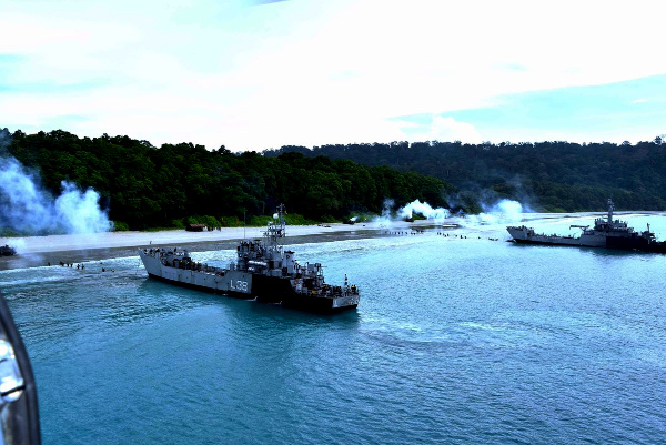
India’s accelerated development of the Andaman and Nicobar Islands is transforming the archipelago from a distant territorial frontier into a major centre of maritime trade, military surveillance, logistics and regional connectivity. Located between the Bay of Bengal and the Andaman Sea, the islands sit close to the sea lanes connecting the Indian Ocean with the Strait of Malacca, through which a substantial share of China’s energy imports and international commerce must pass. Their development therefore carries an importance extending far beyond local infrastructure or tourism. It strengthens India’s ability to secure the eastern Indian Ocean while creating strategic pressure around one of China’s greatest geographical vulnerabilities.
The centrepiece of this transformation is the Holistic Development of Great Nicobar Island. The project combines an International Container Transshipment Terminal at Galathea Bay, a greenfield international airport, a 450 MVA gas-and-solar power system and a planned township. The proposed terminal is designed for an eventual capacity of about 14.2 million twenty-foot equivalent units, while the airport is planned to handle around 4,000 passengers during peak hours. The government describes the project as a strategic maritime and economic hub that will strengthen India’s presence in the Andaman Sea and Southeast Asia.
Great Nicobar’s commercial value comes from its proximity to the principal East–West international shipping route. Galathea Bay lies around 40 nautical miles from this route and possesses a natural water depth exceeding 20 metres, allowing it to receive large container vessels. The port is intended to handle transshipment cargo originating from India’s eastern ports as well as Bangladesh, Myanmar and other regional economies. This could enable India to retain a larger share of container traffic that currently moves through foreign transshipment centres such as Singapore, Port Klang and Colombo.
The port also provides the economic foundation required to sustain a larger Indian presence in the southern islands. A modern container terminal, airport, power system, fuel storage, communications network and township would create infrastructure usable for both civilian and strategic purposes. Large transport aircraft, maritime patrol platforms, coastguard assets, commercial vessels and naval support ships would gain access to improved facilities close to the western approaches of the Strait of Malacca.
This geographical position has long shaped the military importance of the islands. The Andaman and Nicobar Command, headquartered at Sri Vijaya Puram, is India’s first and only operational joint-services command, integrating the Army, Navy, Air Force and Coast Guard. Its responsibilities include protecting India’s island territories, monitoring the surrounding seas and supporting operations across the eastern Indian Ocean.
INS Baaz at Campbell Bay on Great Nicobar already supports aircraft conducting surveillance over the southern Bay of Bengal, the Andaman Sea, the approaches to the Malacca Strait and the southern Indian Ocean. Improved runways, jetties, radar coverage, communications, fuel reserves and maintenance facilities would expand the range and endurance of these operations. They would also allow India to disperse its forces across several islands, making the regional military network more resilient during a crisis.
Development across the archipelago has a wider civilian dimension. The Chennai–Andaman and Nicobar Islands submarine optical-fibre cable, commissioned in 2020, connects Sri Vijaya Puram and several other islands with high-capacity digital infrastructure. It has supported faster broadband, mobile connectivity, telemedicine, online education, banking and e-governance. Fisheries infrastructure, eco-tourism, cruise tourism, inter-island shipping and harbour development are also being expanded, creating economic activity capable of supporting a larger permanent population and reducing the islands’ dependence on slow mainland supply chains.
The strategic importance of this development becomes clearer when viewed through China’s dependence on the Strait of Malacca. The roughly 900-kilometre waterway between the Malay Peninsula and the Indonesian island of Sumatra provides the shortest maritime connection between the Indian Ocean and East Asia. At its narrowest point near the Singapore Strait, the navigable channel is approximately 2.7 kilometres wide, creating one of the world’s most concentrated maritime bottlenecks.
During the first half of 2025, approximately 23.2 million barrels of petroleum and other liquids passed through Malacca every day, representing around 29 per cent of global maritime oil flows. More than 102,500 ships reportedly used the passage during 2025. Around three-quarters of China’s seaborne crude-oil imports from the Middle East and Africa move through this route, making uninterrupted access essential to Chinese industry, transport, electricity generation and military readiness.
This dependency is frequently described as China’s “Malacca Dilemma.” Oil tankers sailing from the Persian Gulf and Africa cross the Indian Ocean before entering Malacca and continuing through the South China Sea towards Chinese ports. Container vessels carrying Chinese exports to Europe, Africa and West Asia follow the same corridor in the opposite direction. Congestion, accidents, piracy, conflict or prolonged disruption along the route could increase freight costs, delay energy supplies and place pressure on the Chinese economy.
Beijing has spent years attempting to reduce this vulnerability. The China–Myanmar oil and gas pipelines connect the Bay of Bengal coast near Kyaukpyu with Yunnan province, allowing a limited volume of energy imports to bypass Malacca. China has also expanded pipeline links with Russia and Central Asia, built strategic petroleum reserves, invested in alternative routes through Indonesia and promoted the China–Pakistan Economic Corridor. These alternatives diversify supply, while the scale and efficiency of maritime shipping preserve Malacca’s central position in China’s commercial system. Routes through the Sunda and Lombok straits add distance and cost, while overland pipelines carry only a fraction of the volumes moved by tankers.
The Andaman and Nicobar Islands give India a favourable position from which to observe vessels travelling between the Indian Ocean and the western approaches to Malacca. Maritime patrol aircraft, satellites, coastal radar stations, underwater sensors, naval ships and allied information-sharing arrangements can provide a detailed picture of merchant and military movements across the region. This awareness becomes especially important when submarines or intelligence-gathering vessels attempt to enter the eastern Indian Ocean.
During peacetime, such capabilities support navigation safety, anti-piracy operations, humanitarian assistance, search and rescue, disaster relief and the protection of commercial shipping. During a military confrontation, the same infrastructure could help India track Chinese naval deployments, protect its own sea lanes and complicate the movement of hostile forces between the South China Sea and the Indian Ocean.
The islands provide strategic leverage through surveillance, deterrence and rapid force deployment. A strengthened airfield network could host maritime reconnaissance aircraft, fighters, transport aircraft, helicopters and unmanned systems. Improved ports and jetties could support warships, coastguard vessels, amphibious platforms and logistics ships. Fuel, ammunition, repair and medical facilities would allow these units to remain deployed farther from the Indian mainland for longer periods.
Great Nicobar also gives India an economic instrument rather than a purely military position. A successful transshipment port could place Indian infrastructure directly beside one of the world’s busiest shipping corridors. Commercial traffic, international shipping services, bunkering, ship repair, warehousing and logistics would generate sustained activity in an area where strategic infrastructure has historically remained limited. Economic density would support military readiness while giving regional partners a practical stake in the islands’ stability.
The project forms part of India’s wider Indo-Pacific approach. The islands can support maritime cooperation with Indonesia, Singapore, Malaysia, Thailand, Australia, Japan, France and other partners interested in secure sea lanes. Great Nicobar lies close to Indonesia’s Aceh province, while the northern islands extend towards Myanmar. This geography places the archipelago at the meeting point of South Asia and Southeast Asia and makes it a natural platform for India’s Act East policy and its vision of Security and Growth for All in the Region.
A strategically important island should also maintain healthy coastlines, stable freshwater systems, protected forests and secure indigenous communities. Independent scientific monitoring, transparent compliance reporting, controlled settlement growth, robust waste treatment and protection of tribal reserves would help ensure that the infrastructure strengthens the island’s resilience across generations.
The development of the Andaman and Nicobar Islands therefore represents far more than a response to China. It creates a commercial gateway, a digital and transport network, a fisheries and tourism economy, and a forward operating base for safeguarding India’s eastern maritime frontier. China’s dependence on the Malacca Strait gives this development additional strategic weight, because Indian facilities lie close to the sea lanes connecting Beijing with its principal energy suppliers and overseas markets.
The islands should be understood as both a shield and a gateway. They can protect India’s eastern approaches, support friendly navies, monitor the movement of potentially hostile forces and connect Indian commerce with Southeast Asia. As Great Nicobar’s port, airport and associated infrastructure take shape, India will gain greater influence over the maritime environment surrounding China’s most sensitive trade and energy corridor. The enduring value of that position will come from preparedness, economic strength, ecological resilience and the ability to keep the eastern Indian Ocean secure.
References:
- Press Information Bureau, Government of India. “Great Nicobar Project: Strategic Significance and Sustainable Development.” 4 May 2026.
https://www.pib.gov.in/PressNoteDetails.aspx?ModuleId=3&NoteId=158406&id=158406&lang=1®=1 - Press Information Bureau, Ministry of Ports, Shipping and Waterways. “International Container Transshipment Port at Galathea Bay, Great Nicobar Island.” 13 November 2023.
https://www.pib.gov.in/PressReleasePage.aspx?PRID=1979157&lang=2®=48 - Press Information Bureau, Ministry of Ports, Shipping and Waterways. “Development of Mega International Container Transshipment Port at Galathea Bay.” 27 January 2023.
https://www.pib.gov.in/PressReleasePage.aspx?PRID=1894045&lang=2®=3 - Press Information Bureau, Ministry of Defence. “Andaman and Nicobar Command—India’s First and Only Joint Services Operational Command.”
https://www.pib.gov.in/PressReleasePage.aspx?PRID=2133190&lang=2&noshow=1®=48 - Press Information Bureau, Prime Minister’s Office. “Prime Minister Launches Submarine Optical Fibre Cable Connecting Andaman and Nicobar Islands with the Mainland.” 10 August 2020.
https://www.pib.gov.in/pressreleasepage.aspx?PRID=1644712&lang=2®=48 - U.S. Energy Information Administration. “World Oil Transit Chokepoints—Strait of Malacca.”
https://www.eia.gov/international/content/analysis/special_topics/World_Oil_Transit_Chokepoints/ - U.S. Energy Information Administration. “The Strait of Malacca, a Key Oil-Trade Chokepoint, Links the Indian and Pacific Oceans.”
https://www.eia.gov/todayinenergy/detail.php?id=32452 - Press Information Bureau. “Development of Mega Transshipment Port at Galathea Bay to Capture Cargo from India’s East Coast, Bangladesh and Myanmar.”
https://www.pib.gov.in/PressReleasePage.aspx?PRID=2089049&lang=1®=3
You may also like
-
India’s First Port-Based e-Methanol Plant at Kandla to Supply Green Fuel to Global Shipping
-
India’s Recent Oil and Gas Discoveries: New Finds, Offshore Frontiers and How Much Crude India Produces at Home
-
India’s Hidden Gold Mountain: How Households Came to Own an Estimated 31,000 Tonnes of Gold
-
India–Afghanistan Air Cargo Corridor Returns to Focus as Both Sides Push for Stronger Trade Connectivity
-
India’s Defence Shipyards Build Common Indigenous Supply Chain for Specialised Naval Cables
