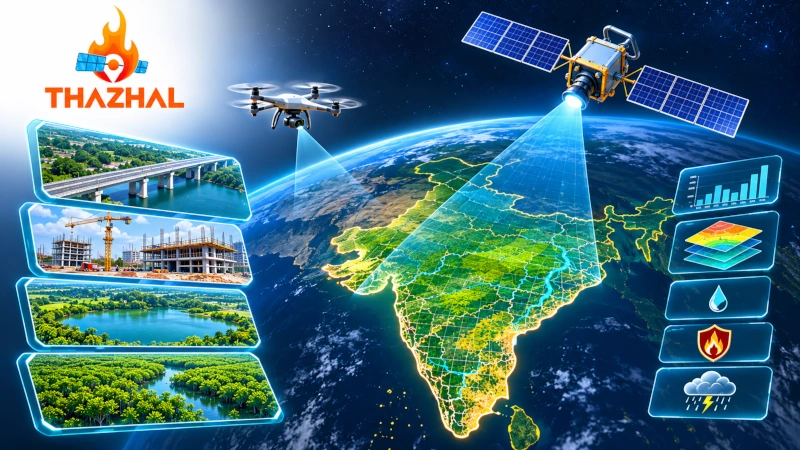
Tirunelveli-based deep technology startup Thazhal Geospatial Analytics is developing indigenous geospatial intelligence solutions that combine satellite imagery, drone-based observations, artificial intelligence and Internet of Things (IoT) sensors to monitor infrastructure assets and assess environmental risks. The company’s technology focuses on converting geographical and remote-sensing data into actionable information for government agencies, infrastructure operators, financial institutions and businesses.
The startup’s technological capabilities received attention following an interaction between its founder and Chief Executive Officer, Vignesh Kandasamy, and Prime Minister Narendra Modi during a gathering of Tamil Nadu entrepreneurs. The interaction was highlighted in a report published on 11 November 2026, showcasing Indian startups working in advanced technologies, including space applications, artificial intelligence, infrastructure management and environmental monitoring.
Established in 2021, Thazhal Geospatial Analytics operates from Tirunelveli in Tamil Nadu. The company specialises in geospatial analytics, location intelligence and environmental monitoring, with a particular focus on applying space-derived information to infrastructure management, climate risk assessment and natural resource conservation.
Integrating Satellite Imagery, Drones and Artificial Intelligence
Thazhal Geospatial Analytics has developed a technology framework that combines information collected from satellites, drones and ground-based sensors with artificial intelligence-powered analytical tools. The company’s approach focuses on integrating geographical data from multiple sources to provide information about the condition of physical assets and the environmental risks affecting them.
Satellite imagery provides observations of geographical areas, while drone-based surveys offer detailed information about selected locations. IoT sensors contribute additional measurements from physical environments and infrastructure installations. The combined information is processed through geospatial analytical systems to support monitoring and assessment.
The company uses these technologies to examine infrastructure conditions, identify geographical changes and evaluate environmental factors affecting assets. Its solutions are designed to support infrastructure owners, businesses and public authorities requiring location-specific information for operational and planning decisions.
Thazhal’s work falls within the downstream space technology sector, which uses satellite-generated data and associated technologies to develop services for industries and government organisations. Unlike companies manufacturing launch vehicles or spacecraft, Thazhal focuses on extracting information from remote-sensing data and integrating it with other geographical observations.
Monitoring Roads, Bridges and Construction Projects
Infrastructure monitoring is one of the principal applications of Thazhal’s geospatial technology. The company has developed solutions intended to support the assessment of roads, bridges, construction projects and other physical infrastructure assets using satellite observations and supplementary geographical information.
Its monitoring approach includes tracking construction progress, identifying potential project delays and assessing risks associated with infrastructure development. By comparing geographical information collected at different stages, the company’s analytical systems are designed to provide information about changes occurring at construction sites and other monitored locations.
During the interaction with Prime Minister Narendra Modi, Vignesh Kandasamy discussed the company’s infrastructure monitoring capabilities. The Prime Minister reportedly enquired whether the technology could be used to assess roads and bridges, highlighting the practical applications of satellite-based analytics in infrastructure management.
The company has identified infrastructure owners, engineering organisations, lenders and insurers among the users of its asset monitoring and risk assessment services. Its geospatial platforms are designed to help these organisations understand the geographical and environmental conditions surrounding physical infrastructure.
Environmental Monitoring of Lakes and Mangrove Ecosystems
Environmental monitoring forms another important component of Thazhal’s activities. The company uses satellite imagery and geospatial analytics to assess changes in natural environments, including lakes, waterbodies, coastal ecosystems and mangrove habitats.
Thazhal has reported working with the Tamil Nadu government on mangrove assessment and lake monitoring activities. These projects involve the application of remote-sensing information to environmental observation and resource management.
Satellite-based monitoring enables geographical features to be examined across different periods, providing information about changes in vegetation cover, surface water distribution and surrounding land use. Thazhal’s work applies these methods to environmental datasets relevant to waterbody management and ecosystem assessment.
The company’s environmental monitoring activities reflect its focus on using space technology for sustainability-related applications. Its expertise includes imagery analysis, geographical information systems and the assessment of environmental conditions affecting natural resources.
SWOAD Platform for Surface Water Monitoring
Thazhal has developed a product called SWOAD — Surface Water Observatory and Anomaly Detection, designed to monitor surface waterbodies using satellite-derived information and geospatial analytics.
The platform focuses on near-real-time observation of surface water conditions and the analysis of historical satellite data. It is designed to help users examine changes in waterbody conditions and access information relevant to water resource management.
According to the company, SWOAD incorporates analytical capabilities for monitoring surface water and identifying anomalies. Its stated objective is to support water sustainability through improved access to geographical information about water resources.
The platform also provides capabilities associated with data-driven assessment, environmental monitoring and decision support. Thazhal identifies city administrations and organisations responsible for managing natural resources among the intended users of these services.
The development forms part of the company’s wider work in water intelligence, which includes geospatial analysis of water resources and the use of digital tools to examine environmental conditions.
Climate Audit Platform for Environmental Risk Assessment
Thazhal’s Climate Audit platform focuses on assessing climate-related risks affecting infrastructure, commercial assets and geographical locations. The company has developed the product to identify hazard zones, evaluate risk intensity and provide information about climate exposure across different regions and sectors.
The platform covers several categories of environmental hazards, including floods, extreme rainfall, droughts, landslides, sea-level rise, temperature-related risks, high winds and cyclones.
Its analytical framework incorporates geographical information and risk assessment methods to examine the exposure of physical assets to these hazards. The company describes the service as a tool for identifying location-specific vulnerabilities and supporting risk management decisions.
Thazhal has identified real estate developers, energy companies, banks, financial institutions and other asset-intensive businesses as potential users of its climate risk assessment services.
For financial institutions, the platform focuses on integrating climate-related geographical information into assessments of physical assets and investment exposure. For infrastructure operators, it provides analytical information about environmental conditions relevant to existing installations and development locations.
Fire Audit and Infrastructure Safety Assessment
Thazhal also offers a product identified as Fire Audit, forming part of its portfolio of risk assessment and infrastructure safety technologies.
The company has described its work in artificial intelligence-based fire audits and indoor and outdoor risk assessment. These activities are associated with its broader focus on evaluating risks to physical infrastructure and commercial facilities.
Its approach involves the application of digital analytical technologies to identify and assess conditions relevant to infrastructure safety.
Fire Audit is listed alongside SWOAD and Climate Audit in the company’s product portfolio, reflecting Thazhal’s focus on developing specialised analytical tools for different environmental and infrastructure monitoring requirements.
Geospatial Intelligence for Financial Institutions
Thazhal’s technology also addresses the requirements of banks, lenders and insurance companies seeking geographical information about physical assets.
Financial institutions frequently assess properties, industrial facilities, infrastructure projects and other assets exposed to environmental hazards. Thazhal’s services focus on providing location-specific analytical information that can be incorporated into these assessments.
The company’s technology combines geographical observations with environmental risk information to help organisations examine the conditions surrounding infrastructure and other physical assets.
Its climate risk assessment platform is designed to support evaluations involving floods, droughts, extreme weather and other location-specific hazards.
By combining satellite imagery, geographical datasets and artificial intelligence, Thazhal provides analytical services intended for asset monitoring, risk assessment and business intelligence.
Participation in India’s Deep Technology Startup Ecosystem
Thazhal Geospatial Analytics has participated in startup development initiatives and technology entrepreneurship programmes supporting India’s geospatial and deep technology sectors.
The company has acknowledged support from the Ministry of Electronics and Information Technology, Software Technology Parks of India and Tamil Nadu Technology Hub in connection with its participation in the interaction with Prime Minister Narendra Modi.
Thazhal has also participated in the Japan–India Innovation Pitch initiative, where it presented its geospatial technology and sustainability-focused solutions.
The company’s participation in these programmes reflects its involvement in India’s expanding ecosystem of enterprises developing commercial applications using satellite imagery, artificial intelligence and advanced digital technologies.
Its operations from Tirunelveli also highlight the emergence of specialised technology companies outside India’s traditional metropolitan startup centres.
Applying Space Technology to Environmental and Infrastructure Management
Thazhal Geospatial Analytics represents an example of an Indian startup applying space-derived information to practical challenges involving infrastructure, environmental management and climate risk assessment.
Its technology portfolio covers satellite-based asset monitoring, drone-supported geographical surveys, surface water observation, climate risk analysis and infrastructure safety assessment.
The company’s SWOAD, Climate Audit and Fire Audit products demonstrate its focus on developing specialised analytical platforms for different monitoring requirements. Its reported work with the Tamil Nadu government on mangrove assessment and lake monitoring provides an example of its involvement in environmental applications.
The interaction between founder Vignesh Kandasamy and Prime Minister Narendra Modi brought attention to these capabilities, particularly the application of satellite-based intelligence to roads, bridges and construction projects.
Through its work in geospatial analytics and environmental intelligence, Thazhal is contributing to India’s domestic capabilities in downstream space technology and the development of data-driven tools for infrastructure and natural resource management.
You may also like
-
Indian SpaceTech Startup Grahaa Space Develops Indigenous Earth-Observation Satellite Constellation
-
Cochin Shipyard Wins ₹498.58 Crore Contract to Modernise INS Betwa with Diesel Propulsion and Upgraded Weapons
-
Cabinet Extends Stand-Up India Scheme Until 2031 with ₹4,111 Crore Credit Guarantee Corpus
-
Chennai SpaceTech Startup Dream Aerospace Develops Indigenous Spacecraft Propulsion Systems
-
Coorg Green Cardamom of Karnataka: The GI-Tagged Heritage of Kodagu’s Aromatic Spice Plantations
