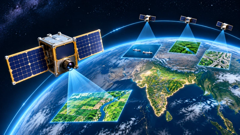
Indian SpaceTech startup Grahaa Space is advancing the development of an indigenous constellation of Earth-observation nanosatellites designed to deliver near-real-time video imagery and geospatial intelligence from low Earth orbit. The company’s technology aims to transform conventional satellite-based observation by providing more frequent visual information about developments on the Earth’s surface, supporting applications in maritime surveillance, agriculture, infrastructure monitoring, environmental protection and disaster management.
The company’s progress received renewed attention following an interaction between its co-founder and Chief Executive Officer, Ramesh Kumar, and Prime Minister Narendra Modi during a gathering of Tamil Nadu entrepreneurs. The interaction was highlighted in a report published on 11 November 2026, which examined emerging Indian startups developing advanced technologies in space, aviation, healthcare and other sectors.
Grahaa Space has already achieved an important milestone with the successful deployment of its SOLARAS nanosatellite aboard Skyroot Aerospace’s Vikram-I orbital launch vehicle on 18 July 2026. The mission marked a significant step in the company’s efforts to validate its indigenous satellite architecture and develop the technological foundations for a larger Earth-observation constellation.
Developing an Indigenous Earth-Observation Satellite Constellation
Grahaa Space is developing a constellation of interconnected nanosatellites designed to capture and transmit high-resolution video imagery of the Earth’s surface. Unlike conventional satellite imaging systems that primarily deliver individual photographs captured during orbital passes, the proposed platform aims to provide video-based observations that can reveal changes and movements over time.
The company describes its long-term objective as developing an orbital observation capability that can provide near-real-time geospatial information to customers requiring timely situational awareness. Such technology could support organisations that need to observe maritime activity, monitor critical infrastructure, assess environmental changes or respond rapidly to natural disasters.
The proposed constellation would use multiple small satellites operating in coordinated orbits to improve observation frequency and expand geographical coverage. As additional spacecraft are deployed, the system is intended to reduce the time between successive observations of selected locations.
This approach is particularly relevant because individual Earth-observation satellites can monitor a given location only when their orbital paths and imaging conditions permit. A larger constellation can improve revisit frequency, although achieving genuinely continuous coverage would require an appropriately designed network of satellites, communication infrastructure and supporting ground systems.
Grahaa Space is developing the satellite platforms, communication technologies and data-processing capabilities required to support this architecture, with the objective of building an integrated system capable of delivering useful geospatial intelligence rather than imagery alone.
SOLARAS Satellite Successfully Deployed During Vikram-I Mission
Grahaa Space achieved a major technological milestone on 18 July 2026 when its SOLARAS technology demonstration satellite was deployed into low Earth orbit aboard Vikram-I, the orbital-class launch vehicle developed by Hyderabad-based Skyroot Aerospace.
The rocket lifted off from the Satish Dhawan Space Centre at Sriharikota at 12:05:30 PM Indian Standard Time, marking India’s first successful private-sector orbital launch from Indian soil. The mission carried multiple payloads, including Grahaa Space’s satellite, and demonstrated the growing capabilities of India’s commercial launch industry.
The Indian Space Research Organisation confirmed the successful launch and deployment of the Grahaa satellite into low Earth orbit. The mission placed the spacecraft at an orbital altitude of approximately 450 kilometres, providing an environment for evaluating its systems under actual spaceflight conditions.
Grahaa Space identified the mission as SIDDHI and announced that the SOLARAS spacecraft had successfully entered orbit. The mission was designed to demonstrate and evaluate the company’s indigenous modular satellite platform, communications architecture and associated spacecraft technologies.
The successful orbital deployment was particularly important because operating a satellite in space requires the integration of multiple subsystems, including onboard electronics, power management, communications, thermal control and structural components capable of surviving launch and orbital conditions.
While the mission confirms Grahaa Space’s progress in developing and deploying satellite hardware, the full range of capabilities proposed for its future Earth-observation constellation remains subject to further technical development and operational validation.
Validating Indigenous Satellite Technologies Through Mission SIDDHI
Mission SIDDHI represents an important stage in Grahaa Space’s technology development programme. The mission is intended to provide practical experience in satellite deployment, communication with ground stations and the operation of indigenous spacecraft systems in the low Earth orbit environment.
The SOLARAS spacecraft serves as a technology demonstrator for components and architectures that could eventually be incorporated into a larger constellation. These include modular satellite structures, onboard electronics, communication systems and interfaces for integrating different payloads.
One of the principal objectives of such missions is to obtain operational data that cannot be fully reproduced through laboratory testing. Spacecraft operating in orbit experience vacuum conditions, thermal variations, radiation exposure and other environmental factors that influence the performance of onboard equipment.
Successful evaluation of these systems can provide valuable information for improving subsequent satellite designs. It can also help engineers identify integration challenges, assess system reliability and establish procedures for more complex future missions.
Grahaa Space has reported continuing telemetry operations associated with the spacecraft. However, satellite deployment and telemetry reception should be distinguished from the successful commercial demonstration of continuous Earth-observation video services, which represents a more advanced operational capability.
Proprietary Stackable Nanosatellite Platform
A central element of Grahaa Space’s technology development is its proprietary modular and stackable nanosatellite platform. The architecture is intended to support different payload configurations while reducing the engineering effort required to design and integrate individual spacecraft.
Traditional satellite development can involve substantial custom engineering because different missions require different instruments, power systems, communication arrangements and structural configurations. Modular satellite platforms seek to simplify this process by providing standardised components and interfaces that can be adapted to different applications.
Grahaa Space’s proposed architecture allows satellite modules to be assembled into configurations suited to specific mission requirements. This could enable the company to develop spacecraft for Earth observation, scientific experiments, technology demonstrations and hosted payload services using a common technological foundation.
The modular approach may also support more efficient manufacturing and integration processes as the company expands its satellite production capabilities. Standardisation can help reduce repetitive design work and simplify the replacement or upgrading of individual subsystems.
For India’s growing commercial space industry, the development of domestically manufactured modular satellite platforms could create opportunities for research institutions, universities and private companies seeking access to orbital technology without developing complete spacecraft independently.
The success of this approach at commercial scale will depend on the platform’s reliability, manufacturing efficiency, payload compatibility and qualification across multiple missions.
Near-Real-Time Video Intelligence from Space
Grahaa Space’s long-term vision extends beyond conventional Earth-observation imagery to the delivery of near-real-time video intelligence from orbit. The proposed service would provide dynamic visual information capable of supporting analysis of moving objects, changing landscapes and developments occurring over relatively short periods.
Conventional satellite imagery remains valuable for mapping, land-use analysis, agricultural monitoring and environmental assessments. However, individual images capture conditions at specific moments and may not fully reveal how objects or activities change between observations.
Video-based Earth observation can provide additional information by recording a sequence of images over time. This could support the analysis of vessel movements, transportation activity, infrastructure operations and other dynamic processes.
Such applications require advanced imaging equipment, suitable satellite pointing capabilities, sufficient onboard processing power and reliable communication links between spacecraft and ground infrastructure.
The volume of data produced by high-resolution video can also create significant technical challenges. Spacecraft must manage limited onboard power, storage and communication capacity while transmitting useful information to customers within appropriate timeframes.
Grahaa Space is developing its technology stack to address these requirements through the integration of satellite hardware, communication systems and data-processing capabilities.
Artificial Intelligence and Edge Computing for Satellite Data Processing
An important component of Grahaa Space’s proposed Earth-observation architecture is the use of onboard artificial intelligence and edge computing.
Traditional satellite imaging systems frequently transmit collected data to ground stations, where information is processed and analysed using terrestrial computing infrastructure. Although effective for many applications, this approach can involve delays associated with communication windows, data transfer and subsequent processing.
Edge computing seeks to perform selected processing tasks directly aboard the satellite. This can reduce the amount of raw data requiring transmission and allow spacecraft to identify potentially useful information before sending it to the ground.
Grahaa Space is developing capabilities involving onboard image processing, data compression, object detection and automated analysis. These technologies are intended to support the transformation of satellite imagery into information suitable for operational decision-making.
For example, an Earth-observation system equipped with suitable sensors and validated analytical models could potentially identify vessels in maritime regions, detect changes in land use or monitor developments around important infrastructure.
The combination of satellite-based sensing and artificial intelligence could also improve the efficiency of constellation operations by allowing satellites to prioritise relevant data rather than transmitting every captured image at full resolution.
However, the successful deployment of a technology demonstration satellite does not establish that the company’s proposed AI-enabled observation network is already providing these services commercially. Such capabilities require further testing, integration and operational validation.
Maritime Surveillance and Coastal Security Applications
One of the potential applications of Grahaa Space’s Earth-observation constellation is maritime monitoring. India possesses an extensive coastline and significant maritime interests, creating demand for technologies capable of observing vessels, shipping routes, coastal infrastructure and activities across large ocean areas.
Satellite-based observation can complement conventional maritime surveillance systems by providing information about regions beyond the immediate coverage of shore-based sensors.
Video imagery from suitable orbital platforms could potentially assist in identifying unusual vessel movements, monitoring port activity and supporting maritime situational awareness.
The integration of satellite imagery with other information sources, including vessel identification systems and maritime databases, could provide a more comprehensive understanding of activities at sea.
Such capabilities may be relevant to coastal security agencies, commercial shipping operators, port authorities and organisations responsible for protecting marine resources.
Grahaa Space’s proposed constellation could contribute to this sector if its imaging performance, revisit frequency and data-delivery capabilities meet operational requirements.
Applications in Agriculture and Environmental Monitoring
Earth-observation satellites are increasingly important in agricultural planning, environmental management and natural resource monitoring. Grahaa Space’s proposed video intelligence capabilities could potentially add another source of information for these applications.
Satellite observations can help identify changes in crop conditions, monitor land use, assess irrigation patterns and provide information about the effects of droughts, floods and other environmental events.
Video-based observations could complement conventional satellite imagery by providing additional temporal information about selected locations, although their usefulness would depend on sensor characteristics, image resolution and observation frequency.
Environmental agencies could potentially use such information to monitor coastal changes, forest degradation, waterbody conditions and developments affecting sensitive ecosystems.
The company’s planned integration of geospatial analytics with satellite observation is intended to convert imagery into information that can support planning and resource management.
For India, where agriculture, water management and environmental conservation are closely connected to economic development, improved access to timely Earth-observation data could support a broad range of public and commercial applications.
Disaster Management and Infrastructure Monitoring
Rapid access to satellite observations can be particularly valuable during natural disasters, when emergency authorities require timely information about changing conditions on the ground.
Floods, cyclones, landslides and other extreme events can damage infrastructure, disrupt transportation and affect large geographical areas. Satellite imagery can assist with identifying affected regions, assessing damage and supporting emergency planning.
Grahaa Space’s proposed constellation could potentially contribute to these activities by improving access to observations of selected locations during suitable orbital passes.
Infrastructure monitoring represents another possible application. Satellite imagery and geospatial analytics can help organisations assess changes around roads, bridges, industrial facilities, construction sites and other important assets.
Regular observations may assist in identifying land-use changes, environmental risks or developments requiring closer inspection.
However, satellite-based monitoring capabilities are influenced by factors such as orbital geometry, cloud cover, sensor resolution and communication availability. The effectiveness of the proposed system will therefore depend on the final constellation design and supporting analytical infrastructure.
Expanding International Space Industry Partnerships
Grahaa Space has also pursued international partnerships to support its satellite development and launch requirements. In April 2026, the company announced an agreement with South Korean launch services provider INNOSPACE to expand cooperation involving future satellite launches.
The partnership followed an earlier launch collaboration associated with the HANBIT-Nano mission from Brazil in December 2025. That mission did not achieve its intended orbital objective following a launch vehicle failure.
The subsequent successful deployment of SOLARAS aboard Skyroot Aerospace’s Vikram-I in July 2026 therefore represented an important recovery and technological milestone for the Indian company.
The agreement with INNOSPACE is intended to support cooperation on multiple launch opportunities, providing greater flexibility in identifying suitable launch services for future spacecraft.
For companies planning satellite constellations, access to reliable and appropriately scheduled launch services is particularly important because multiple spacecraft must be deployed into suitable orbital configurations.
International launch partnerships, combined with India’s growing domestic launch capabilities, could provide Grahaa Space with additional options as it develops its future constellation.
Interaction with Prime Minister Highlights India’s Emerging Space Startups
Grahaa Space’s progress was among the developments highlighted during an interaction between Prime Minister Narendra Modi and startup entrepreneurs from Tamil Nadu.
During the interaction, company co-founder and CEO Ramesh Kumar presented information about the startup’s technology, including photographs associated with its previous launch attempts and the successful SOLARAS mission.
He also discussed the company’s modular satellite platform, communication technologies and plans to develop a constellation capable of providing near-real-time Earth-observation data.
The Prime Minister reportedly enquired about the company’s satellite payloads and technological capabilities while expressing encouragement for India’s growing private space industry.
The discussion highlighted the importance of India’s space-sector reforms, which have opened additional opportunities for private companies to develop launch vehicles, satellites, propulsion systems and commercial applications.
Grahaa Space has acknowledged the role of IN-SPACe and the wider Indian space ecosystem in supporting its efforts to develop indigenous satellite technologies.
Strengthening India’s Indigenous Space Manufacturing Ecosystem
Grahaa Space’s technological development reflects the growing participation of Indian private companies in advanced satellite engineering and geospatial intelligence.
India has established extensive experience in satellite design, launch operations and remote sensing through decades of work undertaken by ISRO and associated institutions. The expansion of private participation is creating opportunities for startups to develop specialised commercial technologies and services within this established ecosystem.
The development of indigenous nanosatellites, modular spacecraft platforms and onboard data-processing technologies could help strengthen domestic capabilities in electronics, precision manufacturing, satellite integration and software development.
Private satellite constellations also offer opportunities for Indian companies to participate in international markets for Earth-observation data, geospatial analytics and space-based information services.
The successful deployment of SOLARAS demonstrates Grahaa Space’s progress in moving from technology development towards practical orbital operations. The next stages will involve validating additional capabilities and developing the infrastructure required for a commercially useful constellation.
Advancing India’s Vision for Space-Based Geospatial Intelligence
Grahaa Space’s development of an indigenous Earth-observation nanosatellite constellation represents an important example of India’s emerging private-sector capabilities in spacecraft manufacturing and space-based information services.
The successful deployment of SOLARAS aboard Vikram-I on 18 July 2026 established a significant technological milestone for the company, while its ongoing work on modular satellites, communication systems and onboard artificial intelligence provides a foundation for future development.
The company’s proposed constellation seeks to extend conventional Earth observation towards more frequent video-based monitoring, with potential applications across maritime security, agriculture, environmental protection, infrastructure management and disaster response.
Although the full near-real-time video service remains a development objective, the successful orbital demonstration provides a foundation for further validation and expansion.
As India’s commercial space ecosystem continues to mature, companies such as Grahaa Space are contributing to the development of indigenous satellite technologies and advanced geospatial capabilities. Their progress illustrates the growing role of Indian startups in transforming domestic aerospace expertise into commercial technologies capable of supporting national requirements and participating in the global space economy.
You may also like
-
Cochin Shipyard Wins ₹498.58 Crore Contract to Modernise INS Betwa with Diesel Propulsion and Upgraded Weapons
-
Tamil Nadu Startup Thazhal Develops Satellite and Drone-Based Infrastructure Monitoring Technology
-
Cabinet Extends Stand-Up India Scheme Until 2031 with ₹4,111 Crore Credit Guarantee Corpus
-
Chennai SpaceTech Startup Dream Aerospace Develops Indigenous Spacecraft Propulsion Systems
-
Coorg Green Cardamom of Karnataka: The GI-Tagged Heritage of Kodagu’s Aromatic Spice Plantations
