Mahabharata Geography — Tamralipta
Modern Identification: Tamluk and the lower Rupnarayan region of West Bengal, India
Tamralipta in the Geography of the Mahabharata
Tamralipta was one of the important eastern regions known to the geographical world of the Mahabharata. It occupied a strategic position close to the coast of the Bay of Bengal, where the river systems of western Bengal opened towards the sea. The ancient name is widely identified with modern Tamluk in Purba Medinipur district of West Bengal, situated on the western bank of the Rupnarayan River. The surrounding lower Rupnarayan region, extending towards the Hooghly estuarine system and the Bengal coast, provides the most convincing geographical setting for the Tamralipta described in ancient literature. Government archaeological records also identify Tamluk with ancient Tamralipti.
Tamralipta should be understood as both an ancient political territory and a major riverine settlement. In different periods its name appears in forms such as Tamralipta, Tamralipti, Tamalitti and Tamalika. The Mahabharata treats the Tamraliptas as a recognisable people or country of eastern Bharata rather than simply as an unnamed coastal population. In the geographical catalogue of the Bhishma Parva, the Tamraliptas are listed among the peoples and regions of Bharata alongside the Vaidehas, Pundras and other eastern communities.
The Land of Tamralipta
The heartland of Tamralipta can be placed around present-day Tamluk and the lower Rupnarayan basin. The Rupnarayan is formed by the combined waters of the Dwarakeswar and Silabati river systems before flowing south-eastwards towards the Hooghly estuary. In antiquity, a shifting network of rivers, tidal channels, creeks and wetlands connected this region closely with the Bay of Bengal.
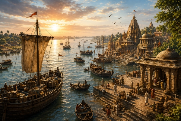
The landscape would have been markedly different from that seen today. Centuries of sediment deposition, changes in river courses and the gradual movement of the coastline have altered the relationship between Tamluk and the sea. Ancient Tamralipta was much more directly connected with navigable estuarine and maritime waters than modern Tamluk appears to be. This helps explain why literary and historical sources repeatedly remember the place as one of eastern India’s great ports.
Its geographical position was exceptional. To the north and north-west lay routes into the lower Ganga basin; towards the east stretched the great deltaic country of Vanga; to the south-west lay Suhma and the approaches towards Odra and Kalinga; and to the south opened the maritime routes of the Bay of Bengal. Tamralipta therefore stood where river transport, overland communication and sea travel met.
Bhima’s Eastern Digvijaya
Tamralipta appears prominently during Bhimasena’s eastern campaign in the Sabha Parva. Before Yudhishthira could perform the Rajasuya sacrifice, his brothers were sent in different directions to establish his political supremacy and obtain tribute from surrounding rulers. Bhima was entrusted with the conquest of the east.
After advancing through Magadha and the countries farther east, Bhima subdued the ruler of Pundra and then moved against Vanga. The narrative subsequently records his victory over Tamralipta, together with rulers and peoples associated with the neighbouring Karvata and Suhma regions and other kingdoms situated along the sea coast. From there Bhima continued eastwards towards the country of the Lohitya, generally associated with the Brahmaputra region.
This sequence is geographically revealing. Tamralipta appears together with Vanga, Suhma and coastal rulers, placing it firmly within the political landscape of eastern and coastal India. The ordering of Bhima’s march also fits reasonably well with locating Tamralipta in the lower Rupnarayan region of present-day West Bengal.
The passage further suggests that Tamralipta possessed its own political identity. Although its boundaries may have overlapped or changed in relation to neighbouring Suhma at different periods, the Mahabharata does not simply treat Tamralipta and Suhma as interchangeable names. Historical geographers have similarly noted that the epic presents them as distinguishable countries.
Tamralipta at Yudhishthira’s Rajasuya
The importance of Tamralipta becomes even clearer in the description of the rulers and peoples who came to Yudhishthira’s court during the Rajasuya.
The Sabha Parva names the Vangas, Kalingas, Magadhas and Tamraliptas among the eastern peoples who arrived with tribute. The passage associates these eastern rulers with magnificent elephants equipped with golden ornaments and coverings, reflecting the importance of elephant forces and elephant wealth in the political economy of eastern India.
This is significant because the Rajasuya passages are not merely lists of distant names. They present a picture of Yudhishthira’s court receiving representatives and tribute from a vast range of regions across the subcontinent. The explicit inclusion of the Tamraliptas indicates that Tamralipta was remembered as a sufficiently important eastern polity to stand alongside better-known kingdoms such as Vanga, Kalinga and Magadha.
Its appearance in this context also complements Bhima’s earlier campaign. Tamralipta is first brought within Yudhishthira’s sphere during the eastern digvijaya and later appears among the regions represented at the imperial sacrifice.
A Tamralipta Ruler at Draupadi’s Svayamvara
The political standing of Tamralipta is also reflected much earlier in the epic narrative.
During Draupadi’s svayamvara at Kampilya, the Adi Parva presents an extraordinary gathering of kings and warriors from across Bharata. Among the rulers named are representatives of Kalinga, Pragjyotisha, Sindhu, Madra, Kosala and many other kingdoms. A ruler associated with Tamralipta is included among this assembly of Kshatriya monarchs.
The reference is valuable because it portrays Tamralipta as participating in the wider political world linking the eastern kingdoms with the major royal houses of northern India. The lower Bengal coast was therefore not imagined as an isolated periphery. Its rulers belonged to the same interregional network of alliances, rivalries, marriages, tribute and warfare that connected the kingdoms of the Mahabharata.
The Tamraliptakas at Kurukshetra
Tamralipta appears again during the great war itself.
In the Karna Parva, the Tamraliptakas are named among eastern and other warriors participating in a major assault involving elephant forces. The passage groups them with the Angas, Vangas, Pundras, Magadhas, Mekalas and Kalingas and specifically describes these forces as skilled in elephant warfare.
During the fighting, warriors from Tamralipta, Utkala, Mekala, Kalinga and Nishadha are described advancing against Nakula, releasing showers of arrows and lances. The Pandava and Panchala forces then rush to Nakula’s assistance, resulting in an intense encounter between chariot warriors and elephant troops.
The episode places Tamralipta’s warriors on the Kaurava side in this phase of the battle. It also links them with one of the characteristic military strengths of eastern India: the war elephant.
This association is geographically plausible. The humid plains and forests of eastern India had long been important elephant country, and the kingdoms of Anga, Vanga, Pundra and Kalinga are repeatedly connected in ancient literature with powerful elephant contingents. Tamralipta’s inclusion among these elephant-fighting forces situates it firmly within that eastern military tradition.
Tamralipta, Suhma and Vanga
Understanding Tamralipta requires placing it alongside the other ancient regions of Bengal.
Vanga broadly occupied the central and eastern parts of the Bengal delta, while Suhma was associated particularly with southwestern Bengal. Tamralipta lay towards the coast and the lower Rupnarayan system, in a position naturally connected with Suhma but possessing a distinct identity in several Mahabharata passages.
The exact political boundaries cannot be reconstructed as modern fixed borders. Ancient kingdoms could expand, contract, fragment or become subordinate to neighbouring powers. Tamralipta may at different times have functioned as an independent coastal kingdom, an important urban centre controlling surrounding territory, or a leading city within a wider Suhma political sphere.
For the geography of the Mahabharata, however, the important point is that Tamralipta and Suhma can appear separately. Bhima’s eastern campaign mentions the Tamralipta ruler and the ruler of the Suhmas in succession, suggesting that the epic tradition recognised a distinction between them.
The most reasonable reconstruction therefore places Tamralipta around Tamluk and the Rupnarayan estuary, Suhma across a wider portion of southwestern Bengal, and Vanga farther east across the Bengal delta.
A Kingdom Shaped by Rivers and the Sea
Tamralipta’s geography explains much of its later historical importance.
The Rupnarayan and its associated waterways offered access inland, while the estuarine channels of the lower Ganga system provided communication towards the eastern delta. From the opposite direction, the Bay of Bengal opened maritime routes along India’s eastern coast and towards Sri Lanka and Southeast Asia.
Such a location could support agriculture in the fertile alluvial hinterland while simultaneously encouraging fishing, river transport, ship movement, trade and the growth of specialised settlements.
Tamralipta consequently developed into one of the most famous maritime centres of ancient eastern India. Later Buddhist, Jain, Classical and Chinese accounts preserve memories of the port under several forms of its name. Chinese pilgrims travelling through India also knew Tamralipti as an important coastal centre, while later traditions associated it with maritime journeys across the Bay of Bengal.
These later records cannot automatically be projected unchanged into the chronological setting of the Mahabharata. They nevertheless demonstrate that the geographical characteristics capable of supporting a major port genuinely existed in the Tamluk region and that Tamralipta eventually became one of the great maritime gateways of eastern India.
Tamluk and the Archaeological Record
The identification with modern Tamluk is strengthened by archaeology.
The Government of India’s National Mission on Monuments and Antiquities identifies Tamluk with ancient Tamralipti and records archaeological exploration and excavation at several locations in the town. These investigations revealed a long sequence of occupation extending from prehistoric or Neolithic horizons through later historical periods.
Systematic excavation by the Archaeological Survey of India and other investigations have recovered evidence demonstrating the considerable antiquity of settlement in the area. The archaeological sequence shows that Tamluk was not a settlement created only in the medieval or early modern period; it occupied a landscape that had supported human habitation for a very long time.
Archaeology, however, should be interpreted carefully. Excavated material can establish the antiquity and importance of Tamluk, but it does not by itself prove individual events narrated in the Mahabharata. The identification of Tamralipta rests on the convergence of the ancient name, literary geography, historical tradition, archaeological evidence and the exceptional riverine-maritime position of Tamluk.
Why the Coast Is Farther Away Today
One apparent difficulty in identifying Tamluk with a great ancient seaport is that modern Tamluk no longer stands directly on the open sea.
The answer lies in the changing geography of the Bengal delta.
Rivers continually transport enormous amounts of silt downstream. Over centuries, sedimentation creates new land, fills older channels and shifts the position of river mouths. Rivers themselves migrate across the floodplain. Channels that were once capable of carrying substantial vessels may become narrower or disappear altogether.
The coast around the lower Rupnarayan and Hooghly has therefore changed greatly since antiquity. The ancient port need not have occupied a shoreline identical to the modern one. Tamralipta’s vessels could have reached the sea through navigable estuarine channels that subsequently silted, shifted or retreated from the urban centre.
This environmental transformation helps explain both the rise and eventual decline of many ancient deltaic ports.
Tamralipta as the Western Gateway of the Bengal Delta
Tamralipta occupied a remarkable position within eastern India. It stood close to the transition between the Rarh and Suhma country of western Bengal, the vast deltaic world of Vanga and the maritime route towards Kalinga and the eastern coast.
Goods travelling down the great river systems of northern India could reach the lower delta and then move towards the sea. Products arriving by ship could similarly be transferred into river craft and carried inland.
This made the region more than a coastal terminal. It functioned as a bridge between the interior and the ocean.
Long after the period represented in the Mahabharata, Tamralipti became famous precisely for this role. Historical studies describe commercial routes linking it with important centres farther up the Ganga valley, while maritime connections extended into the Bay of Bengal.
The geographical foundations for such a role—the Rupnarayan, the estuarine waterways and proximity to the Bengal coast—were already inherent in the landscape.
Tamralipta in the Wider Eastern World
Within the geographical vision of the Mahabharata, Tamralipta belongs to a remarkable concentration of kingdoms across eastern India.
To its west and north-west lay Suhma and the Rarh country. Farther north were Pundra and the lower Ganga territories. To the east stretched Vanga, while the coastal route southward led towards Odra, Utkala and Kalinga.
These were not isolated lands. Bhima’s digvijaya demonstrates that they formed a connected political zone through which armies could move and rulers could exercise influence. The Rajasuya narrative similarly shows their participation in a larger interregional political order centred for a time upon Yudhishthira.
Tamralipta’s distinctive importance within this world came from its relationship with the sea.
Where Magadha commanded the middle Gangetic interior, Vanga occupied the great eastern delta and Kalinga controlled a long stretch of the eastern coast, Tamralipta stood at one of the natural maritime exits from the lower Ganga region.
From the Mahabharata to the Historic Port of Tamralipti
The historical fame of Tamralipti became even greater in subsequent centuries. It emerged as a renowned commercial and religious centre and appears in Buddhist and Jain traditions as well as accounts connected with overseas travel.
Its harbour linked eastern India with maritime routes running south along the coast and across the Bay of Bengal. Traders, pilgrims and travellers could move between the Gangetic hinterland and overseas destinations through this coastal gateway.
The later prosperity of Tamralipti gives additional meaning to its earlier place in epic geography. The Mahabharata remembers Tamralipta as a kingdom whose ruler attended great royal gatherings, whose territory was encountered during Bhima’s eastern conquest, whose representatives brought tribute to Yudhishthira and whose warriors participated in the conflict at Kurukshetra.
Historical Tamralipti would eventually become famous primarily for commerce and navigation, but the epic preserves the memory of Tamralipta as a political and military power as well as a coastal land.
Tamralipta in the Mahabharata Landscape
Tamralipta can therefore be located with considerable confidence in the Tamluk–lower Rupnarayan region of present-day West Bengal.
Its appearance beside Vanga, Suhma, Pundra, Magadha and Kalinga fits the geography of eastern India remarkably well. Bhima encounters it during his eastward digvijaya; its representatives appear in the Rajasuya setting; a ruler associated with Tamralipta is named among the monarchs at Draupadi’s svayamvara; and Tamraliptaka warriors later enter the fighting at Kurukshetra as part of powerful eastern elephant forces.
Its riverine environment provides the key to understanding the kingdom. Tamralipta occupied a place where the waterways of Bengal approached the Bay of Bengal, allowing a regional political centre to develop into one of the subcontinent’s celebrated maritime gateways.
Modern Tamluk stands considerably farther from the open sea than ancient descriptions might suggest, but the rivers and the changing delta preserve the explanation. Beneath the altered landscape survives the geographical memory of Tamralipta—the eastern kingdom where the river roads of Bharata met the ocean.
You may also like
-
Suhma — The River-and-Forest Country of Southwestern Bengal
-
Gauda — The Western Bengal Country of the Bhagirathi and the Rise of Karnasuvarna
-
Pundra — The Northern Bengal Kingdom of the Karatoya and the Ancient City of Pundranagara
-
Vanga — The River Kingdom of the Bengal Delta and the Eastern Sea
-
Kishkindha — The Boulder Kingdom of Pampa, Rishyamukha and the Tungabhadra
