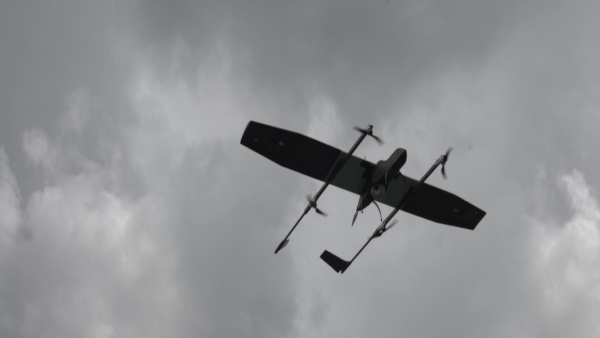
India’s unmanned-aircraft industry has moved rapidly from imported hobby platforms and experimental prototypes to indigenous systems capable of supporting military surveillance, border patrol, disaster response, mapping and industrial operations. Among the companies driving this transformation is ideaForge Technology Limited, a Mumbai-based drone manufacturer whose aircraft have been deployed across some of India’s most demanding environments.
ideaForge designs complete unmanned-aircraft systems rather than supplying only an airframe. Its work covers aerodynamics, propulsion integration, flight-control electronics, autopilot software, communications, electro-optical payloads, ground-control systems, video transmission and drone-data analysis. The company’s expanding portfolio now ranges from backpack-portable surveillance quadcopters to fixed-wing VTOL reconnaissance aircraft and the ambitious YETI autonomous logistics platform, designed to transport heavy cargo across mountains, deserts, islands and inaccessible military positions.
From an IIT Bombay engineering project to an Indian drone company
The origins of ideaForge can be traced to engineering experiments undertaken by its founders while studying at the Indian Institute of Technology Bombay. The company says that Rahul Singh’s work on a hovercraft in 2004 brought the founding team together and eventually led them to build a quadcopter during their college years. Ashish Bhat later developed a miniature commercial autopilot in 2008, helping establish the technological foundation for the company’s autonomous aircraft.
ideaForge Technology Limited was incorporated in 2007. Its present leadership includes chief executive Ankit Mehta and co-founders associated with engineering, research and product development. The company became one of India’s earliest dedicated UAV manufacturers and says it developed an indigenous vertical-take-off-and-landing aircraft as early as 2009.
The company’s early development coincided with growing demand among the Indian armed forces, paramilitary organisations, police forces and disaster-response agencies for lightweight aerial-surveillance systems. Conventional aircraft and large military UAVs provide long-range coverage, but they are expensive and require substantial operating infrastructure. Small indigenous drones offered field units a portable aircraft that could be launched quickly and provide real-time imagery over hills, forests, urban areas and border terrain.
ideaForge now describes itself as a vertically integrated UAV company with an in-house product-development centre. It reports that customers have completed more than one million flights with its aircraft and that an ideaForge-manufactured UAV takes off approximately every three minutes. The company also states that Drone Industry Insights ranked it third globally among dual-use civil-and-defence drone manufacturers in December 2024. These deployment and ranking figures are company-reported.
Why indigenous surveillance drones matter
Modern military operations depend on persistent intelligence, surveillance and reconnaissance. A small drone can fly ahead of a patrol, inspect a valley, watch a suspected infiltration route, identify movement beyond a ridge or provide artillery observers with a wider view of the battlefield.
For police and paramilitary forces, the same aircraft can monitor crowds, search forested areas, inspect prison boundaries, track suspected smugglers and provide situational awareness during counter-terrorist operations. Disaster-management agencies can use them to examine floods, landslides, collapsed structures and areas cut off from road access.
An indigenous platform offers advantages beyond its purchase price. Indian agencies can obtain local maintenance, software modifications, payload integration, operator training and spare parts without depending entirely on overseas manufacturers. Domestic control of flight software, communications architecture and data management is particularly important when a drone records sensitive military installations, border deployments or critical infrastructure.
ideaForge says its aircraft have been designed for operation across terrain ranging from high-altitude and sub-zero regions such as Ladakh to the heat of the Thar Desert. The company’s mission-first approach emphasises ruggedness, repeatable flight performance and autonomous operation without demanding advanced piloting skills from every field operator.
The NETRA family
The NETRA name has become closely associated with ideaForge’s portable vertical-take-off surveillance aircraft. These quadcopters are designed to rise vertically from confined areas, hover over a location and provide stable daylight or thermal imagery.
NETRA V4+
The NETRA V4+ is a man-portable VTOL UAV intended for patrolling, anti-smuggling operations, search and rescue, emergency assessment and other mission-critical work. ideaForge lists an operational range of up to ten kilometres and a flight endurance exceeding 60 minutes at mean sea level.
Its surveillance payload can include a daylight camera with ten-times optical zoom and a 640 × 480 thermal camera with four-times digital zoom. The aircraft is designed for high-altitude and sub-zero operations, uses a tool-free assembly mechanism and is claimed to remain reliable for up to 2,000 flights.
NETRA V4 PRO
The larger NETRA V4 PRO increases endurance to more than 90 minutes and carries a daylight camera offering 25-times optical zoom alongside thermal imaging. The system remains portable and uses snap-fit assembly intended to reduce deployment time in the field.
The longer endurance allows operators to maintain surveillance over a target for a greater period without frequently replacing batteries or recovering the aircraft. Its potential missions include border observation, perimeter security, search operations, emergency response and tactical reconnaissance.
NETRA 5
NETRA 5 represents a more ambitious attempt to prepare a compact UAV for electronically contested environments. The company presents it as a system engineered to operate despite jamming, interference and loss of conventional navigation signals.
Its advertised capabilities include GNSS-denied navigation, frequency-hopping communications, target tracking, terrain-hugging flight, people detection, obstacle avoidance and a safe-return function where satellite navigation is unavailable. The aircraft has two payload bays: a fixed multi-sensor package for day-and-night observation and a secondary bay that can carry equipment such as synthetic-aperture radar, LiDAR, multispectral sensors, loudspeakers, medical supplies or tactical packages weighing up to two kilograms.
ideaForge also claims an IP55 level of weather resistance and a design life of approximately 5,000 flights. The system supports 2.4 GHz radio-frequency and 4G connectivity, where suitable mobile infrastructure is available. NETRA 5 was being offered through an early-access programme, meaning that its complete operational maturity and long-duration performance should be evaluated separately from the company’s older deployed aircraft.
SWITCH: combining vertical take-off with fixed-wing endurance
A conventional quadcopter can hover and take off from a small clearing, but it consumes substantial energy merely to remain airborne. A fixed-wing aircraft is more efficient in forward flight and can cover a larger area, although it normally requires a runway or launching mechanism.
The SWITCH family combines both configurations. Vertical lift motors allow the aircraft to take off and land without a runway. After gaining altitude, it transitions into efficient wing-borne flight for longer-range surveillance.
The original SWITCH UAV offers an operational range of up to 15 kilometres and flight endurance exceeding 120 minutes at mean sea level. Its payload options include a daylight camera with 25-times optical zoom and a thermal camera. The company says SWITCH has been tested against relevant provisions of Indian joint-services quality standards and MIL-STD-461E electromagnetic-interference requirements.
Its tool-free assembly and portable configuration are important for troops operating near remote posts. A team can carry the aircraft close to the operational area, launch it vertically and use fixed-wing flight to monitor routes, valleys, coastlines or border sectors beyond the immediate position.
SWITCH V2
The newer SWITCH V2 extends the concept with a company-stated range of more than 20 kilometres and endurance of up to 150 minutes. It is intended to support wide-area surveillance, high-resolution military mapping, change detection, target recognition, route planning and disaster assessment.
The aircraft can use daylight, thermal, mapping and dual-sensor payloads. ideaForge also presents it as a platform for airborne data relay, remote video access, moving-target indication and direction-of-artillery-fire applications.
The usefulness of SWITCH lies in its balance. It lacks the endurance and payload capacity of a large runway-launched military UAV, but it can be carried and operated far closer to frontline units. This gives tactical formations an aerial-surveillance asset under their own control.
ZOLT: a larger tactical UAV
The ZOLT platform marks ideaForge’s movement towards heavier tactical unmanned aircraft.
The company lists an operational range of up to 50 kilometres, endurance exceeding 180 minutes and a payload capacity reaching ten kilograms. It is being developed around GPS-denied autonomy, artificial-intelligence-assisted flight, secure communications and modular payload integration.
A ten-kilogram payload capacity creates options beyond ordinary optical surveillance. Depending on final integration and certification, the platform could carry larger multi-sensor turrets, electronic-intelligence equipment, radar, communications relays, specialised mapping systems or supplies.
ideaForge describes ZOLT as built end-to-end in India and is inviting potential users to participate through its Co-innovate Access Program. This indicates that the aircraft is being positioned as a configurable next-generation platform whose final mission packages may be developed with military and institutional customers. Its published figures should therefore be understood as manufacturer specifications rather than evidence of widespread operational deployment.
YETI: autonomous logistics for inaccessible terrain
Surveillance represents only one part of the drone revolution. Modern armed forces must also deliver ammunition, food, batteries, medical supplies and equipment to isolated positions. This becomes especially difficult in high mountains, dense forests, islands and areas exposed to hostile fire.
Ground convoys can be slow, vulnerable to ambushes and dependent on roads. Helicopters can carry large loads but are costly, scarce and place aircrew at risk. A heavy-lift autonomous aircraft could fill the space between a small delivery drone and a crewed helicopter.
ideaForge’s answer is YETI, an all-terrain logistics unmanned-aircraft platform designed around autonomous vertical take-off and fixed-wing flight. The company is positioning it for military resupply, casualty evacuation, industrial transport, offshore logistics, firefighting support and emergency response.
Proposed performance
ideaForge presents YETI in configurations pairing loads of approximately 50 to 200 kilograms with mission-dependent ranges of 50 to 200 kilometres. Heavier loads reduce achievable range, while lighter cargo permits longer missions.
The published mission concepts include:
- a 100-kilogram casualty-evacuation or medical-support configuration with a range of approximately 100 kilometres;
- a 200-kilogram tactical-transport configuration covering approximately 50 kilometres;
- cargo-delivery configurations carrying between 50 and 200 kilograms over corresponding ranges of roughly 200 to 50 kilometres.
The company lists a maximum take-off altitude of 6,500 metres above mean sea level and an operating-temperature envelope from −45°C to +55°C. These ambitious specifications are particularly relevant to Himalayan logistics, where reduced air density, severe cold and limited road access make flight demanding.
Military logistics
YETI is intended to transport ammunition, rations, fuel, batteries, communications equipment and other critical supplies to forward operating posts without requiring a crewed aircraft to enter the same risk zone.
Its vertical-take-off capability could allow it to operate from small clearings, temporary landing areas and remote posts without prepared runways. Once airborne, a fixed-wing configuration would provide greater cruise efficiency than a conventional heavy multicopter.
The company also proposes casualty-evacuation capability and transport of up to two persons in selected configurations. Such operations would demand considerably higher levels of certification, redundancy, communication reliability and flight safety than ordinary cargo carriage.
Civilian and industrial uses
Outside defence, YETI could move equipment to mines, oil and gas facilities, offshore platforms, mountain construction sites and disaster-affected regions. It could also carry firefighting equipment, emergency supplies or engineering components to areas where roads are damaged or absent.
The aircraft is currently promoted through ideaForge’s Co-innovate Access Program. YETI should therefore be described as an advanced development and customer-collaboration platform rather than an already established military transport fleet. Its final performance will depend on flight testing, certification, payload integration and validation under operational conditions.
Q6 and mapping aircraft
ideaForge’s work also extends to surveying and geospatial data collection.
The Q6 V2 is a compact quadcopter that can support surveillance as well as mapping. The company lists up to 72 minutes of flight time, a radio line-of-sight range reaching ten kilometres and a maximum take-off weight of approximately 5.9 kilograms. Surveillance payloads include a 27-times optical-zoom daylight camera and thermal imaging.
The Q6 V2 GEO variant is intended for photogrammetry, terrain modelling and high-precision surveying. Such aircraft can support land records, construction planning, mining-volume calculations, railway and pipeline inspection, agricultural assessment and disaster mapping.
Unlike a surveillance mission, where a live video feed may be the primary output, a mapping flight produces overlapping georeferenced images. Software then converts these images into orthomosaics, elevation models, three-dimensional terrain representations and measurable digital maps.
The intelligence layer behind the aircraft
A modern drone is only one component of the operational system. The value comes from combining the aircraft, sensors, communications, mission-planning software and post-flight analysis.
BlueFire Touch
BlueFire Touch is ideaForge’s ground-control software. It allows operators to plan routes, define waypoints, assess terrain, command autonomous take-off and landing and monitor the aircraft during its mission.
Its features include pre-flight area checks, custom-map integration, mission replay, real-time annotation and fail-safe responses to communication loss, low battery or strong winds. The software is intended to reduce reliance on joystick flying and allow the operator to concentrate on the mission and imagery.
BlueFire Live
BlueFire Live enables secure transmission of the drone’s video to users beyond the immediate ground-control station. Command centres and authorised personnel can receive encrypted live footage, remotely control compatible payloads and observe thermal imagery during night operations.
This matters during a border incident or disaster because the person flying the drone may be several levels removed from the officer making the operational decision. Secure live streaming allows commanders, police control rooms and emergency teams to see the same aerial picture.
FLYGHT CLOUD
FLYGHT CLOUD extends the system into data storage, processing and analytics. It is designed to organise mapping data and surveillance video, connect footage with telemetry and geographic coordinates and allow teams to analyse information centrally.
The company has introduced capabilities such as synchronised map-and-video viewing, incident tagging, automated organisation, AI-assisted object or event detection and searchable mission archives. The platform is aimed at sectors including mining, utilities, agriculture, infrastructure and security.
ideaForge is therefore evolving from a hardware manufacturer into a broader aerial-intelligence company. The aircraft collects information, the ground station controls the mission, the communications system distributes it and the cloud platform converts the collected data into operational decisions.
Applications beyond defence
Although defence and security remain central to ideaForge’s identity, its platforms are designed for dual use.
Mapping and land administration
UAVs can survey large tracts faster than conventional ground teams. High-resolution aerial data supports land-record modernisation, urban planning, road construction, railway projects and corridor surveys.
Mining
Drone mapping can calculate stockpile volumes, examine pit geometry, inspect haul roads and monitor changes across a mine. Repeated flights create comparable datasets that allow managers to measure progress and detect unsafe conditions.
Critical infrastructure
Power lines, pipelines, railways, ports, dams and oil installations often stretch across difficult terrain. UAVs allow inspection teams to examine structures while reducing the need to expose personnel to heights, unstable slopes or hazardous industrial sites.
Disaster response
After floods, earthquakes, cyclones or landslides, drones can reach affected areas before roads reopen. They can identify stranded people, map damage, inspect bridges and help emergency agencies decide where to deploy resources.
Public safety and municipal services
Potential uses include traffic monitoring, crowd observation, forest-fire detection, waste-site inspection, coastal surveillance, wildlife monitoring and perimeter security. ideaForge is also developing drone-as-a-service offerings under the FLYGHT brand for organisations that need aerial data without purchasing and maintaining an entire fleet.
Electronic warfare and the changing battlefield
The rapid use of drones in recent conflicts has revealed their strengths as well as their vulnerabilities.
Satellite-navigation signals can be jammed or spoofed. Radio links can be interrupted. Video feeds may be targeted by electronic warfare. Aircraft can be detected by radar or acoustic sensors and attacked using guns, missiles, electronic countermeasures or opposing drones.
ideaForge’s newer platforms increasingly emphasise GNSS-denied navigation, frequency hopping, encrypted communications, terrain awareness, automated return-to-home functions and onboard intelligence. NETRA 5, SWITCH V2 and ZOLT reflect the company’s effort to move from drones designed for relatively permissive airspace to systems that retain some utility in contested environments.
Complete resilience against electronic warfare remains difficult. Performance claims must be tested against different jammers, terrain conditions, communication distances and threat systems. A platform that survives one form of interference may remain vulnerable to another.
Building an indigenous UAV supply chain
The strategic importance of ideaForge lies not merely in assembling aircraft in India. Its deeper contribution is the accumulation of domestic knowledge in flight-control algorithms, autopilots, airframe design, communications, thermal management, sensor integration and mission software.
The company says its vertically integrated facilities allow engineers to oversee the design, development, testing and manufacture of its UAVs. It also holds intellectual property across avionics, software, artificial intelligence and material science.
India still depends on international supply chains for several specialised drone components, including some sensors, semiconductor devices, imaging modules, batteries and electronic hardware. Genuine technological sovereignty will require the domestic ecosystem to deepen across these supporting industries.
ideaForge’s approach nevertheless gives Indian customers greater control than purchasing a sealed imported platform. Software can be adapted, payloads can be integrated locally and repairs can be undertaken through a domestic support network.
The road ahead
ideaForge faces a different challenge from the one it confronted during its early years. The task is no longer simply proving that an Indian team can build a reliable drone. It must now compete in a crowded global market where systems are becoming cheaper, more autonomous and more rapidly replaced.
Its future progress will depend on:
- validating new platforms through extensive flight testing;
- reducing dependence on imported critical components;
- demonstrating resistance to electronic warfare;
- scaling manufacturing without reducing reliability;
- expanding exports;
- improving payload and battery performance;
- obtaining regulatory approval for beyond-visual-line-of-sight and heavy-cargo operations;
- maintaining secure software and communications;
- converting YETI and ZOLT from development platforms into proven operational systems.
Heavy logistics will be especially demanding. Carrying 100 or 200 kilograms safely through mountainous weather requires powerful propulsion, redundant flight computers, reliable communications and carefully engineered emergency procedures. Casualty evacuation or human transport will require even stronger safety assurance.
An Indian company moving from eyes in the sky to aerial mobility
ideaForge began by helping Indian users see beyond the next hill, building portable aircraft that provided real-time surveillance without requiring a runway or a large aviation unit.
Its present portfolio shows how far that original idea has expanded. NETRA provides vertical-take-off observation, SWITCH combines portability with fixed-wing endurance, Q6 supports mapping and surveillance, NETRA 5 addresses electronically contested missions, ZOLT moves towards heavier tactical intelligence, and YETI attempts to carry substantial cargo through environments where roads and helicopters face serious limitations.
The company’s importance to Make in India lies in this progression. It is moving beyond reproducing existing small drones and attempting to develop complete Indian aerial systems integrating autonomous flight, secure communications, advanced sensors, data analytics and heavy logistics.
YETI remains an ambitious development programme rather than a proven replacement for military helicopters or ground convoys. Yet the concept points towards a significant future capability: autonomous aircraft carrying ammunition, medical supplies, equipment and casualties across the Himalayas, islands, deserts and disaster zones without placing pilots in danger.
ideaForge is therefore building both eyes in the sky and a new form of unmanned aerial mobility. Its success will be measured by whether these indigenous systems can remain reliable, secure and operational when missions move from demonstrations into the most demanding environments faced by India’s armed forces and civilian agencies.
References
1. ideaForge Technology Limited — Official website: https://ideaforgetech.com/ 2. ideaForge — Company overview, leadership and operational deployment: https://ideaforgetech.com/aboutus 3. ideaForge — YETI autonomous logistics UAV: https://ideaforgetech.com/logistics/yeti-uav 4. ideaForge — SWITCH fixed-wing VTOL surveillance UAV: https://ideaforgetech.com/security-and-surveillance/switch-uav 5. ideaForge — SWITCH V2 high-endurance surveillance UAV: https://ideaforgetech.com/aero-india/switch-v2-uav 6. ideaForge — NETRA 5 resilient tactical UAV: https://ideaforgetech.com/security-and-surveillance/netra5 7. ideaForge — NETRA V4+ portable surveillance UAV: https://ideaforgetech.com/security-and-surveillance/netra-v4-uav/ 8. ideaForge — NETRA V4 PRO: https://ideaforgetech.com/security-and-surveillance/netra-v4-pro 9. ideaForge — ZOLT tactical UAV: https://ideaforgetech.com/security-and-surveillance/zolt-uav/ 10. ideaForge — Q6 V2 surveillance UAV: https://ideaforgetech.com/q6-v2-surveillance-uav 11. ideaForge — Q6 V2 GEO mapping UAV: https://ideaforgetech.com/mapping/q6-v2-geo 12. ideaForge — DGCA type-certified unmanned-aircraft systems: https://ideaforgetech.com/lp/type-certified-uas 13. ideaForge — BlueFire Touch ground-control software: https://ideaforgetech.com/software/bluefire-touch 14. ideaForge — BlueFire Live secure video-streaming solution: https://ideaforgetech.com/software/bluefire-live%21 15. ideaForge — FLYGHT CLOUD drone-data management platform: https://flyghtcloud.ideaforgetech.com/about-us 16. ideaForge — FLYGHT CLOUD video-intelligence platform: https://flyghtcloud.ideaforgetech.com/flyght-video 17. Securities and Exchange Board of India — ideaForge Technology Limited Draft Red Herring Prospectus: https://www.sebi.gov.in/filings/public-issues/feb-2023/ideaforge-technology-limited-drhp_68081.html 18. Securities and Exchange Board of India — ideaForge Technology Limited Red Herring Prospectus: https://www.sebi.gov.in/filings/public-issues/jun-2023/ideaforge-technology-limited-rhp_72859.html 19. National Stock Exchange of India — ideaForge Annual Report 2024–25: https://nsearchives.nseindia.com/corporate/IDEAFORGE_04072025191057_Intimation_SE_Annual_Report.pdf 20. Defence Research and Development Organisation — NETRA and other indigenous defence products: https://drdo.gov.in/drdo/en/offerings/products
You may also like
-
Bharat Forge Secures Long-Term Pratt & Whitney Canada Contract for Critical Aero-Engine Components
-
India’s First Fleet Support Ship Set for Launch as Hindustan Shipyard Expands Capacity for 45,000-Tonne Vessels
-
HAL Koraput to Add ₹218-Crore Shakti Engine Production Line as India Marks 2,000th Aero-Engine Milestone
-
Indian Defence Production Delegation Visits Saab in Sweden as Defence Co-Manufacturing Talks Deepen
-
DRDO Expands Space-Based ELINT and RF Geolocation Technologies for Future Defence Surveillance
