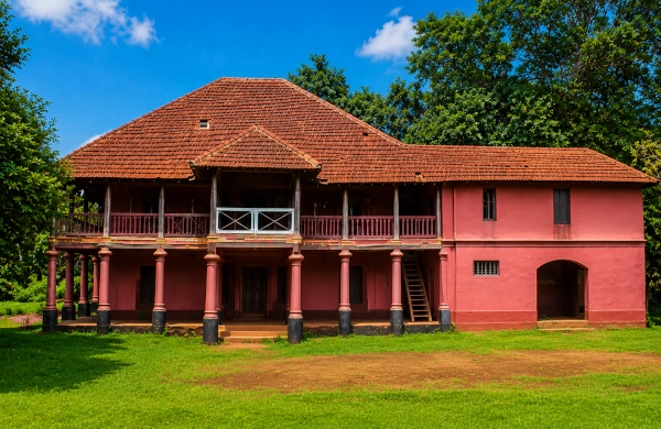
The Palakkad Rajas were the hereditary rulers of the principality that developed around present-day Palakkad in central Kerala. Known in different historical records as the rulers of Palakkattussery, the Sekhari Varma Rajas, the Palakkad Achans and the royal house of Tarur or Tharoor Swaroopam, they governed a territory positioned beside one of southern India’s most important natural corridors—the Palakkad Gap.
Their kingdom lacked the maritime wealth and extensive coastal influence enjoyed by the Zamorins of Kozhikode or the rulers of Kochi. Its importance arose from geography. Whoever exercised authority over Palakkad could influence movement between the Malabar coast and the Tamil plains, making the principality valuable to Kerala rulers, Mysore and eventually the British East India Company.
Origins of the Palakkad Royal House
The early history of Palakkad contains a mixture of inscriptional evidence, royal genealogies and regional traditions. After the decline of the Chera Perumals, Kerala became divided among hereditary chiefs and royal houses exercising authority over different nadus or territorial divisions. The prominent powers of the Palakkad region included the Valluvakonathiri of Valluvanad, the Kollengode Rajas of Vengunad and the Sekharivarma Rajas of Palakkattussery.
The Palakkad ruling family is generally connected with the older Nedumpurayur lineage. Government historical material identifies the dynasty with the Tarur Swaroopam, whose seat was associated with Tarur in the present Alathur region. Over time, this house became known as the Palakkad Raja Swaroopam.
The terms used for the dynasty require some explanation. Swaroopam in medieval Kerala referred to a royal lineage and the political territory organised around it. Sekhari Varma appears to have functioned as an important dynastic title, while the male members of the family were popularly addressed as Achans. Consequently, historical writings sometimes refer to the rulers collectively as the Palghat or Palakkad Achans.
“Palakkad Raja” therefore represents a succession of hereditary rulers rather than one individual king.
The Kingdom of Palakkattussery
The territory ruled by the dynasty was centred on the plains surrounding Palakkad and extended through areas later associated with Palakkad, Alathur and Chittur. Its boundaries changed with warfare, alliances and the expansion of neighbouring states. The royal centre was closely connected with Tarur, while other family branches and estates developed in different parts of the principality.
Like many Kerala kingdoms, Palakkad functioned through a network of royal households, local chiefs, landed families, temples and military retainers. The authority of the Raja depended upon his ability to preserve the loyalty of these groups, maintain agricultural production and protect the routes crossing his territory.
Palakkad’s fertile plains formed part of the Bharathapuzha river system and supported extensive paddy cultivation. Agricultural wealth gave the rulers a stable regional base, while the routes leading through the Western Ghats provided wider political and economic importance.
The Palakkad Gap and the Power of Geography
The defining feature of the kingdom was the Palakkad Gap, a broad break in the Western Ghats measuring approximately 32 to 40 kilometres across. It creates a natural passage between Kerala and the plains of Coimbatore in Tamil Nadu.
For centuries, the gap facilitated the movement of merchants, pilgrims, armies, cattle, agricultural produce and cultural communities between the eastern and western sides of peninsular India. Trade goods moving from the Tamil country could pass through Palakkad towards ports on the Malabar coast, while pepper and other western products travelled eastward through the same corridor. Kerala Tourism describes the gap as an important link in trade between the east and west coasts since ancient times.
This geographical advantage brought opportunity and danger. The Rajas could benefit from commerce and communication across the pass, yet their kingdom also stood directly in the path of armies entering Kerala from Mysore and the Tamil plains.
Palakkad consequently became Kerala’s eastern gateway and one of the most strategically contested territories of eighteenth-century southern India.
Relations with Kochi and the Zamorin
The Palakkad Rajas governed between several stronger political powers. To the west and northwest stood the expanding Zamorin kingdom of Kozhikode. To the south lay territories influenced by the rulers of Kochi and Kollengode. Beyond the mountains were Coimbatore, Dindigul and the emerging military power of Mysore.
The Tarur Swaroopam maintained links with the Perumpadappu royal house of Kochi, including matrimonial relationships recorded in regional historical accounts. These connections sometimes drew Palakkad into the struggle between Kochi and the Zamorin.
The Zamorins had expanded steadily from Eranad towards Valluvanad and central Kerala. Palakkad’s location and connections with Kochi made it a natural obstacle to further expansion. Relations between Kozhikode and Palakkad moved through periods of submission, alliance, rivalry and armed confrontation.
The Palakkad Raja possessed fewer military resources than the Zamorin. His strongest defensive advantage was the terrain: control of routes, forests, river crossings and approaches to the gap. As the Zamorin’s influence increased, however, geography alone could no longer protect the principality.
Temple Patronage and Kalpathy
The Palakkad Rajas played an important role in the religious and cultural development of the region. Their patronage supported temples, settlements and festivals that linked Kerala’s traditions with those of the Tamil country.
A significant example is the Sree Viswanatha Swamy Temple at Kalpathy. A stone inscription at the temple records an endowment made by Ittikombi Achan, a member of the Palakkad royal family, in Malayalam Era 600, corresponding to 1424–1425 CE. The inscription demonstrates that the ruling house was actively supporting temple institutions and settlements by the early fifteenth century.
Kalpathy later became one of Kerala’s best-known Tamil Brahmin settlements. Its annual Ratholsavam combines Vedic rites, Carnatic musical traditions and the ceremonial movement of enormous temple chariots. Kerala Tourism connects the festival’s development with the patronage of Palakkad’s rulers and the settlement of Brahmin ritual specialists from the Tamil country.
Palakkad’s cultural character reflects this long interaction. Malayalam and Tamil customs met within the principality, producing distinctive traditions in architecture, music, food, language and temple worship. The Palakkad Gap served as a cultural bridge as powerfully as it served as a military and commercial corridor.
The Crisis of 1757
The decisive turning point in the history of the Palakkad Rajas came in 1757, when the Zamorin invaded the principality. Facing a stronger enemy, the Palakkad Raja sought military assistance from Hyder Ali of Mysore, who was then emerging as one of southern India’s most capable commanders.
Hyder Ali’s intervention forced the Zamorin’s forces to withdraw. The immediate threat to the Raja was removed, yet Mysore’s entry fundamentally altered the balance of power. Hyder recognised that Palakkad controlled the most convenient route through the Western Ghats into Malabar. Assistance soon developed into political and military domination.
The Raja’s appeal was understandable within the circumstances. His principality faced possible absorption by Kozhikode, and Mysore offered the military strength required for survival. The alliance protected the dynasty temporarily while opening the gateway for a far greater power.
Palakkad consequently became the bridge through which Mysore extended its influence into Kerala.
Hyder Ali and the Transformation of Palakkad
After intervening against the Zamorin, Hyder Ali consolidated his position in the region. Territories previously held by the Zamorin around Palakkad were brought under Mysorean authority, and the lands of the Palakkad Raja gradually passed into the hands of Hyder and his son Tipu Sultan.
In 1766, Hyder Ali constructed the present Palakkad Fort, strengthening an earlier strategic position with massive granite defences, bastions and a surrounding moat. The fort became the principal military centre controlling communication between Mysore and Malabar.
The building of the fort symbolised a major political change. Palakkad had moved from being the centre of a regional royal house to becoming a fortified frontier station within a larger Mysorean state.
Hyder Ali used the corridor to move troops, supplies and officials towards the Malabar coast. Under Tipu Sultan, Palakkad continued to serve as an essential military base during conflicts involving Mysore and the British East India Company. The fort changed hands during the Anglo-Mysore struggle before the British secured it and modified its defences in 1790.
Decline of the Raja’s Political Authority
Mysorean occupation ended the effective independence of the Palakkad Rajas. Members of the royal family retained social standing, inherited property and ceremonial identity, while sovereign control over the territory shifted first to Mysore and later to the East India Company.
Following the establishment of British supremacy in Malabar, the Palakkad Rajas were treated as pensioned representatives of the former ruling family. Their lands became part of the administrative and revenue system of British Malabar within the Madras Presidency.
This transformation followed a pattern seen across many smaller Indian principalities. A local dynasty whose authority had rested upon kinship, temples, landholding and military service was gradually displaced by centralised Mysorean administration and then by the Company’s bureaucratic government.
The political kingdom disappeared, yet the royal family and its branches continued to preserve genealogical, religious and cultural traditions.
Palakkad Fort as a Symbol of Transition
Palakkad Fort is often called Tipu’s Fort, though its construction is principally associated with Hyder Ali. It represents the layered history of the region: the strategic concerns of the Palakkad Raja, Mysore’s expansion through the Western Ghats and the eventual triumph of British power.
Situated in the centre of modern Palakkad, the fort remains surrounded by its moat and retains much of its eighteenth-century military character. It was taken over and modified by the British in 1790 and is now protected by the Archaeological Survey of India.
The fort’s survival sometimes overshadows the dynasty whose political crisis first brought Mysore into the region. Its walls therefore commemorate Mysorean engineering while also marking the final chapter of independent rule by the Palakkad Rajas.
Cultural Legacy of the Palakkad Rajas
The dynasty’s most enduring legacy lies in the regional identity that developed around the Palakkad plains. Their principality stood at the meeting point of Malabar, Coimbatore, Kongu and the wider Tamil country. The rulers helped sustain a society in which Kerala temple customs, Tamil Brahmin traditions, agrarian festivals, Carnatic music and Malayalam cultural forms existed side by side.
The temples and agraharams of Kalpathy, the Poorams and Velas of the district, the agricultural landscape and the continuing memory of the Sekhari Varma rulers all reflect this shared heritage. Palakkad remains widely known as a meeting place of Kerala and Tamil cultures, a character directly shaped by its location beside the great mountain passage.
The story of the Palakkad Rajas also demonstrates the difficult position occupied by smaller kingdoms during periods of imperial expansion. Their rulers had to negotiate with Kochi, resist the Zamorin, seek aid from Mysore and eventually face the East India Company. The appeal to Hyder Ali in 1757 saved the principality from immediate conquest while accelerating the loss of its independence.
Guardians of the Gap
The Palakkad Rajas governed a relatively compact kingdom whose influence exceeded its territorial size. Their power came from control of fertile plains, important settlements and the most accessible passage through the southern Western Ghats.
For centuries, they served as guardians of Kerala’s eastern gateway. Merchants, armies, migrants and religious traditions travelled through their territory, making Palakkad both a frontier and a cultural meeting ground.
Their political authority faded during the rise of Mysore and British Malabar, while their historical presence remains visible in the identity of Palakkad, the traditions of Kalpathy and the strategic fort standing at the centre of the modern city. The dynasty belongs among Kerala’s significant regional royal houses—rulers whose kingdom was shaped by the Palakkad Gap and whose decisions helped redirect the course of Malabar’s eighteenth-century history.
Reference
Palakkad District Administration. “History of Palakkad.” Government of Kerala.
https://palakkad.nic.in/en/history/
Palakkad District Administration. “Palakkad Fort.” Government of Kerala.
https://palakkad.nic.in/en/palakkad-fort/
Palakkad District Administration. “About Palakkad District and the Palakkad Gap.” Government of Kerala.
https://palakkad.nic.in/en/
Kerala State Land Use Board. “Palakkad District: Historical, Geographical and Socio-Economic Profile.” Government of Kerala.
https://kslub.kerala.gov.in/wp-content/uploads/2024/02/12_Palakkad.pdf
Kerala Tourism. “Palakkad: The Granary of Kerala and the Gateway through the Western Ghats.” Department of Tourism, Government of Kerala.
https://www.keralatourism.org/districts/palakkad/
Kerala Tourism. “Tipu’s Fort or Palakkad Fort.”
https://www.keralatourism.org/destination/tipus-fort-palakkad/130/
District Tourism Promotion Council, Palakkad. “Palakkad Fort.”
https://www.dtpcpalakkad.com/destination/palakkad-fort
Kerala Tourism. “Kalpathy Agraharam, Palakkad.”
https://www.keralatourism.org/malabar/kalpathy-agraharam/27
Kerala Tourism. “Kalpathy Ratholsavam.”
https://www.keralatourism.org/kerala-article/2020/kalpathy-ratholsavam/1029
Kerala Tourism. “Kalpathy Ratholsavam: A Carnival of Colours.”
https://www.keralatourism.org/kerala-article/2017/kalpathy-ratholsavam/684
Archaeological Survey of India. “List of Centrally Protected Monuments and Sites.” Ministry of Culture, Government of India.
https://asi.nic.in/pdf/CPM_List.pdf
Logan, William. Malabar Manual. Originally published by the Madras Government Press, 1887. Reprinted by the Government of Kerala.
You may also like
-
Setu — The Sacred Southern Crossing Between Rameswaram and Lanka
-
One Voice – One Resolve – One India: Namami Bharatam Marks 150 Years of Vande Mataram Across the Nation
-
Dravida — The Ancient Tamil Country of Rivers, Temples and the Southern Ocean
-
Pandya — The Southern Kingdom of the Vaigai, Tamiraparani and the Pearl-Rich Sea
-
Chola — The Kaveri Kingdom of Fertile Fields, Ancient Cities and the Eastern Sea
