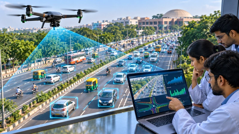
Researchers at the Indian Institute of Technology Guwahati (IIT Guwahati) have developed advanced mathematical and machine-learning models to analyse and predict traffic movement under India’s complex road conditions. Using high-resolution aerial footage collected by drones, the research team examined the movement of more than 36,000 vehicles and nearly nine million recorded vehicle positions, creating a detailed dataset intended to improve traffic forecasting, highway design and intelligent transportation systems.
The research was led by Professor Akhilesh Kumar Maurya of IIT Guwahati’s Department of Civil Engineering, alongside research scholars Shekhar Singh and Surya H. Ravikumar. Published in the International Journal of Intelligent Transportation Systems Research, the study addresses limitations in conventional traffic models that were primarily developed for road networks characterised by relatively uniform vehicle types and more predictable driving behaviour.
Drone Technology Captures Complex Indian Traffic Patterns
The research team deployed unmanned aerial vehicles to record traffic movements along an eight-lane divided highway with wide paved shoulders on the outskirts of Delhi. The observations were conducted during daytime traffic conditions, allowing researchers to examine how different categories of vehicles interact while travelling along the same road.
India’s road transportation environment presents distinctive challenges because motorcycles, three-wheelers, passenger cars, buses and commercial vehicles frequently share road space while travelling at different speeds. Differences in vehicle size, acceleration, manoeuvrability and driving behaviour create complex interactions that are not always adequately represented by conventional traffic models.
The researchers used drone footage to capture approximately 8.94 million vehicle-position data points at a sampling rate of ten frames per second. This detailed record enabled the team to examine vehicle trajectories, longitudinal spacing, traffic density and variations in speed across changing traffic conditions.
Unlike traditional observations taken from fixed roadside locations, drone-based monitoring provides a broader view of traffic movement over an extended road section. This allows researchers to analyse interactions among multiple vehicles simultaneously and understand how collective traffic behaviour changes as congestion develops.
Researchers Identify Important Changes in Vehicle Spacing
One of the study’s significant findings concerns the relationship between traffic density and the spacing maintained between vehicles. The researchers observed that vehicles travelling on relatively empty roads generally maintain larger gaps, reflecting the freedom available to drivers when traffic density is low.
As traffic increases to moderate levels, these gaps become smaller because vehicles move closer together and available road space becomes increasingly occupied. However, the researchers found that spacing patterns change again as traffic approaches severe congestion, demonstrating that the relationship between vehicle density, spacing and speed is more complex than a simple linear progression.
The observations provide important insights into the behaviour of heterogeneous traffic, where vehicles with different physical and operating characteristics influence one another. Understanding these interactions is essential for developing models capable of representing actual Indian road conditions rather than relying on assumptions derived from more uniform traffic environments.
The researchers also examined road capacity under different operating conditions. Their observations indicated that traffic flow could approach 3,000 vehicles per hour per lane under the conditions studied, while vehicle density during stationary congestion could reach approximately 900 vehicles per kilometre across the entire road width.
These findings provide empirical information that can support the development of more realistic traffic simulations and improve understanding of how congestion forms and evolves.
Mathematical and Machine-Learning Models Improve Traffic Analysis
Using the collected dataset, the IIT Guwahati team evaluated six mathematical traffic models and trained two machine-learning models to examine relationships between traffic density and vehicle speed. The objective was to determine which approaches could most effectively represent the irregular movement patterns observed on Indian roads.
The research included conventional regression-based modelling techniques alongside artificial neural networks and random forest algorithms. These approaches were used to analyse the relationship between traffic conditions and vehicle movement while accounting for the considerable variation present in the observations.
The researchers found that the Underwood mathematical model performed particularly consistently in representing the observed traffic relationships. The machine-learning approaches also demonstrated the ability to analyse complex traffic patterns, although they did not outperform the strongest conventional model in the reported comparison.
An important contribution of the research was its treatment of traffic speed as a variable rather than a single predictable value. Instead of assuming that all vehicles travelling under similar density conditions would maintain the same speed, the researchers developed methods for estimating a range of possible speeds.
This approach is particularly relevant to Indian traffic because different vehicle categories may travel at substantially different speeds even when they share the same road section. Accounting for this variability allows traffic models to represent actual road behaviour more accurately.
Applications in Smart Traffic Management and Highway Planning
The findings have practical relevance for transportation planning, congestion management and the development of intelligent road infrastructure. Traffic engineers depend on reliable mathematical models to estimate road capacity, design intersections and evaluate how transportation networks respond to changing demand.
Models developed using Indian traffic observations can help planners understand the operating characteristics of roads carrying diverse vehicle types. This information can support improvements in highway design, junction planning and traffic management strategies suited to local driving conditions.
The research also creates opportunities for developing intelligent transportation systems that combine traffic monitoring with data-driven analysis. Such systems could use real-time observations and predictive models to identify emerging congestion patterns, support traffic signal management and improve the coordination of transportation networks.
Emergency management is another potential application. More accurate traffic simulations can assist authorities in examining alternative routes, evaluating road capacity and planning transportation arrangements during major disruptions.
The research provides a scientific foundation for these applications, although it does not represent the deployment of a completed real-time traffic management platform.
Supporting Autonomous Mobility and Digital Traffic Modelling
The development of detailed traffic datasets also has implications for emerging autonomous mobility technologies. Automated vehicles and intelligent transportation systems require an accurate understanding of how surrounding vehicles behave, particularly in environments where traffic movements are diverse and difficult to predict.
Data collected through drones can help researchers examine vehicle interactions that are difficult to capture through conventional roadside sensors. These observations may contribute to the development and evaluation of traffic simulation environments used in research involving connected vehicles and automated mobility.
Another potential application involves urban traffic digital twins, which are virtual representations of transportation networks that use data and simulation models to examine real-world operating conditions. India-specific traffic models could improve these systems by incorporating the characteristics of mixed traffic rather than relying entirely on assumptions developed for different road environments.
The study also demonstrates the increasing importance of integrating unmanned aerial systems with advanced data analysis. By combining drone-based observations, mathematical modelling and machine learning, researchers can generate detailed insights into transportation systems and develop methods that support evidence-based infrastructure planning.
Strengthening Indigenous Research in Intelligent Transportation
IIT Guwahati’s research represents an important contribution to the development of transportation modelling methods adapted to India’s infrastructure requirements. The study demonstrates how advanced aerial monitoring and computational analysis can be combined to investigate traffic behaviour at a level of detail that is difficult to achieve through conventional observation methods.
The work also contributes to India’s growing research capabilities in drone technology, artificial intelligence and intelligent transportation engineering. These disciplines are increasingly interconnected as researchers develop systems capable of collecting detailed environmental information and converting it into practical insights for infrastructure management.
By analysing more than 36,000 vehicles and nearly nine million data points, the researchers have established a substantial empirical foundation for understanding heterogeneous traffic conditions. The study’s mathematical and machine-learning approaches provide additional tools for examining congestion, vehicle movement and road capacity.
The research highlights the value of developing technological solutions around India’s actual operating conditions. Its findings can support more realistic transportation models, better-informed infrastructure planning and the continuing development of intelligent traffic management systems suited to the country’s diverse road networks.
You may also like
-
India and EU Conclude Horizon Europe Negotiations, Opening New Opportunities for Scientific Research
-
Wildlife Institute of India Study Reveals How Lightning Helps Andaman Mangrove Forests Regenerate
-
Indian and Russian Scientists Develop Solar-Powered Ammonia Production Method for Greener Fertilisers
-
Advanced Protective Coatings to Improve Machining of Critical Superalloys can Help Aerospace, Energy & Petrochemical Sectors
-
India Advances Space Debris Removal Technology as Cosmoserve Opens Advanced Robotics Facility in Hyderabad
