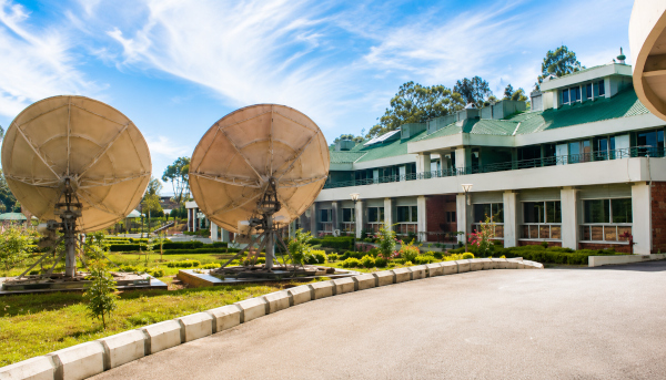
The North Eastern Space Applications Centre (NESAC) is strengthening strategic border management, disaster preparedness and development planning across the Northeast through nearly 130 space-technology projects, Union Minister Dr. Jitendra Singh said during a review visit to the institution at Umiam in Meghalaya.
NESAC is currently supporting the geospatial mapping of the India–Myanmar border and inter-State boundaries in the region. Its satellite-based applications are also being deployed across agriculture, forestry, water management, urban planning, governance, natural-resource assessment, communications and disaster-response systems.
Dr. Jitendra Singh, Union Minister of State for Science and Technology, Earth Sciences, Atomic Energy and Space, said NESAC has developed into an important institution serving both national strategic requirements and the socio-economic priorities of the eight Northeastern States.
During the visit, NESAC Director Dr. S.P. Aggarwal presented an overview of the Centre’s achievements and current programmes. The portfolio includes around 50 recently completed projects and 78 ongoing initiatives covering geosciences, geoinformatics, satellite communication, unmanned aerial vehicle applications, atmospheric sciences, information technology, regional planning and capacity-building.
Space Technology for Regional Governance
The Minister said NESAC has become an effective link between India’s advanced space capabilities and the everyday developmental needs of the Northeast. Its growing cooperation with State Governments has helped integrate satellite data and geospatial tools into public administration, infrastructure planning and resource management.
Space-based information can assist governments in identifying agricultural patterns, monitoring forests, assessing water resources, planning settlements and improving the delivery of public services. Such applications are particularly valuable in the Northeast, where mountainous terrain, heavy rainfall, extensive forest cover and dispersed settlements create complex planning challenges.
Mapping the India–Myanmar Border
NESAC’s work on the India–Myanmar border carries significant strategic importance. Accurate geospatial mapping can support boundary management, infrastructure development, terrain assessment and coordination among security and administrative agencies.
The Centre is also mapping inter-State boundaries within the Northeast, helping authorities improve land records, planning processes and administrative coordination.
Dr. Jitendra Singh said NESAC should continue supporting national priorities in strategically important border regions while maintaining close cooperation with the agencies concerned.
Strengthening Flood Early-Warning Systems
Flood forecasting and disaster management remain central components of NESAC’s work. The Northeast frequently experiences intense rainfall, river flooding, landslides and erosion, making timely satellite-based information essential for protecting communities and infrastructure.
The Minister called for further improvements in the accuracy and location-specific capabilities of NESAC’s flood early-warning system. More precise warnings could provide residents, district administrations and disaster-response teams with timely and actionable information during emergencies.
Satellite imagery, rainfall observations, terrain models and river data can be combined to identify vulnerable areas and support evacuation planning, relief deployment and post-disaster damage assessment.
Scientific Mapping of Bamboo Resources
Dr. Jitendra Singh also encouraged closer collaboration between NESAC, the North East Cane and Bamboo Development Council and State Governments for the Centre’s bamboo-mapping programme.
The Northeast possesses substantial bamboo resources that support construction, handicrafts, furniture, paper production, textiles, bioenergy and rural industries. Scientific mapping can help authorities identify bamboo-growing areas, estimate available resources and plan harvesting and processing facilities.
The programme could strengthen the regional bamboo value chain, encourage value addition and generate sustainable livelihood opportunities for farmers, artisans and rural enterprises.
Water Harvesting and Resource Planning
The Minister highlighted the importance of expanding successful water-harvesting models across the region. He referred to the initiative implemented at the Ramakrishna Mission in Cherrapunjee as an example that could be adapted by State Governments.
Despite receiving extremely heavy rainfall, several parts of the Northeast experience seasonal water shortages because of steep slopes, rapid runoff and limited storage infrastructure. Satellite-based terrain analysis and watershed mapping can help identify suitable locations for reservoirs, ponds, recharge structures and rainwater-harvesting systems.
Such interventions can improve drinking-water availability, agricultural productivity and long-term water security.
Promoting Tourism Through Geospatial Platforms
NESAC has also developed the GeoTourism “ManzilNE” dashboard to highlight the Northeast’s natural, ecological and cultural destinations.
Dr. Jitendra Singh called for greater participation from private tourism operators to expand the platform’s reach and utility. A stronger geospatial tourism system could provide visitors with information on destinations, routes, terrain, local attractions and travel infrastructure.
The initiative can support responsible tourism while promoting the region’s mountains, forests, rivers, wildlife, traditional communities and heritage sites.
Wider Partnerships for Space-Based Development
The Minister urged NESAC to deepen its partnerships with Central Ministries, State Governments, universities, research institutions, start-ups and private companies.
Such cooperation can accelerate the adoption of satellite-based applications and transform research projects into scalable solutions. Participation from local institutions and industry can also support innovation in drones, geospatial analytics, communications, disaster management and digital governance.
Dr. Jitendra Singh said science and technology have become major drivers of the Northeast’s growth and development. He expressed confidence that NESAC’s expanding programmes would continue to strengthen governance, improve disaster resilience, support sustainable resource use and advance a technologically empowered Northeast.
Through its strategic mapping initiatives and development-oriented applications, NESAC is demonstrating how India’s space programme can serve both national security and regional prosperity.
Source: PIB
You may also like
-
IIT Hyderabad Develops Lung-Derived Bioink for 3D Bioprinting and Regenerative Medicine
-
Indian Scientists Discover Molecular Switch That Can Regulate Cellular Autophagy
-
Scientists Map Earliest Glow of Hydrogen, Opening A New Window to the Universe
-
Indian Researchers Study RAD51 DNA-Repair Gene Variant in Prostate Cancer
-
TDB Backs Multi Nano Sense With ₹37.51 Crore to Build Indigenous Multi-Gas Sensor Platform
