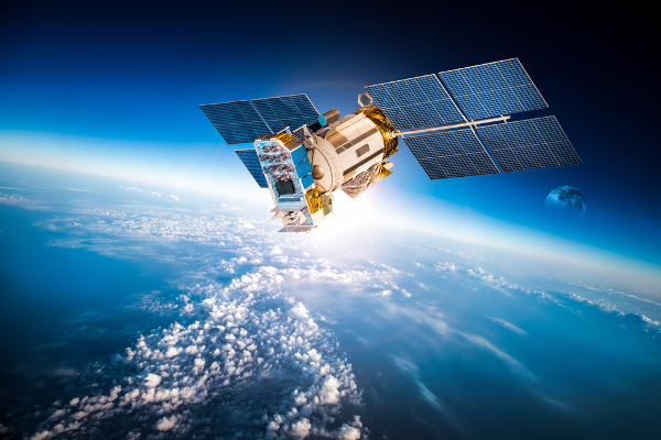
India’s effort to rebuild and strengthen its indigenous satellite-navigation system is entering an important phase, with the third second-generation NavIC satellite, NVS-03, now ready for launch and two more spacecraft progressing through advanced stages of realisation.
The Press Information Bureau, citing the Department of Space, has confirmed that NVS-03 is launch-ready while NVS-04 and NVS-05 are at advanced stages of manufacture. Together, the three spacecraft form the remaining part of the five-satellite NVS series designed to restore continuity and introduce new capabilities into India’s Navigation with Indian Constellation, or NavIC.
The development assumes additional importance because India’s indigenous navigation constellation is presently operating with a reduced number of satellites capable of delivering positioning, navigation and timing services. The arrival of NVS-03, followed by NVS-04 and NVS-05, could therefore mark the beginning of a substantial restoration of India’s sovereign navigation capability.
NavIC Constellation Currently Operating Below Full Strength
The urgency behind the second-generation programme becomes clearer when the present status of the constellation is examined.
In a written reply to Parliament on July 29, 2026, the Department of Space said that only IRNSS-1B, IRNSS-1I and NVS-01 were then providing Position, Navigation and Timing services. At least four operational satellites are required for basic standalone positioning, meaning the constellation currently cannot provide standalone positioning using NavIC alone, although its timing service remains functional.
India’s armed forces are therefore currently using NavIC in conjunction with other global navigation satellite systems. The government has said that the multi-constellation approach prevents existing users from being left without navigation capability while NavIC’s orbital infrastructure is strengthened.
The launch of NVS-03 is therefore not simply another satellite mission. A successful deployment would add another modern navigation spacecraft to the operational architecture and move NavIC closer to restoring the satellite numbers needed for stronger independent service.
NVS Series Represents the Second Generation of NavIC
ISRO has planned five second-generation satellites—NVS-01, NVS-02, NVS-03, NVS-04 and NVS-05—to augment and progressively renew the original IRNSS/NavIC constellation.
NVS-01 became the first spacecraft of the new series when it was launched aboard GSLV-F12 in May 2023. The NVS generation introduces several improvements over the original satellites, most notably an additional L1 navigation signal alongside the L5 and S-band signals traditionally used by NavIC.
The addition of L1 is particularly important because the band is widely used by civilian satellite-navigation receivers and global GNSS systems. Supporting L1 makes it easier for smartphone, automotive, Internet-of-Things and other mass-market chipsets to incorporate NavIC without requiring specialised receiver architecture.
ISRO has worked with companies including Qualcomm to incorporate NavIC’s L1 signal into mobile, automotive and IoT platforms, potentially taking the system from specialised applications into devices used by millions of consumers.
Indigenous Atomic Clock Is Another Strategic Advance
The NVS series also carries another strategically important Indian technology: an indigenous space-qualified rubidium atomic clock.
NVS-01 became the first NavIC spacecraft to fly an atomic clock developed in India. Atomic clocks are fundamental to satellite navigation because positioning depends on extremely precise measurement of the time taken for navigation signals to travel between spacecraft and receivers on Earth. Even extremely small timing errors can translate into large positioning errors.
Developing these clocks domestically reduces dependence on foreign suppliers for one of the most sensitive components within a navigation satellite.
ISRO’s Space Applications Centre has also developed the Atomic Clock Monitoring Unit used with the NavIC timing system. ISRO says domestic development of this subsystem saves approximately ₹3 crore for each navigation satellite while strengthening technological self-reliance.
NVS-02 Setback Increased Importance of Remaining Satellites
The second spacecraft in the series, NVS-02, was launched aboard GSLV-F15 on January 29, 2025. The launch vehicle performed as planned and accurately placed the spacecraft into its intended geosynchronous transfer orbit.
However, the satellite could not subsequently raise itself into its designated operational orbit because the propulsion system required for orbit raising could not be activated.
An ISRO investigation later determined that the most probable cause was a problem involving electrical connector contacts that prevented the required drive signal from reaching the pyro valve associated with the oxidiser line of the orbit-raising engine.
The review committee subsequently recommended improvements to redundancy and reliability in the pyro system. ISRO says the corrective measures were incorporated into the CMS-03 spacecraft launched in November 2025 and will be applied to future missions where relevant.
The inability of NVS-02 to reach its intended orbit makes the successful deployment of NVS-03 and the completion of NVS-04 and NVS-05 even more consequential for NavIC.
NavIC Is Moving Far Beyond Vehicle Navigation
NavIC is sometimes viewed simply as India’s equivalent of GPS, but the system’s role is considerably broader.
Satellite navigation provides three fundamental services—positioning, navigation and precise timing. The timing element has become particularly important because modern infrastructure depends on highly accurate clocks to coordinate systems spread across large geographical areas.
India is integrating NavIC into power-grid synchronisation, real-time train tracking, vehicle monitoring, Aadhaar-related geo-tagging, public warning systems and mobile-chipset platforms. It is also being adopted across vessel monitoring, logistics, geofencing and other location-based services.
By December 2025, the government reported that more than 10,000 trains were equipped with NavIC-enabled tracking devices, while over 30,000 fishing vessels had NavIC-compatible transponders. More than 140 certified tracking-device models had also been installed in over 15 lakh public and commercial vehicles.
More than 60 smartphone models from different manufacturers were already supporting NavIC by that stage, indicating that the system is gradually moving from specialised government applications into the wider consumer ecosystem.
Railways Are Becoming One of NavIC’s Largest Civilian Users
Railway tracking represents one of NavIC’s most visible large-scale applications.
The government had earlier set a target of equipping approximately 12,000 trains for real-time tracking using NavIC together with other GNSS constellations. By July 2025, around 8,700 trains were already equipped; by December that number had crossed 10,000.
Accurate real-time positioning can improve train monitoring, passenger-information systems, fleet management and operational awareness across one of the world’s largest railway networks.
The programme also demonstrates why India does not necessarily need NavIC to operate in isolation in every civilian application. Modern receivers can combine signals from several satellite constellations, increasing accuracy and resilience while still ensuring that an indigenous Indian system forms part of the navigation architecture.
Precise Timing Has Strategic Importance for India’s Power Grid
One of NavIC’s less publicly visible applications is synchronisation of India’s electricity infrastructure.
Power grids require extremely precise timing to monitor frequency, compare electrical phases and coordinate equipment spread across widely separated locations. Satellite-derived timing allows operators to maintain a common reference across the network.
Dependence entirely on foreign navigation constellations for such functions would create a strategic vulnerability. An indigenous timing source therefore provides India with an additional layer of technological sovereignty in infrastructure that is critical to national security and economic activity.
The Department of Space has also been establishing NavIC-based secondary time scales to help disseminate a common Indian Standard Time reference across the country.
Navigation Sovereignty Matters in a Crisis
The strategic importance of NavIC becomes most obvious during conflict or geopolitical confrontation.
Global satellite-navigation systems are operated by individual countries or groups of countries. Although their civilian services are widely available, India cannot assume that unrestricted access to every foreign navigation signal will always be guaranteed under every strategic circumstance.
A sovereign navigation constellation gives India control over its own positioning and timing infrastructure and provides restricted services designed for authorised users.
This is particularly important for military aircraft, ships, missiles, unmanned systems, precision weapons and secure communications, where navigation data can directly influence operational effectiveness.
The government confirmed in July that India’s armed forces currently use multi-constellation GNSS solutions that include NavIC. Strengthening the indigenous constellation therefore increases the Indian component within that broader navigation architecture.
L1 Could Transform NavIC’s Consumer Adoption
The addition of the L1 signal may ultimately prove as significant for NavIC’s civilian future as the arrival of new satellites.
Legacy NavIC primarily operated in L5 and S bands, limiting compatibility with some inexpensive mass-market navigation receivers. L1 is already widely supported by the global consumer electronics industry.
ISRO designed the new NavIC L1 signal with indigenous spreading codes, channel coding and modulation structures. The agency has stated that the architecture was developed partly to avoid reliance on externally controlled code structures.
As new NVS satellites expand L1 coverage, smartphone and chipset manufacturers should find it increasingly practical to include NavIC alongside GPS, Galileo and other navigation systems.
That could eventually make NavIC largely invisible to ordinary users: rather than choosing a dedicated NavIC device, consumers would simply use phones, vehicles and connected equipment whose location chips automatically draw upon Indian navigation satellites.
NVS-03 Is Now the Key Mission to Watch
The government has confirmed that NVS-03 is ready for launch, but an exact launch date has not yet been publicly announced. NVS-04 and NVS-05 remain in advanced stages of realisation.
That distinction is important. Earlier schedules had envisaged launches on a quicker timetable, but the present official position should be treated as the authoritative status rather than relying on older projected dates.
A successful NVS-03 mission would represent an important step towards restoring the basic NavIC constellation after the ageing of first-generation spacecraft and the NVS-02 orbit-raising failure.
NVS-04 and NVS-05 would then provide further opportunities to strengthen coverage, redundancy and service continuity.
NavIC Is Becoming National Infrastructure Rather Than Just a Space Programme
The larger story behind the second-generation NavIC constellation is therefore not simply the replacement of ageing satellites.
India is gradually embedding its navigation system into railways, electrical grids, fishing fleets, road vehicles, mobile devices, government services and strategic platforms. At the same time, ISRO is introducing indigenous atomic clocks, domestically designed navigation signals and more broadly compatible L1 services.
NavIC is consequently evolving from an ISRO satellite programme into a layer of national digital and physical infrastructure.
The immediate challenge is restoring the orbital constellation to sufficient strength. NVS-03, followed by NVS-04 and NVS-05, will be central to achieving that objective.
You may also like
-
ICAR Scientists Develop Indigenous Protective Gloves for Cotton Farmers, Sign Commercial Manufacturing Agreement
-
India Moves Towards Five-Year Assured Orders for Defence Startups Under New Procurement Reforms
-
BHEL–Coal India Joint Venture Begins Construction of ₹25,016 Crore Indigenous Coal Gasification Project in Odisha
-
Zen Technologies Introduces Indigenous Hyper-Strike Falcon AI-Guided Counter-Drone Interceptor
-
L&T and Germany’s SCHOTTEL Expand Partnership for Controllable Pitch Propeller Systems in Indian Shipbuilding
