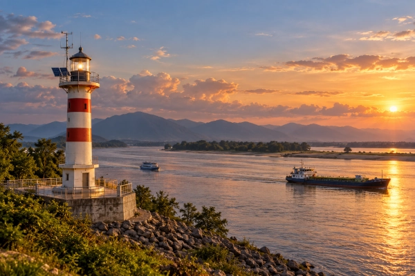
India is establishing its first four riverine lighthouses along the Brahmaputra River in Assam, marking a significant advancement in inland waterway infrastructure. The project will introduce modern navigation facilities to one of the country’s most important river transport corridors, supporting safer vessel movement, improved cargo transportation, and the development of river-based tourism.
The Ministry of Ports, Shipping and Waterways highlighted the initiative in its latest backgrounder, released on 16 October 2026, as part of India’s expanding inland navigation network. The project covers four locations along National Waterway-2 (NW-2): Pandu, Bogibeel, Silghat, and Biswanath Ghat.
Union Minister of Ports, Shipping and Waterways Sarbananda Sonowal laid the foundation stones for the four lighthouses on 5 March 2026 at Lachit Ghat in Guwahati. The Directorate General of Lighthouses and Lightships (DGLL) is implementing the project in collaboration with the Inland Waterways Authority of India (IWAI).
The project represents India’s first initiative to establish conventional lighthouse infrastructure on an inland river, extending navigation technology traditionally associated with maritime shipping to the country’s river transport network.
Four Riverine Lighthouses Along the Brahmaputra
The four lighthouses are being established at strategically selected locations along the Brahmaputra to improve navigation across Assam’s inland waterway network.
Pandu, located in Kamrup Metropolitan district, serves as an important river transport and logistics centre near Guwahati. The proposed lighthouse will support navigation along one of the Brahmaputra’s busiest transport stretches.
Bogibeel, in Dibrugarh district, occupies a strategic location in eastern Assam. Its position near major transportation infrastructure makes it relevant to the movement of cargo and passengers through Upper Assam.
Silghat, in Nagaon district, is another important river transport location associated with commercial activities and regional connectivity.
Biswanath Ghat, situated on the northern bank of the Brahmaputra in Biswanath district, completes the four-site development programme. The other three lighthouses will stand along the river’s southern bank.
Together, these installations will create additional navigational reference points along the Brahmaputra corridor, strengthening the infrastructure available to commercial vessels, passenger services, and river tourism operators.
Solar-Powered Lighthouses with Advanced Navigation Technology
Each riverine lighthouse will rise approximately 20 metres above ground level and incorporate modern lighting and observation systems.
The installations will have a geographical range of approximately 14 nautical miles and a luminous range of 8–10 nautical miles. These capabilities will help vessels identify navigational reference points over considerable distances, particularly during nighttime operations.
Solar energy will power the lighthouse installations, reducing their dependence on conventional electricity supplies and supporting reliable operation in riverine environments.
The facilities will also incorporate weather-observation sensors to provide information relevant to navigation and vessel safety.
Such equipment is particularly valuable on the Brahmaputra, where changing water levels, seasonal flooding, sandbanks, and shifting river channels create challenges for vessel operators.
The lighthouses will complement existing navigational aids, hydrographic surveys, and digital information systems used to maintain safe passage through inland waterways.
National Waterway-2 Connects Dhubri to Sadiya
The Brahmaputra forms National Waterway-2, extending approximately 891 kilometres between Dhubri and Sadiya in Assam.
The route is among India’s most important inland water transport corridors and plays a significant role in connecting communities and commercial centres across the northeastern region.
The waterway supports the transportation of commodities such as tea, coal, and fertilisers, alongside passenger movement and tourism activities.
According to the Ministry of Ports, Shipping and Waterways, cargo movement on NW-2 increased from 0.90 million metric tonnes in FY2024–25 to 1.29 million metric tonnes in FY2025–26.
The expansion demonstrates the increasing commercial importance of the Brahmaputra as a transportation corridor.
Improved navigation infrastructure can support further growth by helping vessels operate more safely and predictably across different stretches of the river.
Strengthening Round-the-Clock Inland Navigation
One of the project’s principal objectives is to support navigation during both daylight and nighttime hours.
River transportation presents challenges that differ considerably from those associated with roads and railways. Water depth, current patterns, sediment movement, and seasonal variations influence the routes available to vessels.
The Brahmaputra is particularly dynamic because of its substantial sediment load and changing river morphology.
Reliable navigation therefore requires a combination of physical markers, updated water-depth information, weather monitoring, and vessel-positioning technologies.
The new riverine lighthouses will provide prominent visual reference points that can support vessel movement after sunset.
Their integration with existing navigational infrastructure will strengthen efforts to develop dependable, round-the-clock transport services along National Waterway-2.
Digital Navigation Systems Transform India’s Inland Waterways
The riverine lighthouse project forms part of a wider programme to modernise India’s inland navigation infrastructure.
The Inland Waterways Authority of India conducts hydrographic surveys to monitor river depths, underwater obstacles, channel conditions, and changes in river morphology.
These surveys help identify navigable routes and determine where dredging or channel maintenance may be required.
Digital navigation platforms are also improving access to information required by vessel operators.
The Portal for Asset and Navigation Information (PANI) provides details about waterways, infrastructure, navigable routes, and associated facilities.
The IWAI Vessel Tracker supports vessel monitoring and access to operational information, while the Naudarshika National River Traffic and Navigation System integrates navigation-related data to improve river traffic management.
As of September 2026, Electronic Navigational Charts had been prepared for 18 operational and tidal waterways.
Together, these technologies are helping India develop an increasingly integrated inland navigation network.
Lower Transportation Costs Support Regional Economic Growth
Inland waterways offer important economic advantages for transporting bulk commodities over suitable routes.
According to the Ministry of Ports, Shipping and Waterways, moving a tonne of freight by water can cost approximately one-third as much as road transportation and half as much as rail transportation.
Actual costs depend on cargo type, distance, terminal facilities, waterway conditions, and associated logistics requirements.
For Northeast India, where difficult terrain can increase transportation costs, greater utilisation of inland waterways can provide an additional logistics option.
The Brahmaputra offers a natural transportation corridor connecting agricultural centres, industrial areas, river terminals, and commercial markets.
Improved navigation facilities can support the movement of tea, coal, fertilisers, construction materials, and other commodities while complementing existing road and railway networks.
The lighthouses are therefore relevant not only to vessel safety but also to the wider development of Assam’s logistics and transportation infrastructure.
Riverine Lighthouses to Become Tourism Attractions
The Brahmaputra lighthouse project incorporates an additional component beyond its primary navigational responsibilities.
Each lighthouse complex will include visitor-oriented infrastructure such as museums, amphitheatres, cafeterias, landscaped public spaces, children’s play areas, and souvenir shops.
These facilities are intended to develop the lighthouse locations as tourist attractions while promoting awareness of India’s navigation and river transport heritage.
The initiative follows the government’s broader programme to develop selected coastal lighthouses as tourism destinations.
Extending the concept to inland waterways provides opportunities to connect river transportation infrastructure with regional tourism.
For Assam, the programme could create additional opportunities for local businesses, hospitality services, handicraft producers, and tourism-related enterprises.
India’s Inland Waterways Record Major Cargo Growth
The development of the Brahmaputra lighthouses comes amid a wider expansion of India’s inland water transport sector.
India has 111 declared National Waterways, covering approximately 20,187 kilometres across 23 states and four Union Territories.
Of these, 32 National Waterways are currently operational.
Cargo transportation through inland waterways has increased substantially, rising from approximately 29 million metric tonnes in FY2014–15 to 218 million metric tonnes in FY2025–26.
The increase represents a compound annual growth rate of approximately 20.13%.
The latest cargo volume has already exceeded the 200-million-tonne target established under Maritime India Vision 2030.
This expansion reflects increasing investment in navigation channels, river terminals, logistics infrastructure, digital systems, and waterway development.
The Brahmaputra project will extend these improvements by introducing a new category of navigation infrastructure to India’s river transport system.
Building a Modern Navigation Network for Northeast India
India’s first riverine lighthouses represent an important step towards developing safer and more efficient inland water transportation.
The project combines solar-powered lighting, modern observation equipment, digital navigation support, and public infrastructure along the Brahmaputra.
By strengthening navigational guidance across National Waterway-2, the installations will support the continued development of cargo movement, passenger transport, and river tourism.
The initiative also demonstrates how existing maritime technologies can be adapted to meet the requirements of India’s extensive inland waterway network.
With inland cargo volumes increasing and new navigation infrastructure under development, the Brahmaputra is gaining a larger role in India’s transportation and logistics system.
The four lighthouses at Pandu, Bogibeel, Silghat, and Biswanath Ghat will become important additions to this expanding network, supporting India’s efforts to strengthen connectivity, reduce logistics costs, and promote sustainable economic development across the northeastern region.
References
- Press Information Bureau, Government of India, 16 October 2026. Navigating India’s Waterways: Building a Safer, Smarter Network. Detailed backgrounder covering the Brahmaputra riverine lighthouses, modern navigation technology, and inland waterway cargo growth.
https://www.pib.gov.in/PressReleaseIframePage.aspx?PRID=2324232&lang=2®=48 - Ministry of Ports, Shipping and Waterways, 5 March 2026. India’s First Riverine Lighthouses to Come Up on Brahmaputra (NW-2) as Sarbananda Sonowal Lays Foundation Stones.
https://www.pib.gov.in/PressReleaseIframePage.aspx?PRID=2235574&lang=2®=48 - Inland Waterways Authority of India (IWAI) – Official information concerning National Waterway-2, hydrographic surveys, inland navigation, and infrastructure development.
https://iwai.gov.in/ - Directorate General of Lighthouses and Lightships (DGLL) – Official information on navigation infrastructure, lighthouse technologies, and aids to navigation.
https://dgll.nic.in/ - Ministry of Ports, Shipping and Waterways – Government programmes for inland waterways, shipping infrastructure, and maritime connectivity.
https://shipmin.gov.in/
You may also like
-
India Approves Accession to Southern Indian Ocean Fisheries Agreement, Expanding High-Seas Fishing Opportunities
-
India’s Trout Production Grows Sixfold as Himalayan Coldwater Aquaculture Expands
-
Indian Health-Tech Startup Kubo Care Develops Radar-Based Technology for Elderly Care
-
Indian Startup Pramatra Space Develops Chip-Based Quantum Security for Space and Ground Networks
-
Indian Railways Introduces Kerala’s First Vistadome Coach on Scenic Punalur–Sengottai Route
