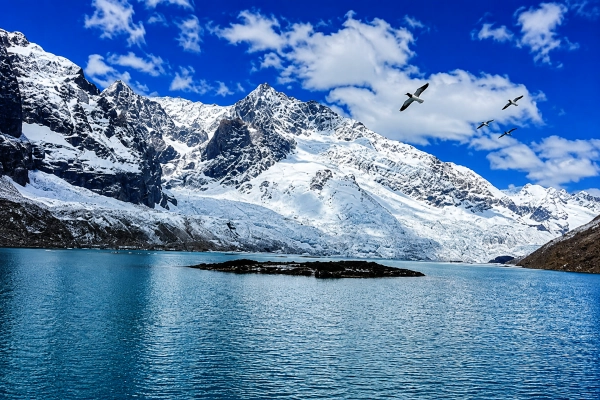
Himachal Pradesh is preparing to install a real-time Glacial Lake Outburst Flood early-warning system at Ghepan Ghat Lake in Lahaul-Spiti, one of the state’s most closely monitored high-altitude glacial lakes, as authorities strengthen protection for settlements downstream of the rapidly expanding water body.
The system is planned for installation in September 2026 through the Centre for Development of Advanced Computing, Thiruvananthapuram, subject to final approval from the National Disaster Management Authority. Lahaul-Spiti Deputy Commissioner and District Disaster Management Authority Chairman Kiran Bhadana said the system would continuously monitor the lake’s water level and other critical parameters and transmit information in real time.
The proposed deployment follows the successful testing of an indigenous GLOF-monitoring system developed by C-DAC at Sissu in Lahaul-Spiti, close to the vulnerable downstream area.
C-DAC Has Already Tested the Technology at Sissu
C-DAC officially confirmed in March 2026 that it had successfully deployed and operationalised a proof-of-concept Glacial Lake Outburst Flood Early Warning System at a high-altitude lake in Sissu, in collaboration with NDMA, the Himachal Pradesh disaster-management authorities and the local administration.
The Sissu system combines a buoy-based lake-monitoring station, Automatic Weather Station and Glacier Vision Unit, with S-band and INSAT satellite communications providing real-time transmission from the remote Himalayan terrain.
C-DAC says the system uses embedded electronics, geospatial intelligence, satellite communication and AI-based analysis to continuously track water levels, weather conditions and changes in the lake environment. It was designed to operate autonomously despite extreme cold, snowfall and weak terrestrial communications.
The Ghepan installation is expected to build on this architecture after validation of the Sissu prototype.
Ghepan Lake Has Expanded 178% Since 1989
The concern surrounding Ghepan Ghat is supported by official Himachal Pradesh disaster-management assessments.
The Himachal Pradesh State Disaster Management Authority places the lake at approximately 4,068 metres above mean sea level and records that its surface area expanded from about 36.49 hectares in 1989 to 101.30 hectares in 2022 — an increase of roughly 178%.
The lake lies above Sissu in the Chandra basin. Water leaving Ghepan travels through Sissu Nallah before joining the Chandra River approximately 11 kilometres downstream.
Official observations describe Ghepan as a moraine-dammed lake, meaning its water is held back by loose glacial debris deposited by the retreating glacier rather than by a conventional rock or concrete dam.
That distinction is important because moraine dams can be vulnerable to erosion, overtopping and destabilisation.
Moraine Dam Vulnerable to Overtopping
A Himachal Pradesh SDMA field assessment found that the frontal moraine holding Ghepan Lake is composed of unconsolidated glacial material ranging from fine sediments to large boulders.
The report noted that the downstream face has relatively limited vegetation and could therefore be vulnerable to erosion if a sufficiently large wave overtopped the moraine. Such an overtopping event could progressively erode the dam and potentially lead to failure.
Possible triggers for a GLOF can include avalanches or rockfalls entering the lake, intense rainfall, erosion inside a moraine dam, earthquakes or sudden increases in inflow.
C-DAC’s own technical description of GLOFs notes that ice or rock avalanches striking a lake can generate waves capable of overtopping natural moraine barriers, while piping through the dam or heavy rainfall can also cause failure.
NRSC Has Already Modelled a Ghepan Lake Outburst
The National Remote Sensing Centre of ISRO has carried out a dedicated GLOF risk assessment of Ghepan Ghat Lake under the National Hydrology Project.
NRSC modelled multiple possible failure scenarios using two-dimensional hydrodynamic simulations, including the release of 50%, 75% and 100% of the lake’s water volume, along with overtopping, piping and extreme-rainfall scenarios.
The modelling generated information on potential flood depth, water velocity, inundation extent and flood-wave arrival times at locations downstream.
NRSC’s study area extended as far as 150 kilometres downstream of the lake, reflecting the potential for a major GLOF to propagate well beyond the immediate Sissu valley before substantially attenuating.
The agency specifically identifies such modelling as useful for designing GLOF early-warning systems and disaster-response planning.
Sissu Is Particularly Exposed
Sissu is located considerably below the glacial lake and close to the narrow channel carrying its outflow towards the Chandra River.
The steep Himalayan terrain means that a sudden release of millions of cubic metres of water could accelerate rapidly while carrying rock, sediment, ice and other debris.
The district administration has therefore been shifting its approach from simply responding after disasters towards continuous monitoring and risk mitigation before a possible lake failure.
The early-warning system is intended to provide authorities with additional time to assess abnormal lake behaviour and issue alerts to downstream communities if monitoring equipment detects dangerous changes.
An EWS cannot prevent a moraine dam from failing. Its value lies in potentially providing the minutes or hours needed for evacuation, road closures, movement of emergency personnel and protection of vulnerable infrastructure.
GSI Team to Conduct Detailed Study
Alongside the proposed warning system, a five-member Geological Survey of India team is scheduled to begin a 14-day scientific assessment of the Ghepan Lake region from 1 September.
According to the district administration, the team will map the area, identify avalanche- and landslide-prone slopes, study lake depth and water flow and collect meteorological information. The resulting assessment is expected to be submitted to the Himachal Pradesh State Disaster Management Authority.
This work could provide important information for determining whether additional structural or non-structural mitigation measures are required around the lake.
Part of a Wider Himalayan GLOF Monitoring Push
Ghepan is not an isolated concern. Retreating Himalayan glaciers are creating new lakes while expanding existing ones across several mountain states.
The Himachal Pradesh State Disaster Management Authority has identified rising GLOF risk as an important climate-related hazard and lists Ghepan among the state’s sensitive expanding glacial lakes.
At the national level, agencies including NDMA, C-DAC, ISRO-NRSC, the Central Water Commission and Geological Survey of India are increasingly combining satellite observations, field surveys, weather sensors, hydrological modelling and satellite communications to monitor vulnerable lakes.
C-DAC’s earlier work in Sikkim illustrates how such a system can operate. Its GLOF platform uses indigenous water-level sensors linked through INSAT satellite communication, while computer models calculate possible inundation, flood arrival times and downstream impacts.
The Sissu proof of concept represents the next generation of this approach, integrating lake sensors, automated weather observations, imaging systems and AI-assisted geospatial analysis.
Moving from Satellite Monitoring to Real-Time Warning
India has long been able to monitor changes in glacial lakes through satellite imagery. The harder challenge is creating an operational system capable of detecting a dangerous event at the lake itself and rapidly transmitting an actionable warning to people downstream.
The planned Ghepan deployment represents precisely that transition.
Satellite analysis has already established that the lake has expanded dramatically. Hydrodynamic models have mapped potential flood behaviour. Ground studies have identified the vulnerability of the moraine and downstream terrain.
The next step is continuous observation at the lake itself.
For settlements such as Sissu beneath a rapidly changing Himalayan glacier, the objective is straightforward: detect abnormal conditions at the lake early enough that a sudden flood does not arrive without warning.
You may also like
-
India Post and Blue Dart Join Forces to Expand Parcel Delivery Across Urban and Rural India
-
Starlink-Ukraine, Myanmar and Drug Smuggling: Why India Must Regulate Satellite Internet for National Security
-
GST Council Recommends Major Compliance Reforms, Raises Prosecution Threshold to ₹5 Crore
-
Narendra Modi Completes 25 Years in Government: From Gujarat to the Mission of Viksit Bharat
-
Andhra Pradesh Launches India’s First 3D Concrete-Printed Rural Housing Pilot With 177 Homes
