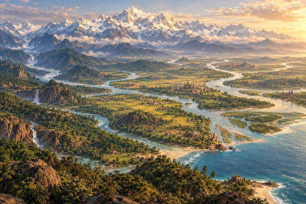
The geographical imagination of the Mahabharata extends far beyond the kingdoms that dominate its political narrative. Hastinapura, Indraprastha, Panchala, Gandhara, Madra, Magadha, Kalinga and the many other states encountered throughout the epic belong to a much larger conception of the inhabited world. At the broadest terrestrial level relevant to the narrative stands Jambūdvīpa, a vast division of the earth within which Bhārata-varṣa occupies a distinctive place. The relationship between the two is essential for understanding ancient Indian geography because the Mahabharata does not simply use Jambūdvīpa as another name for the Kuru realm, northern India or even Bhārata itself.
Jambūdvīpa belongs to a geographical tradition in which observed landscapes, memories of distant lands, sacred mountains and cosmological ideas coexist. Some elements of its description correspond closely with identifiable physical geography, particularly the Himalaya, the great river systems of Bhārata and the numerous kingdoms known from the epic. Other elements, especially the organisation of the world around Mount Meru and the extraordinary characteristics attributed to distant regions, belong to sacred cosmography. The result is a layered picture of the world rather than a map that can be transferred directly onto modern political boundaries.
The Meaning of Jambūdvīpa
The Sanskrit word Jambūdvīpa combines jambū, the name associated with the jambu or Indian rose-apple tree, and dvīpa, a word commonly translated as island but capable of denoting a great geographical division surrounded or separated by waters. Later cosmological texts explain the name through an immense and sacred jambu tree associated with this central land, but the geographical term itself became much broader than the literal image of an island containing such a tree.
Within the developed Indian cosmographical tradition, Jambūdvīpa forms the central and most important of the great dvīpas of the terrestrial world. It is divided into large regions called varṣas, separated by enormous mountain systems. Bhārata-varṣa is one of these divisions rather than the entirety of Jambūdvīpa. The Bhagavata Purana later systematises this scheme explicitly, describing nine varṣas separated by eight boundary mountains and placing Ilāvṛta at the centre around Mount Meru. The Vishnu Purana preserves a closely related arrangement in which the lands extending south and north of Meru are distributed among the descendants of Agnidhra.
These later Puranic descriptions are important for understanding the mature Jambūdvīpa system, but they should not simply be projected backwards onto every passage of the Mahabharata. The epic contains many of the same regions, mountains and cosmological ideas, yet its geographical material is less uniformly systematised and appears in several narrative contexts. Jambūdvīpa in the Mahabharata therefore represents an important stage within a longer tradition of Indian world geography.
Jambūdvīpa in the Bhishma Parva
The Mahabharata’s most sustained geographical vision appears in the Bhishma Parva, immediately before the narration of the Kurukshetra War gathers full momentum. Dhritarashtra asks Sanjaya about the earth whose possession has drawn so many rulers into conflict, and Sanjaya responds with an extensive description of lands, mountain systems, rivers and peoples. The placement of this geographical discourse is deliberate because the epic briefly enlarges its perspective from a dynastic dispute in the Kuru country to the immense world from which the assembled armies have come.
This section traditionally includes descriptions associated with Jambūkhanda and the earth as a whole. Instead of presenting the battlefield in isolation, the epic places Kurukshetra within a vast terrestrial framework containing Bhārata and the greater regions surrounding it. The geographical survey effectively asks the reader to consider the scale of what is about to be destroyed. Kings have gathered from numerous directions, and the earth over which they contend is portrayed as something far greater than the territory around Hastinapura.
The Mahabharata names immense mountain systems in this context, including the Himavat, Hemakuta, Nishadha, Nila, Sveta and Sringavan ranges. These mountains do not function merely as local landmarks. They divide vast regions and form part of the structural geography later developed more systematically in the Puranic accounts of Jambūdvīpa. The repetition of the same major mountain names across epic and Puranic traditions demonstrates continuity in the underlying cosmographical conception, even though individual texts arrange and describe them with varying degrees of detail.
Bhārata-varṣa Is Part of Jambūdvīpa
One of the most important points for modern readers is that Bhārata-varṣa and Jambūdvīpa are not synonymous in the developed geographical scheme. Bhārata is one major region within Jambūdvīpa. Later texts make this relationship explicit, and the geographical framework already visible in the Mahabharata is consistent with that distinction. The Bhagavata tradition, for example, clearly describes Bhārata-varṣa as one of the nine divisions of Jambūdvīpa rather than as the whole continent.
Bhārata is the region most directly connected with the recognisable political and cultural world of the Mahabharata. It contains the kingdoms, dynasties, sacred rivers, pilgrimage routes and battlefields that dominate the human narrative. Jambūdvīpa is the wider terrestrial framework within which this active human world is situated. This difference explains why the epic can move naturally from catalogues of historical-looking kingdoms into descriptions of far northern lands that increasingly acquire extraordinary or cosmological characteristics.
Treating Jambūdvīpa simply as an ancient Sanskrit word for modern India therefore obscures the much larger conception preserved by the texts. In some later historical and religious usages the name could certainly be applied broadly to the human world associated with India, but the epic-Puranic geographical structure is more expansive. Bhārata occupies a privileged position within Jambūdvīpa without exhausting its geographical extent.
Bhārata as the World of the Mahabharata’s Human History
Most of the epic’s political history unfolds within Bhārata-varṣa. The Kuru and Panchala countries occupy its northern heartland, while the narrative reaches eastward towards Anga, Vanga and Magadha, southward towards the Deccan and peninsular kingdoms, westward through Sindhu and Sauvira, and northwest towards Gandhara, Kamboja and other frontier peoples. This enormous geographical range allows the Mahabharata to portray the Kurukshetra conflict as something far greater than a local war.
The epic’s catalogues of rivers reinforce this connection with the physical geography of the subcontinent. The Ganga, Yamuna, Sarasvati, Sindhu, Narmada, Godavari and many other rivers belong to an identifiable landscape of settlement, pilgrimage and political life. The great mountains likewise provide recognisable geographical anchors. The Himalaya forms the dominant northern barrier of Bhārata, while other mountain systems structure the internal geography of the subcontinent.
Bhārata is therefore neither purely mythical nor simply equivalent to a modern nation-state. It is a broad civilisational and geographical region containing many kingdoms and peoples that maintained their own rulers and political identities. The Mahabharata preserves this diversity repeatedly, particularly in the Digvijaya narratives and in the lists of contingents that join the opposing armies at Kurukshetra.
Why the Land Is Called Bhārata
The name Bhārata is inseparable from the dynastic traditions at the heart of the Mahabharata. The epic repeatedly identifies its leading figures as descendants of Bharata, and the Kuru lineage itself belongs within the larger Bharata genealogical tradition. The geographical term consequently carries both ancestral and territorial meaning.
Ancient Indian texts preserve more than one genealogical explanation concerning the figure from whom Bhārata-varṣa ultimately received its name, and the Puranic traditions sometimes connect the geographical designation with different layers of royal genealogy. The Mahabharata, however, already treats Bhārata as an established cultural and geographical name. Its importance therefore exceeds the problem of identifying a single historical eponym.
The word becomes a powerful way of linking land, ancestry and political memory. The story of the Bharata descendants unfolds in the land bearing the same name, and the struggle between the Pandavas and Kauravas consequently becomes a crisis affecting the wider world of Bhārata rather than merely one royal household.
The Himalaya Does Not Mark the End of the Epic’s World
The Himalaya forms one of the great boundaries of Bhārata, but it does not represent the outer edge of Mahabharata geography. The epic repeatedly looks beyond the mountains towards trans-Himalayan peoples and remote northern territories. This is particularly visible in the Sabha Parva, where Arjuna undertakes his northern conquest before Yudhishthira’s Rajasuya sacrifice.
Arjuna’s route begins among territories that can be discussed in relation to historical geography and progressively carries him towards increasingly remote lands. The narrative moves through northern and trans-Himalayan regions until it eventually reaches the country of the Northern Kurus, or Uttarakurus. At this point the nature of the geography changes noticeably.
The guardians of Uttarakuru tell Arjuna that the region cannot be conquered by ordinary human warfare and warn that a human entering further would be unable to perceive what lies there. Arjuna does not insist on entering the forbidden country. Instead, he explains that his purpose is to establish Yudhishthira’s imperial dignity and asks that tribute be given as acknowledgement of that sovereignty. The guardians then provide celestial fabrics, ornaments and other extraordinary objects as tribute.
This episode is extremely valuable for understanding Mahabharata geography because it shows the transition from political conquest into sacred or cosmological space within a single narrative journey. Arjuna does not suddenly leave one literary universe and enter another. The boundaries between historical geography, legendary geography and cosmology remain permeable.
Uttarakuru and the Far Northern Horizon
Uttarakuru occupies a special position in ancient Indian geographical thought. The name literally evokes a northern counterpart to the Kurus, yet the region is consistently placed far beyond the ordinary Kuru country. In the Mahabharata it belongs to a distant northern world whose inhabitants and conditions cannot be understood simply as those of another neighbouring kingdom.
Attempts have long been made to identify Uttarakuru with specific territories in Central Asia, the Pamir region, Tibet or lands beyond the Himalaya. Such proposals may reflect genuine memories of distant northern geography preserved within Indian tradition. The epic’s description, however, also gives Uttarakuru qualities that clearly exceed ordinary political geography.
The most cautious interpretation is that the name preserves both geographical and idealised elements. Knowledge that peoples and lands existed far beyond the Himalaya could have formed the historical foundation, while centuries of sacred geography transformed the far north into a region of exceptional qualities. The Mahabharata allows both dimensions to coexist.
The Mountain Belts of Jambūdvīpa
The organisation of Jambūdvīpa depends heavily upon great mountain ranges that separate its principal regions. The mature Puranic scheme places Himavat, Hemakuta and Nishadha south of the central Ilāvṛta region, while Nila, Sveta and Sringavan extend to the north. The Bhagavata Purana preserves this arrangement and places Mount Meru within central Ilāvṛta.
In this system Bhārata lies south of the Himalaya, while Kimpurusha and Harivarsha occupy successive regions beyond it before the central area surrounding Meru is reached. North of that central region lie Ramyaka, Hiranmaya and Uttarakuru. Bhadrasva and Ketumala extend east and west of Meru in the developed cosmographical arrangement.
The importance of these mountain divisions should not be underestimated. Ancient travellers approaching Central Asia from the Indian subcontinent encountered successive barriers formed by the Himalaya, Karakoram, Hindu Kush, Pamirs and associated highland systems. The cosmographical mountain belts may preserve transformed memories of such enormous geographical barriers, but their literary dimensions and symmetrical arrangement demonstrate that the final model belongs to sacred world geography rather than simple topography.
Kimpurusha and the Transition Beyond Bhārata
Immediately beyond the Himalayan boundary in the later Jambūdvīpa arrangement lies Kimpurusha-varṣa. The Vishnu Purana places this region between the Himavat and Hemakuta mountain systems, while Harivarsha follows beyond Hemakuta towards Nishadha.
Kimpurushas appear elsewhere in Sanskrit literature as beings associated with remote mountainous environments, and their portrayal often acquires semi-divine or extraordinary characteristics. Their geographical position is therefore significant because they occupy precisely the zone where the recognisable geography of Bhārata begins to give way to a more elevated and sacred landscape.
The gradual nature of this transition is characteristic of ancient Indian cosmography. The world beyond the mountains is not immediately separated from the human world by an absolute line. Instead, familiar geographical structures slowly acquire increasingly extraordinary qualities as distance from Bhārata grows.
Harivarsha and the Approach to the Centre
Beyond Kimpurusha in the developed scheme lies Harivarsha, another great region of Jambūdvīpa. Later devotional literature assigns Harivarsha an explicitly sacred character, associating it with divine worship and extraordinary inhabitants. The Bhagavata Purana, for example, describes the various varṣas of Jambūdvīpa as regions associated with particular manifestations of the divine.
The Mahabharata’s geographical tradition should not automatically be made identical with these later theological elaborations, but the recurrence of the same regional names demonstrates that the basic map was already deeply rooted in the older epic tradition. Harivarsha belongs to the sequence that leads geographically and symbolically towards the central territory surrounding Meru.
This progression from Bhārata through mountain-separated regions towards the cosmic centre illustrates how physical distance and sacred significance become increasingly intertwined. The farther the geography moves from the political world of the epic, the less appropriate it becomes to search for precise equivalents on a modern atlas.
Ilāvṛta and Mount Meru
At the centre of the developed Jambūdvīpa cosmography lies Ilāvṛta-varṣa, and within Ilāvṛta rises Mount Meru. Later texts make Meru the axial mountain of the terrestrial world. The Bhagavata Purana explicitly places Meru in the centre of Ilāvṛta and describes the mountain on a scale that clearly belongs to cosmology rather than ordinary terrestrial measurement.
Meru is therefore fundamentally different from ordinary mountains named in the epic. The Himalaya can be approached as both a sacred range and a recognisable geographical formation. Meru serves a larger cosmological function. It is a central axis around which the regions of the world are organised and a place associated with divine and semi-divine realms.
This distinction is essential for responsible geographical interpretation. Identifying Meru directly with one specific mountain in the Pamirs, Himalaya or Central Asia may produce interesting hypotheses, but none can be treated as a settled historical identification. The literary Meru operates within a sacred spatial model whose dimensions and functions exceed those of any normal mountain.
The Nine-Varṣa Model of Jambūdvīpa
In its mature form, Jambūdvīpa is divided into nine principal varṣas: Bhārata, Kimpurusha, Harivarsha, Ilāvṛta, Ramyaka, Hiranmaya, Uttarakuru, Bhadrasva and Ketumala. The Bhagavata Purana explicitly describes nine divisions separated by eight great mountain boundaries, while related traditions preserve the same fundamental structure with occasional variations in names and arrangement.
Bhārata occupies the southern portion of the scheme. Kimpurusha and Harivarsha lie successively to its north before Ilāvṛta and Meru are reached. Ramyaka, Hiranmaya and Uttarakuru extend further north, while Bhadrasva and Ketumala occupy the eastern and western sides of the central region.
The Mahabharata contains many of these same regional names, but the fully ordered nine-varṣa structure is more clearly articulated in the Puranic literature. It is therefore more accurate to describe the Puranic scheme as a systematisation of geographical concepts already strongly represented in the epic tradition, rather than claiming that every later detail appears in precisely the same form in the Mahabharata.
Bhadrasva and Ketumala
The eastern and western dimensions of Jambūdvīpa are represented particularly by Bhadrasva and Ketumala. Later cosmography places Bhadrasva east of Meru and Ketumala west of it. The Bhagavata tradition explicitly identifies both among the principal varṣas of Jambūdvīpa and preserves references linking them with Mahabharata geographical material.
These regions demonstrate that Jambūdvīpa was not conceived merely as a sequence extending northward from India. The cosmographical structure expands in all major directions around a central axis. Meru serves as the organising centre, while the surrounding lands define a world extending east, west, north and south.
Modern attempts to identify Bhadrasva and Ketumala with specific countries remain uncertain. Their geographical orientation may preserve memories of distant eastern and western lands, but the literary descriptions also contain features that belong unmistakably to sacred cosmology. Their importance lies less in assigning them modern borders than in recognising the extent of the geographical horizon imagined by ancient Indian authors.
Jambūdvīpa Was Never a Single Political Kingdom
Jambūdvīpa should not be understood as an empire with a capital, a fixed frontier and a single administrative ruler in the manner of Magadha or Kuru. It is a large geographical and cosmological division containing many regions, peoples and kingdoms. Political authority exists within this framework, but Jambūdvīpa itself belongs to a different category of spatial organisation.
This distinction is particularly important when reading descriptions of universal conquest in the Mahabharata. Yudhishthira’s Rajasuya requires the Pandava brothers to establish his supremacy in the four directions, and their campaigns reach an extraordinary range of peoples. The language of imperial sovereignty can consequently become universal in scope, yet such sovereignty should not be confused with the direct bureaucratic administration of every distant region.
Arjuna’s encounter with Uttarakuru demonstrates this clearly. He does not occupy or administer that country. Its guardians simply acknowledge Yudhishthira’s imperial claim by providing tribute. The episode reflects the ritual and political conception of samrājya, or paramount sovereignty, rather than territorial government in the modern sense.
The Rajasuya and the Geography of the Four Directions
The Digvijaya undertaken before Yudhishthira’s Rajasuya provides one of the Mahabharata’s richest geographical frameworks. Each Pandava brother proceeds in a different direction, bringing rulers into tributary relationships with Yudhishthira. These expeditions allow the epic to catalogue kingdoms far beyond the Kuru heartland.
Bhima campaigns towards the east, Sahadeva towards the south, Nakula towards the west and Arjuna towards the north. Their journeys collectively present Bhārata and its surrounding world as an interconnected political space whose rulers could be symbolically incorporated into an imperial ritual.
The northern expedition is particularly revealing because it moves furthest from ordinary political geography. Arjuna proceeds from recognisable kingdoms towards increasingly distant regions until the Uttarakuru episode marks the boundary of ordinary human conquest. The Digvijaya therefore becomes not merely a story of military expansion but a literary journey through the geographical layers of the Mahabharata’s world.
Jambūdvīpa and the Kurukshetra War
The geographical breadth established elsewhere in the epic becomes politically visible at Kurukshetra. Armies arrive from many parts of Bhārata and from frontier regions beyond its central plains. Gandharas, Sindhus, Madras, Kambojas, Shakas, Yavanas, Kiratas and numerous other peoples become participants in the conflict.
This extraordinary concentration of distant contingents transforms the war from a Kuru dynastic dispute into a conflict involving a large portion of the epic’s political world. The geographical discourse of the Bhishma Parva therefore acquires additional meaning. Before describing the destruction of these armies, the Mahabharata pauses to describe the greater earth from which they have assembled.
The relationship between geography and narrative is deliberate. The scale of the land amplifies the scale of the tragedy. Kurukshetra is geographically small when compared with Jambūdvīpa, yet events occurring there affect rulers drawn from an enormous expanse of the known world.
Bhārata as the Land of Human Action
Later Indian religious geography gives Bhārata-varṣa a distinctive spiritual status as the land of karma, where human action produces consequences and liberation can be actively pursued. The Bhagavata Purana explicitly contrasts Bhārata with the other eight varṣas, describing Bhārata as the field of activity while presenting the remaining regions primarily as places of enjoyment.
This later theological formulation resonates strongly with the Mahabharata’s narrative structure. The great moral crises of the epic occur in Bhārata. Kings must choose between justice and ambition, warriors must confront conflicting duties, families destroy themselves through political rivalry, and individuals repeatedly face the consequences of their actions.
Bhārata consequently becomes more than a geographical subdivision. It is the landscape in which the Mahabharata’s central problem of dharma is worked out through human history. The distant varṣas may appear more wondrous, but Bhārata is where choice, responsibility and consequence dominate the narrative.
Jambūdvīpa and the Indian Subcontinent
Bhārata-varṣa can be related broadly to the geographical world of the Indian subcontinent, although its precise literary boundaries vary across texts and periods. Jambūdvīpa, however, cannot be equated so easily with India. Its geography extends far beyond Bhārata and includes regions that ancient authors placed north, east and west of the subcontinent.
Some modern interpretations have consequently proposed that Jambūdvīpa represents an ancient Indian conception of Asia. There is a certain attraction to this interpretation because the textual geography clearly looks beyond the Himalaya towards Central Asian and other distant regions. However, Jambūdvīpa also contains Meru, highly idealised lands and cosmological mountain systems whose scale cannot be reconciled straightforwardly with the physical continent of Asia.
It is therefore more accurate to understand Jambūdvīpa as an ancient Indian model of the greater inhabited world centred on Bhārata and organised through sacred geography, rather than as the exact equivalent of any modern continent.
Real Geography Behind the Sacred Landscape
The existence of cosmological features does not mean that Jambūdvīpa should be dismissed as purely imaginary. Ancient Indian geographical knowledge developed through travel, pilgrimage, military campaigns, trade and contact with neighbouring peoples. Merchants knew routes towards Central Asia and western Asia, pilgrims crossed major mountain systems, political traditions remembered frontier peoples, and travellers carried information about territories beyond the immediate horizon.
This knowledge could gradually be integrated into sacred world models. The enormous northern mountain ranges of cosmography may preserve a transformed awareness of the succession of highland barriers encountered beyond the Gangetic plain. Distant peoples could likewise become increasingly idealised as geographical knowledge merged with religious imagination.
Jambūdvīpa therefore represents neither a modern scientific map nor arbitrary fantasy. It belongs to an ancient intellectual tradition in which geography, cosmology, sacred history and cultural memory were not treated as entirely separate disciplines.
A Geography of Different Scales
The Mahabharata becomes easier to understand when its places are recognised as belonging to different geographical scales. Hastinapura and Indraprastha are individual cities, while Kuru and Panchala are political kingdoms. Gandhara, Kamboja, Magadha and other territories occupy comparable political levels, although their size and organisation differ.
Above these kingdoms stands the broader geographical and civilisational region of Bhārata-varṣa. Beyond Bhārata lies the larger structure of Jambūdvīpa, whose great varṣas are divided by immense mountain systems and arranged around the central sacred geography of Meru.
Confusion develops when all these categories are treated as equivalent. Jambūdvīpa is not simply a very large kingdom, just as Meru is not merely another Himalayan peak. The epic can move between these scales because its geographical vision encompasses both the human political world and the sacred structure of the earth.
Why Jambūdvīpa Cannot Be Plotted Precisely on a Modern Map
Many Mahabharata locations can be investigated meaningfully through modern historical geography. Gandhara can be associated broadly with regions of present-day Pakistan and Afghanistan, Kamboja with the northwestern frontier and adjoining Central Asian zones, and numerous rivers and cities retain strong geographical continuities.
Jambūdvīpa requires greater caution because it incorporates a different level of spatial thought. The Himalaya is physically identifiable, and Bhārata possesses strong connections with the Indian subcontinent, but Ilāvṛta, Meru and some of the outer varṣas operate within a cosmological framework that cannot be reduced confidently to modern coordinates.
Attempts to create precise modern political borders for every varṣa therefore give the texts a degree of cartographic precision they do not claim for themselves. A responsible reconstruction should distinguish between locations supported by geographical evidence, regions that may preserve memories of distant historical territories, and areas whose primary function is cosmological.
Jambūdvīpa Reveals the Scale of the Mahabharata’s World
The concept of Jambūdvīpa fundamentally enlarges the geographical setting of the Mahabharata. Hastinapura is one city within Kuru, Kuru is one political region within Bhārata, and Bhārata itself occupies only one part of the much greater world represented by Jambūdvīpa. Beyond the familiar kingdoms rise mountain systems and distant lands that lead towards the sacred centre around Meru.
This layered geography mirrors the structure of the epic itself. The Mahabharata begins repeatedly with individual human decisions but expands their consequences across families, kingdoms and eventually the entire political world. In the same way, its geography can move from a palace chamber in Hastinapura to the plains of Kurukshetra, from Kurukshetra to the kingdoms of Bhārata and from Bhārata outward towards Jambūdvīpa.
Jambūdvīpa is therefore not merely an archaic geographical term. It preserves an ancient Indian attempt to understand the place of Bhārata within a much larger world. Real rivers, mountain ranges and political regions stand beside distant lands transformed by sacred imagination, creating a geographical vision in which human civilisation occupies one part of an ordered and meaningful cosmos.
Within that vast framework, Bhārata-varṣa remains the decisive human landscape of the Mahabharata. It is here that kingdoms rise and fall, alliances are formed, pilgrimages are undertaken, dharma is tested and the consequences of human action unfold. Jambūdvīpa provides the greater world surrounding that drama, while Bhārata gives the epic its historical, political and moral centre.
References
Mahabharata, Bhishma Parva — geographical descriptions associated with Jambūkhanda, Bhārata-varṣa, mountains, rivers and peoples.
Mahabharata, Sabha Parva — Arjuna’s northern Digvijaya and encounter with the guardians of Uttarakuru.
Mahabharata, Sabha Parva — the four directional campaigns undertaken before Yudhishthira’s Rajasuya.
Vishnu Purana, Book II — division of Jambūdvīpa among the nine regions and the geographical position of Meru, Bhārata, Kimpurusha, Harivarsha, Uttarakuru, Bhadrasva and Ketumala.
Bhagavata Purana, Fifth Skandha, Chapters 16–18 — developed description of Jambūdvīpa, its nine varṣas, boundary mountains and Mount Meru.
Kisari Mohan Ganguli, The Mahabharata of Krishna-Dwaipayana Vyasa — English translation of the Sabha and Bhishma Parva geographical passages.
Bibek Debroy, The Mahabharata — modern translation of the critical-text tradition, including the Sabha Parva and Bhishma Parva geographical material.
You may also like
-
Tamraparni in the Mahabharata: The Sacred Southern River at the Edge of the Pandya Country
-
Simhala or Simhaladvipa in the Mahabharata: The Island Kingdom of Sri Lanka
-
Lanka in the Mahabharata: The Island Kingdom Beyond India’s Southern Shore
-
Cina in the Mahabharata: The Trans-Himalayan World at the Edge of the Epic’s Geography
-
India and France Sign Agreement to Preserve and Digitise Ancient Indian Manuscripts
