India and France are preparing to launch the TRISHNA satellite in 2027, marking a major step in one of the world’s most important space partnerships for climate, water and agricultural security. Prime Minister Narendra Modi announced the mission timeline during his Paris visit, placing the satellite at the centre of India-France cooperation in science, technology and sustainable development.
TRISHNA stands for Thermal infraRed Imaging Satellite for High-resolution Natural Resource Assessment. It is a joint mission between the Indian Space Research Organisation and the French space agency CNES. The mission is designed to observe Earth’s surface in the visible and thermal infrared bands, giving scientists, planners and policymakers a powerful tool to measure heat, water stress, land condition, crop health, coastal water quality and environmental change.
The significance of TRISHNA lies in its practical purpose. This is a satellite created for real-world planetary challenges. Water stress, climate change, drought, food security, glacier melt, urban heat and inefficient irrigation are among the biggest problems facing governments today. TRISHNA will help monitor these problems with high-resolution thermal data, giving decision-makers better information for agriculture, water management and environmental planning.
India and France have a long history of space cooperation. Their partnership has produced important missions such as Megha-Tropiques for tropical weather and climate study, and SARAL for oceanography and sea-surface monitoring. TRISHNA continues that tradition, but with a sharper focus on heat, water and natural resource management. It reflects how space technology has moved from prestige missions to direct support for farmers, cities, water managers and climate scientists.
The mission’s core strength is thermal imaging. Earth’s surface temperature carries deep information. A crop field under water stress becomes warmer. A city with heat-island build-up shows thermal imbalance. A glacier undergoing melt displays changing temperature patterns. A water body with pollution or mixing changes its thermal signature. By observing temperature patterns from space, TRISHNA can help identify environmental stress before it becomes a deeper crisis.
For agriculture, TRISHNA can become highly valuable. Irrigation is one of the largest users of freshwater, and many farming regions face pressure from groundwater depletion, irregular rainfall and rising temperatures. By measuring evapotranspiration and plant water stress, the satellite can help estimate how much water crops are actually using. This can support irrigation advisories, better water-saving practices, improved crop productivity and more scientific watershed management.
For India, this is especially important. Indian agriculture depends heavily on monsoon behaviour, irrigation systems, groundwater and local climatic conditions. A satellite that can provide high-resolution thermal information can help agricultural planners understand stress in fields, detect early signs of drought and support region-specific water decisions. This directly connects space technology with food security.
For France and Europe too, the mission has strong relevance. Climate change is creating heatwaves, water stress, wildfires and agricultural disruptions across Europe. TRISHNA’s ability to monitor surface temperature and water-linked stress will support climate adaptation strategies, sustainable farming and environmental protection. The mission therefore serves both national and global needs.
TRISHNA will also support monitoring of urban heat islands. Modern cities are becoming hotter because of concrete surfaces, dense construction, traffic, reduced tree cover and trapped heat. Urban heat has direct effects on health, power demand, labour productivity and quality of life. Thermal satellite data can help city planners identify hotspots, improve green cover planning, design cooling strategies and issue better heat alerts.
The mission has clear importance for coastal and inland water bodies. Lakes, rivers, reservoirs, estuaries and coastal waters are sensitive to pollution, temperature change, runoff, mixing and biological activity. TRISHNA’s observations can help detect water quality changes and study the dynamics of these water bodies. For a country like India, with vast river systems, reservoirs, wetlands and a long coastline, this capability has large environmental value.
TRISHNA will also contribute to cryosphere monitoring. Snow cover, glacier melt and snow-melt runoff are vital for river systems, especially in regions dependent on mountain water sources. By monitoring thermal and surface patterns, the mission can help improve hydrological models and support better understanding of glacier-linked water flows. This is especially relevant in the Himalayan region, where climate change is reshaping long-term water security.
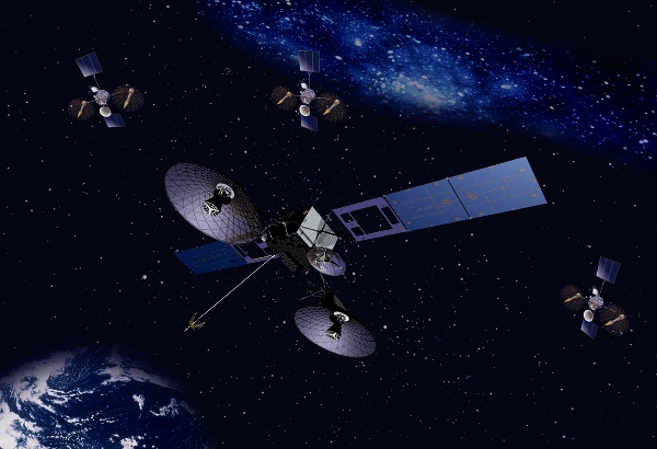
The satellite will carry two main payloads. The Thermal Infra-Red payload is provided by CNES. It will support high-resolution mapping of surface temperature and emissivity. The Visible-Near Infra-Red-Short Wave Infra-Red payload is developed by ISRO. It will provide spectral observations useful for mapping surface reflectance, vegetation, radiation variables and biophysical parameters. Together, these instruments will give a rich picture of how land, water and atmosphere interact.
The planned orbit also matters. TRISHNA will operate in a sun-synchronous orbit at about 761 kilometres altitude, with a local equator crossing time around 12:30 PM. This orbit helps the satellite observe Earth under consistent lighting and thermal conditions. Its spatial resolution is expected to be around 57 metres for land and coastal regions, while oceanic and polar regions will have coarser but useful coverage. The mission life is planned for five years.
The repeat observation capability will make TRISHNA especially powerful. Many environmental problems change quickly. A crop field may face water stress within days. A heatwave can intensify rapidly. A lake may show fast thermal shifts. Regular observation allows scientists to track change rather than capture only isolated snapshots. This gives the mission operational value for advisories and planning.
The mission also strengthens India’s role in global climate action. India has repeatedly argued that technology must support inclusive development and must be shared for wider human benefit. TRISHNA fits that vision. Its data can contribute to global frameworks connected with agricultural monitoring, sustainable development goals, climate variables and water security. It gives India a visible role in providing science for the Global South as well as advanced economies.
TRISHNA also reflects India’s rising space diplomacy. India’s space programme has moved from self-reliant national development to international partnership and global service. Missions such as Chandrayaan, Aditya-L1, Gaganyaan preparations, navigation services, small-satellite launches and Earth-observation platforms have increased India’s credibility. TRISHNA shows that India can co-develop sophisticated missions with a major European space power.
For France, the mission deepens its trusted scientific partnership with India. The two countries have built cooperation across defence, nuclear energy, space, climate, blue economy, artificial intelligence and high technology. Space cooperation is one of the strongest pillars of this relationship because it combines scientific trust, long-term planning and shared global purpose.
The announcement also comes at a time when India-France relations are expanding beyond traditional strategic sectors. The partnership now includes innovation, deep technology, startups, digital infrastructure, clean energy, education, professional mobility and global governance. TRISHNA sits naturally within this new framework because it uses advanced technology for public good.
The satellite can also support disaster preparedness. Thermal anomalies can help in detecting sub-surface fires, volcanic activity, geothermal zones and other environmental changes. Heat data can support drought analysis, fire risk assessment and climate resilience planning. In an era of extreme weather, satellites like TRISHNA become part of national security and economic planning.
The agricultural value of TRISHNA may become one of its strongest outcomes. Better irrigation intelligence means better crop planning. Better water-stress monitoring means better protection of yields. Better evapotranspiration data means better use of scarce water. This can help farmers, agro-industries, watershed managers and policymakers make decisions based on science.
The mission also has strong value for environmental research. Scientists will be able to study energy balance, radiation variables, surface heat fluxes, vegetation stress, hydrological behaviour, urban climate and coastal systems. This can improve climate models and give governments better tools to respond to environmental change.
For India’s space ecosystem, TRISHNA is another example of mission maturity. It combines instrument development, international coordination, data science, environmental modelling and applied governance. Space missions today require strong links between scientists, engineers, farmers, ministries, local governments and global research networks. TRISHNA will bring all these communities together through data.
The name TRISHNA is also meaningful. In Sanskrit and many Indian languages, Trishna means thirst. This gives the mission a poetic connection with its purpose. A satellite named after thirst will help the world understand water stress, crop thirst, land heat and climate pressure. It is a powerful example of how scientific missions can carry civilisational symbolism.
The 2027 launch will therefore be more than a technical event. It will be a statement of India-France trust, climate responsibility and space-based public service. It will show how two major democracies can work together to address food security, water security and environmental resilience.
As climate pressures intensify across the world, the demand for reliable Earth-observation data will rise. Countries will need timely information on water, heat, crops, cities, glaciers and coastlines. TRISHNA is designed for that future. It will help transform thermal data into practical knowledge.
India and France are building this mission at the right time. The world needs smarter farming, better water use, safer cities, cleaner water bodies and stronger climate monitoring. TRISHNA will serve these goals from space.
The satellite represents a new generation of space cooperation: scientific, strategic and humanitarian. It connects high technology with human survival. It connects orbit with agriculture. It connects thermal imaging with water conservation. It connects India and France through a mission for the planet.
You may also like
-
India–China Border Trade Reopens Through Three Himalayan Routes After Six-Year Suspension
-
Maldives–India Real-Time Payment Corridor Goes Live Through Favara and UPI
-
India and Bhutan Review Development Partnership Under 13th Five-Year Plan
-
India and Japan Plan Exchange of Five Lakh People, Including 50,000 Skilled Indians
-
India’s NBCC to Build 1,008 Affordable Homes in Seychelles Under Landmark Housing Agreement