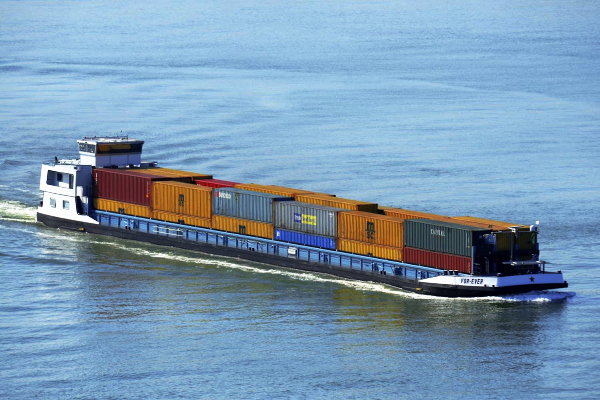
India’s inland water transport sector has achieved a major milestone, with cargo movement reaching 218 million metric tonnes (MMT) during the financial year 2025–26, surpassing the 200 MMT target established under Maritime India Vision 2030 four years ahead of schedule.
According to the Ministry of Ports, Shipping and Waterways, cargo transportation through inland waterways has increased from 29 MMT in 2014–15 to 218 MMT in 2025–26. This represents more than sevenfold growth over eleven years and reflects the increasing importance of inland waterways in India’s freight transportation network.
The achievement comes as the government continues to expand navigation infrastructure, modernise river transport systems and improve connectivity between waterways, roads, railways and ports. These initiatives form part of India’s broader strategy to develop an efficient, economical and environmentally sustainable multimodal logistics network.
Inland Waterway Cargo Movement Records Sevenfold Growth
India’s inland waterway cargo transportation has expanded substantially over the past decade, supported by infrastructure development, improved navigability and government initiatives encouraging the movement of goods through rivers and canals.
Cargo movement increased from 29 million metric tonnes in 2014–15 to 218 million metric tonnes in 2025–26, representing approximately 7.5 times the volume recorded eleven years earlier. This expansion has enabled India to surpass the Maritime India Vision 2030 target of 200 million metric tonnes ahead of schedule.
India has designated 111 National Waterways covering approximately 20,187 kilometres across 23 states and four Union Territories. Of these, 32 waterways are operational, supporting cargo transportation, passenger services and river tourism. The National Waterways Act, 2016, provided the legislative framework for expanding the country’s inland navigation network, while the Inland Waterways Authority of India (IWAI) oversees the development, maintenance and regulation of these routes.
The expansion of operational waterways has created opportunities for transporting industrial commodities, agricultural products and construction materials through an alternative freight network. With additional infrastructure and improved navigational facilities, inland waterways are becoming an increasingly important component of India’s transport system.
Inland Water Transport Supports Lower Logistics Costs
The government is promoting inland waterways as an economical and environmentally sustainable alternative to road and rail transportation, particularly for bulk cargo movement over long distances.
According to the Ministry of Ports, Shipping and Waterways, transporting one tonne of freight through inland waterways costs approximately one-third of road transportation and half of rail transportation. Water transport also offers advantages in energy efficiency because large quantities of cargo can be moved using comparatively less fuel per tonne-kilometre.
Inland vessels are particularly suitable for transporting coal, iron ore, minerals, construction materials, fertilisers and other bulk commodities. Greater utilisation of these routes can reduce pressure on highways, supplement railway freight services and improve the movement of goods between industrial centres and maritime ports.
The integration of waterways with other transport networks is an important component of India’s logistics modernisation programme. By developing terminals, jetties and multimodal transport facilities, the government aims to establish efficient connections between manufacturing centres, agricultural regions, ports and domestic markets.
Navigation Infrastructure Expands Across National Waterways
The Inland Waterways Authority of India is strengthening navigation infrastructure through hydrographic surveys, maintenance dredging, channel marking and the installation of modern navigation aids. These activities help maintain navigable routes and improve operating conditions for cargo vessels and passenger services.
Hydrographic surveys provide information about river depths, riverbed conditions, water currents and other physical characteristics that influence vessel movement. Authorities use these assessments to identify suitable navigation channels, monitor changes in river conditions and plan infrastructure development.
As of September 2026, regular thalweg surveys covered 22 National Waterways. A thalweg represents the deepest navigable channel along a river, and monitoring its alignment helps vessel operators identify safer routes. Depending on the characteristics of individual waterways, authorities conduct these surveys weekly, fortnightly or monthly.
The monitoring network also covers the Indian section of the Indo-Bangladesh Protocol route, which facilitates inland water transportation between India and Bangladesh. This route plays an important role in strengthening regional connectivity and supporting cargo movement between northeastern India and the wider inland navigation network.
India’s First Riverine Lighthouses Under Development on Brahmaputra
India is strengthening navigational infrastructure along the Brahmaputra River through the establishment of its first four riverine lighthouses. The initiative forms part of the government’s efforts to improve vessel movement along National Waterway-2, one of the country’s most important inland transport corridors.
The four lighthouses are being established at Pandu, Bogibeel, Silghat and Biswanath Ghat in Assam, with an estimated investment of approximately ₹74 crore. Each lighthouse will rise around 20 metres above ground and provide navigational guidance to vessels operating along the river.
The facilities will incorporate solar-powered systems and weather-monitoring equipment to support safer navigation. By improving visibility and providing reliable navigational references, the lighthouses will help cargo vessels and passenger services operate more efficiently, including during periods of reduced natural light.
National Waterway-2 extends approximately 891 kilometres along the Brahmaputra from Dhubri to Sadiya. Cargo movement along this route increased from 0.90 million metric tonnes in 2024–25 to 1.29 million metric tonnes in 2025–26, reflecting its growing utilisation for commercial transportation.
The development of riverine lighthouses complements other infrastructure improvements along the Brahmaputra, including terminals, navigational channels and modern cargo-handling facilities. Together, these initiatives support the expansion of inland water transport in Assam and the northeastern region.
Digital Navigation Systems Improve Inland Waterway Operations
India is introducing digital technologies to improve navigation planning, vessel monitoring and the management of inland waterway infrastructure. These systems provide operators with access to information about navigable channels, vessel movements, terminals and changing river conditions.
The Portal for Asset and Navigation Information (PANI) provides information concerning waterways infrastructure, terminals, jetties and navigation facilities. The IWAI Vessel Tracker supports the monitoring of vessels operating along designated routes, enabling authorities and operators to access information relevant to navigation and fleet management.
The government has also introduced Naudarshika, the National River Traffic and Navigation System, to strengthen river traffic management through digital technologies. The system provides information concerning navigation conditions, including the Least Available Depth, which indicates the minimum water depth available along a particular navigable stretch.
Reliable information about water depth is essential for inland cargo vessels because river conditions can change due to seasonal variations, sediment movement and fluctuations in water levels. Access to updated navigation information helps operators select suitable routes and plan vessel movements more effectively.
Electronic Navigational Charts provide another important technological improvement. As of September 2026, authorities had prepared electronic navigation charts for 18 operational and tidal waterways. These digital charts present information about navigation routes, water depths and other features necessary for safer vessel movement.
The growing use of digital navigation systems is helping modernise India’s inland water transport network by improving operational planning, strengthening navigation safety and supporting more reliable commercial services.
Kerala’s National Waterway-3 Strengthens Regional Connectivity
Kerala’s National Waterway-3 represents an important component of India’s inland water transport network, connecting settlements, industrial areas and commercial centres through the state’s extensive system of canals and backwaters.
The West Coast Canal system extends between Kottapuram and Kollam and includes the Champakkara and Udyogamandal canals. These waterways provide transport connections across parts of central and southern Kerala, supporting passenger movement and opportunities for commercial cargo transportation.
The Ministry of Ports, Shipping and Waterways has highlighted National Waterway-3 as an example of modern inland navigation infrastructure. The waterway has been equipped with 312 solar-powered lighted fibre-reinforced plastic buoys and 17 beacon lamp posts to facilitate vessel movements during both daytime and nighttime operations.
The navigation aids help vessel operators identify designated channels and navigate through sections where water depth, visibility or channel alignment may present operational challenges. Solar-powered installations also reduce dependence on conventional electricity infrastructure while supporting continuous navigation services.
Kerala’s inland waterways offer opportunities to strengthen the movement of industrial materials, agricultural products and other commodities between production centres and transport terminals. Improved waterway connectivity can also complement the state’s road and rail infrastructure while supporting passenger services and tourism.
The development of National Waterway-3 demonstrates how inland navigation infrastructure can contribute to regional economic activity, particularly in states with extensive natural waterways and established commercial centres.
Jalvahak Scheme Encourages Cargo Transportation Through Rivers
The government has introduced the Jalvahak Scheme to encourage cargo owners and logistics operators to use inland waterways for transporting goods. The initiative provides financial incentives for eligible cargo movement and seeks to improve the commercial attractiveness of river transportation.
Under the scheme, eligible cargo operators can receive incentives of up to 35%, reducing transportation expenses and encouraging businesses to explore inland shipping as an alternative to conventional freight services.
The government has also approved scheduled cargo services along National Waterway-1, National Waterway-2 and National Waterway-16 through the Indo-Bangladesh Protocol route. These services cover important stretches of the Ganga, Brahmaputra and Barak river systems, strengthening transportation links across northern and northeastern India.
Scheduled cargo operations are intended to provide greater predictability for businesses by establishing regular shipping services along designated waterways. Such arrangements can help industrial enterprises, traders and logistics companies plan cargo movements more efficiently while improving the commercial utilisation of inland vessels and terminals.
The government is simultaneously encouraging private investment in jetties, terminals and associated infrastructure. The National Waterways (Construction of Jetties/Terminals) Regulations, 2025, provide a regulatory framework for private participation in infrastructure development.
Greater involvement from private operators is expected to support the expansion of cargo-handling facilities, improve logistics services and create additional opportunities for businesses involved in inland shipping.
Maritime Amrit Kaal Vision 2047 Targets 500 Million Tonnes of Cargo
Having surpassed the cargo transportation target established under Maritime India Vision 2030, India is pursuing more ambitious objectives through Maritime Amrit Kaal Vision 2047.
The long-term roadmap envisages increasing inland waterway cargo movement to more than 500 million metric tonnes annually by 2047, reflecting the government’s objective of making waterways a more significant component of the national freight transportation network.
The vision also seeks to increase the share of inland water transport in India’s overall freight movement from approximately 2% to 5%. Achieving this objective will involve expanding navigable routes, developing cargo terminals, improving multimodal connectivity and encouraging greater commercial adoption of river transportation.
Another major objective is to increase the number of operational National Waterways to more than 50 by 2047. The expansion will strengthen connectivity across different regions while creating opportunities for cargo transportation, passenger services and river tourism.
The Union Budget 2026–27 announced plans to operationalise 20 additional National Waterways over five years, providing further momentum to the development of inland transport infrastructure.
These initiatives form part of India’s broader maritime and logistics development strategy, which places emphasis on modern infrastructure, technological advancement, private participation and efficient transportation networks.
Inland Waterways Become an Important Part of India’s Logistics Expansion
India’s achievement of 218 million metric tonnes in inland waterway cargo movement during 2025–26 marks an important stage in the development of the country’s transport infrastructure.
The growth from 29 million metric tonnes in 2014–15 reflects sustained investment in navigable waterways, cargo terminals, navigation systems and institutional support for inland shipping. Surpassing the Maritime India Vision 2030 target four years ahead of schedule demonstrates the expanding commercial role of river transportation.
The development of modern navigation infrastructure along the Brahmaputra, digital vessel-monitoring systems and improved waterways in states such as Kerala is strengthening the operational capabilities of India’s inland transport network. Government initiatives encouraging scheduled cargo services and private investment are also creating opportunities for wider commercial participation.
With Maritime Amrit Kaal Vision 2047 targeting more than 500 million metric tonnes of annual cargo movement, India is advancing towards a more integrated and sustainable logistics system. The continued expansion of inland waterways will support industrial growth, improve regional connectivity and strengthen the country’s transportation infrastructure as part of its long-term economic development.
References
- Press Information Bureau, Government of India – October 16, 2026: Navigating India’s Waterways: Building a Safer, Smarter Network
- Ministry of Ports, Shipping and Waterways, Government of India: Inland Water Transport – Development, Cargo Movement and National Waterways
- Press Information Bureau: Sagarmala Project, National Waterways and Coastal Shipping
- Press Information Bureau: Private Investment and Expansion of National Waterways
- Akashvani News – October 16, 2026: Waterways Cargo Movement Reaches 218 MMT in 2025–26, Surpassing Maritime India Vision 2030 Target
You may also like
-
Government Finalises Airfare Pricing Rules to Protect Passengers from Excessive Ticket Charges
-
SberIndia Partners with Space 1 to Develop Russian-Indian Cooperation Center in New Delhi
-
GRSE Signs ₹1,032 Crore Contract with ONGC to Build Four Hybrid Platform Supply Vessels
-
QNu Labs Secures ₹150 Crore Govt Support to Develop Indigenous Quantum Security and Sensing Technologies
-
Balaghat Chinnor: Madhya Pradesh’s Fragrant Heritage Rice from the Fields of Balaghat
