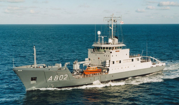
The keel of the first of the newly designed Survey Vessel (Large) was laid down at Garden Reach Shipbuilders & Engineers (GRSE) on November 08, 2019 under Yard 3025 project for the construction of four survey ships for the Indian Navy. The RFP for these ships was promulgated in 2016 to the six shortlisted Indian Shipyards for construction of 3,300 tonnage ships, measuring 110m in length and suitable for accommodating about 230 seamen onboard. The ship shall have state of the art Survey equipment payload, including Autonomous Underwater Vehicle and rover, along with capability to operate helicopter from its deck. The first of ship is planned to be commissioned within the next 36 months and the rest within the next 54 months. These Survey ships shall enhance the Navy’s capabilities for coastal and deep-water hydrographic surveys and undertake additional responsibility as a Hospital ship for the fleet during hostilities.
What is Hydrographic Surveys & Nautical Charting?
Established 21 June 1921, International Hydrographic Organisation (IHO), Monaco oversees the safety of sea navigation during a passage for all ships and sets the Standards for various procedures and Survey equipment to be complied with for the Survey work. Every year, the date of 21 June is celebrated as ‘World Hydrography Day’ to mark the importance of IHO’s role. Various seafaring countries are a member of IHO and abide by IHO’s hydrographic and nautical charting standards. In about last 100 years of its existence, the IHO has been able to standardize various maritime measurements, marine cartographic products and geographical information systems for safe navigation. As a member country of IHO, India too regularly shares its part of obligations through the Chief Hydrographer to the government of India, who is a Vice Admiral rank naval officer.
The National Hydrographic Office (NHO) is located at Dehradun presently. In various forms the Indian Naval Hydrographic Department has effectively completed about 300 years of hydrographic surveying of Indian waters since the establishment of its first Office at Kolkata during British East India era. NHO is the National Authority for publication of nautical charts and publications.
As part of international responsibility entrusted to it, NHO provides coverage for marine safety information in the NAVAREA VIII region (in accordance with IHO Publication S-53) comprising of the Indian Ocean, Arabian Sea and Bay of Bengal. As part of NHO, Indian Naval Hydrographic Department has eight naval ships assisting in Survey duties and is recognized as IHO’s Centre for imparting training in Hydrography in South East Asia. The Indian Naval Hydrographic Department has two Chart Depots (one each at Mumbai and Visakhapatnam) as custodian of naval charts. The Chart distribution services are also being undertaken by the private agencies registered with IHO. It is mandatory for all seagoing vessels to always have an updated set of navigational charts as per the Laws of the Sea. Though charts are still printed on papers, with technological advancements, electronic navigation charts are getting popular. With the advent of technology, more and more Chart Work is occurring on gadgets like Electronic Chart Display Information System (ECDIS).
ECDIS is a navigational chart system used on board naval vessels and ships for ease of ship’s navigation. The Naval ships involved in surveying duties have specialised equipment fitted onboard like multi-beam echo sounders, Conductivity Temperature Depth instrument, Acoustic Doppler current profiler (ADCP), Sound Velocity profiler, Acoustic tide gauge and Sub Bottom Profiler. The digital data recorded by Survey ships and units are put through a rigorous verification for Quality Control before being provided to the Mariners in the form of Nautical Charts. Real-time dissemination of marine safety information is very essential for all ships underway at sea for their route planning. And for this NHO promulgates maritime safety information as Navigational Warnings round the clock through Global Maritime Distress and Safety Services (GMDSS) using International Maritime Satellites.
For safety purpose, the NHO also publishes regular Indian Notices to Mariner which carries details like the Chart correction information, warnings, unexplored regions (including not dangerous to navigation) etc. For example, the 2019 Notice advised mariners to exercise extreme caution while using the Global Positioning System positions in WGS 84 datum on the Indian navigational charts produced in Everest datum. The variation in these parameters was considerable along the Indian coast, Andaman & Nicobar and Lakshadweep islands. Mariners were also advised to apply datum shift parameters on the Indian navigational charts before using GPS positions on Indian charts and to use alternate methods of fixing while operating in restricted waters and in the vicinity of dangers.
India already has its marine survey roles and responsibilities mandated by IHO for providing information on safe navigable routes for all shipping in the region of Indian Ocean, Arabian Sea and Bay of Bengal. To achieve this effectively, Indian Navy needs resources to deliver the services as per IHO Standards and even though Survey ships are mostly on operational deployment at sea, they face tremendous challenges due to various ship related maintenance refit requirements etc., whereas the Survey work pressure always exists. The induction of these new larger dimensions Survey vessels shall help in improving the Survey work quality, especially in deeper sea waters since such larger ships can be positioned at sea for longer durations. With an autonomous Underwater Vehicle and a rover onboard, deep Oceanography research shall also get a boost. Ship’s role as a Hospital ship for the fleet task force is an important and critical role which too is required to be performed by it.
Source: FE
Image Courtesy: Damen Shipyard
You may also like
-
Indian Navy Launches DSC A24, Final Vessel in Indigenous Diving Support Craft Programme
-
India–China Border Trade Reopens Through Three Himalayan Routes After Six-Year Suspension
-
Ajit Doval Receives Lokmanya Tilak National Award, Calls on Youth to Place Nation Above Personal Interest
-
Indigenous DRDO Radome Set to Strengthen Tejas Mk1A Production
-
INS Nistar Strengthens Indian Navy’s Deep-Sea Diving and Submarine-Rescue Capability