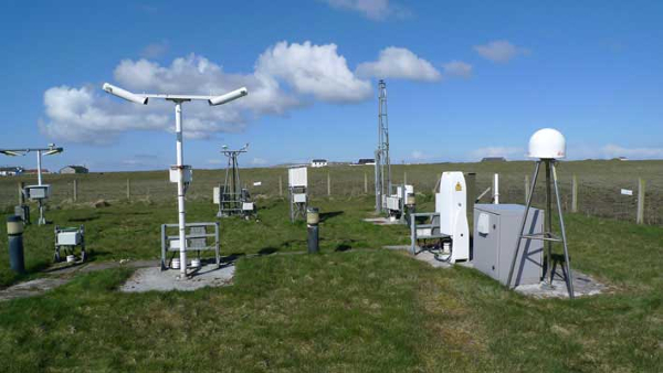
GNSS technology has transformed how surveying is done. However, its use in survey applications is limited because of inherent errors associated with the GPS signals. Continuously Operating Reference System (CORS) is an infrastructure that can solve the problem of accuracy and real-time data acquisition. Looking at the importance and usefulness of the technology, the Survey of India has started an initiative of establishing nationwide CORS network.
Dr Harsh Vardhan, Minister of Science and Technology, Health and Family Welfare and Earth Sciences inaugurated CORS infrastructure on the occasion of National Science Day 2020 in New Delhi. The theme of National Science Day 2020 was “Women in Science”.
President of India, Ram Nath Kovind, who was also present in the event said, “science and technology has a great role in the development of India. We can address the issue of climate change, health care, energy, food and water scarcity, etc. through science and technology ” Challenges are many and complex, the increasing misbalance between demand and supply and scarcity of resources will lead to conflict, thus it is the only way to solve such pressing issues, he added further.
Dr Harsh Vardhan said, “Our goal is to establish deep foundation of science of rapid socio-economic development of India. To aid the government of India has launched various schemes like empowering women in field of science and technology, creation of end to end startup ecosystem and bringing of global science to India.” India has launched various ambitious mission of cyber-physical system has been launched to prepare the nation for disruptive technologies like Artificial Intelligence, Machine Learning, Industry 4.0 and robotics. Department of Science and technology has also formulated a policy Scientific Social Responsibility to reach out widest spectrum stakeholders of science and technology to with knowledge, HR and infra.
Dr Harsh Vardhan also launched Hindi and Sanskrit map of India produced by Survey of India.
About CORS Network
CORS is a geopositioning infrastructure that provides seamless consistent and uniform framework of the country. It offers highly accurate DGPS service that also improves the speed, efficiency, and simplicity of in-house data-acquisition process. CORS network also act as a driver for reliable data collection by ‘authorized-crowd-sourcing’. CORS takes the overall productivity to the next level by overcoming the limitations of the current RTK technique.
Talking to Geospatial World, Surveyor General of India Lt General Girish Kumar VSM (RETD) said, “we are going to establish around 200 CORS network in Maharashtra Uttar Pradesh and Karnataka. By the end of this year we plan to build it all across the nation where communication network has not yet reached.
CORS Network has a wide application in the development of India. It will help in the construction of large infrastructure projects and in generation and updation of revenue maps, which is one of the major problems being faced by the country today.
The system will also augment with the NAVIC network along with other GNSS networks like GPS, Galileo and GLONASS. In future, when the NAVIC system improves, dependence on foreign satellite systems will be reduced, making India a self-reliant nation, said Lt General Girish Kumar.
Source: Geospatialworld
Image Courtesy: GPSWorld
You may also like
-
Trade Connect E-platform For Exports Is Single Window, Fast, Accessible And Transformational: Shri Piyush Goyal
-
Dot Simplifies Approval Processes For Telecom Licenses And Wireless Equipment
-
Coal Production and Supply Trends on Positive Trajectory
-
Union Minister To Release Booklets On Promotion Of Indigenous Species & Conservation Of States Fishes
-
2nd India-Japan Finance Dialogue held in Tokyo on 6th September, 2024
