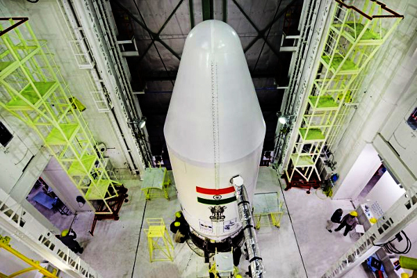
Starting 2019 with the liftoff of two surveillance satellites for Defence Research and Development Organisation (DRDO), one of which was used as a target for the A-Sat missile test, Indian Space Research Organisation (Isro) is gearing up to launch a slew of advanced military satellites this year that will enhance surveillance capabilities of security forces and boost the country’s “strategic assets in space”.
Isro is scheduled to launch four new series Risat satellites and an advanced Cartosat-3 satellite. The images from old Risat-series satellites were used to plan the surgical strike in 2016 and the air strike on a Jaish camp in Pakistan’s Balakot this year.
In the past, the space agency had launched one or two military satellites a year but its focus has now shifted towards boosting defence assets in space amid heightened tension along the Pakistan border and increased Chinese naval activities in the Indian Ocean.
ISRO chairman K Sivan told TOI, “We are targeting to launch 33 missions, including satellites and rockets, this year. In the middle of May, PSLV-C46 rocket will launch Risat-2B and thereafter in the fourth week of June, PSLV-C47 will launch Cartosat-3. Cartosat-3 is the advanced version with the capability to zoom up to a resolution of 0.2 metre (20 cm), which is considered the best in the world.” The resolution of Cartosat-3 will be so refined that it will be able to capture clear images of very small objects like a gun or an enemy bunker. The old Cartosat-2 series satellites had a resolution of only up to 0.5 metre. Sivan said Risat-2BR1 will be launched in July, Risat-2BR2 in October and Risat-1A in November. Risat-2B series is a lighter version of the spy satellite with an X-band synethic aperture radar that can penetrate clouds and zoom up to a resolution of 1 metre.
The ISRO chief said, “In September, we are going to launch a new series of remote-sensing satellite Geo-Imaging Satellite-1 (Gisat-1) and Gisat-2 in November.” Gisat will carry a geo-imager with multi-spectral (visible, near infra-red and thermal), multi-resolution (50m to 1.5 km) imaging instruments that will enhance the country’s land mapping capabilities. Gisat has both military and civilian use. Till now, old imaging satellites could map a particular area only once in 22 days. With Gisat, military can scan or map an area every other day. The satellite will provide near real-time pictures of large areas of the country under cloud-free conditions.
Besides military satellites, Isro is also planning to launch high-profile Chandrayaan-2 mission and first demonstration test of the mini-PSLV or SSLV this year. Advanced communication satellites like Gsat-20, Gsat-30 and Gsat-32 will also be launched by early next year. Gsat-32 will replace Gsat-6A, which was lost in space after the successful launch due to a communication failure and was meant to mainly serve ground forces.
Source: TNN
Image Courtesy: IndiaTvNews
You may also like
-
IAF Aircraft Set Course For Exercise Eastern Bridge VII At Oman
-
IAF Set To Host The Indian Defence Aviation Exposition-II At Jodhpur
-
Defence Secretary to co-chair 5th India-Philippines Joint Defence Cooperation Committee meeting in Manila
-
Simultaneous Launch Of ‘malpe And Mulki’, Fourth And Fifth Ships Of Asw Swc (Csl) Project
-
Aatmanirbharta in Defence: MoD signs Contract with HAL for 240 AL-31FP Aero Engines for Su-30MKI Aircraft
