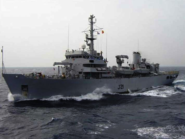
(Seychelles News Agency) – A hydrographic survey in Seychelles’ waters by an Indian navy ship will allow the island nation to update its nautical charts and facilitate the implementation of national projects.
The ship, INS Darshak, will carry out a hydrographic survey in the seas around the nation’s three main islands of Mahe, La Digue, and Praslin.
The survey consists of measuring and describing features that scientifically affect maritime navigation, construction, dredging and off-shore oil exploration and related activities.
Joachim Valmont, the director general of the Seychelles Maritime Safety Administration (SMSA), told SNA on Monday that these surveys will serve to reinforce safety for maritime navigation and other maritime activities.
“The survey will provide us with much-needed data for our own records as well as the latest information which is necessary for future projects, for example, the extension of main ports as we anticipate some dredging activities in these areas,” explained Valmont.
The survey is a joint initiative between the Seychelles Coast Guard, the Seychelles Ports Authority and the SMSA.
The vessel will survey areas around Port Victoria – the main port of the island nation – as well as port areas of La Passe, La Digue, and Baie Ste Anne on Praslin.
A communique from the Indian High Commission in Victoria said the visit is being organised by the Indian High Commission along with the Indian Navy on the request for survey from the government of Seychelles.
This falls under a memorandum of understanding in the field of hydrographic cooperation signed by both sides in March 2015, thus further strengthening the defence and hydrographic cooperation between both countries.
“This will be the fourth visit by INS Darshak to Seychelles, the last one dating back to 2015. The deployment of the Indian hydrography ship on this survey assignment adds yet another chapter to the strong defence and maritime cooperation between India and Seychelles,” added the communique.
INS Darshak has a crew of 171 and is carrying a Chetak helicopter, primarily used to ascertain the geographical extent and nature of coastline during the survey operations.
The ship will conduct the survey for 12 days and the work is expected to be over by January 15. The Indian Navy officers are also having meetings with the national hydrographic committee over the survey requirements.
During the port call, the commanding officer of the vessel — J. Gurumani — also paid courtesy calls to various dignitaries including Barry Faure, secretary of state for foreign affairs.
The ship’s officers and crew members will also participate in several sporting, social and charitable activities during their stay in Seychelles, an archipelago in the western Indian Ocean.
Source: SNA
Image Courtesy: Yovizag
You may also like
-
IAF Aircraft Set Course For Exercise Eastern Bridge VII At Oman
-
IAF Set To Host The Indian Defence Aviation Exposition-II At Jodhpur
-
Defence Secretary to co-chair 5th India-Philippines Joint Defence Cooperation Committee meeting in Manila
-
Simultaneous Launch Of ‘malpe And Mulki’, Fourth And Fifth Ships Of Asw Swc (Csl) Project
-
Aatmanirbharta in Defence: MoD signs Contract with HAL for 240 AL-31FP Aero Engines for Su-30MKI Aircraft
