Buoyed by the precision of photogrammetric mapping and its efficacy in planning manpower deployment at the Modi-Xi informal summit in Mamallapuram, the Tamil Nadu police will put the technology to use in all major security arrangements, including VIP bandobusts, in the State.
According to police sources, special teams drawn from the Tamil Nadu Commando School and local police were trained by scientists and technicians of the Madras Institute of Technology, Anna University, in flying drones for the purpose of photogrammetric mapping and aerial survey of the topography required to be brought under surveillance and control.
Though the Technical Services wing of the State police have already purchased four Unmanned Aerial Vehicles fitted with high quality cameras, the drones have not been put to much use in recent times. However, during the historic Indo-China summit held at Mamallapuram in Kancheepuram last weekend, police flew the quad-copter drones for over a week to take high quality visuals and photographs of roads, buildings, trees etc. for 500 metres on either side of the East Coast Road between VGP Golden Beach and the venue for the summit.
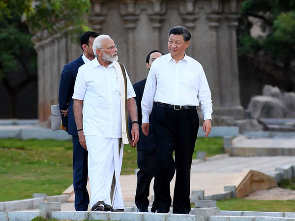
Thousands of police personnel were deployed along the convoy route of Prime Minister Narendra Modi and Chinese President Xi Jinping on October 11 and 12. The deployment of manpower was based on the real-time visuals captured by the drones. “At least 30,000 photographs and dozens of videos were taken for planning the deployment of police personnel and security infrastructure, including teams of Bomb Detection & Disposal Squad, Quick Reaction Teams and Rapid Action Force and Special Task Force. The data is being stored in our server for future reference,” a University official told The Hindu on Sunday.
On the request of Director-General of Police J.K. Tripathy, the Centre for Aerospace Research (CASR), Madras Institute of Technology, trained police personnel a month before the Indo-China summit. The work on flying the drones for photogrammetric mapping commenced a week before the event.
“They (the police) find the concept very useful. The cameras fitted to the drones are capable of zooming down to the number plate of a moving vehicle from an altitude of about 100 metres. They also have the endurance of flying up to 30-45 km. Besides live monitoring and appropriate action, visuals taken in advance go a long way in strengthening preparedness. It also helps in better understanding the topography,” the official said.
Permanent feature
Mr. Tripathy said photogrammetric mapping would from now on be a part of the Standard Operating Procedure (SOP) in VVIP security and major bandobust schemes. A clear cut drone policy would be devised to facilitate the regular utilisation of the UAVs by the police.
On how photogrammetric mapping was useful in planning security during the Indo-China summit, he said that there were many inaccessible terrains along the stretch of VIP convoy, including swampy lands and uninhabited places.
“The drones produced real-time visuals to understand the ground situation better and also to zoom down on suspicious buildings or objects. We also conducted a thorough recce,” Mr. Tripathy said adding that more drones would be procured in the near future.
Source: The Hindu
Image Courtesy:ET
You may also like
-
India’s First Indigenous Air Cushion Vehicle Joins Indian Coast Guard: A Major Boost for Coastal Security
-
Indian Army Heads to Mongolia for Exercise Khaan Quest 2026
-
Morale Management in the Ramayana: The Battlefield Weapon That Kept Rama’s Army Fighting
-
Battlefield Medicine and Casualty Recovery: Hanuman’s Sanjivani Mission and the Military Logic of Saving Combat Power
-
India’s Defence Production Reaches Record ₹1.78 Lakh Crore in FY 2025–26